Reviewed By |
Mike Barrett |
 |
| Review Date |
17th December 2013 |
| Manufacturer |
Garmin |
RRP |
GBP £39.99 inc VAT
USD $59.99 |
|
Various incarnations of Garmin StreetPilot have been around for a long time. Indeed we did our first review of Garmin's StreetPilot back in January 2003. The navigation engine has been available on a lot of platforms, and now it has finally arrived on the iPhone after a few failed attempts on mobile phones.
The latest version of Garmin's StreetPilot for iPhone offers full route guidance with spoken instructions and on-board mapping. There are add-ons that can be purchased in-app to further enhance the functionality, including Traffic, 3D Panoramas, photoLive Traffic Cameras, Urban Guidance etc. Some of these add-ons are available for free and include PhotoReal Junction Views and 3D Landmarks. This review focuses on the free components of the app as purchased in the Apple iTunes AppStore.
As mentioned above Garmin has had a few forays into navigation on the smartphone platform, all of which failed abysmally for one reason or another. With this in mind I was wondering what the new app would bring to my iPhone. Well I can say that I am pleasantly surprised! At first sight the app looks exactly the same as the established PND software. Indeed if you have a dedicated Garmin SatNav then you will be right at home with this iPhone app. The big difference between this app and previous Garmin applications is that all the data is stored on the device and thus does not rely on the oft-times fickle cellular network to deliver the mapping or routing.

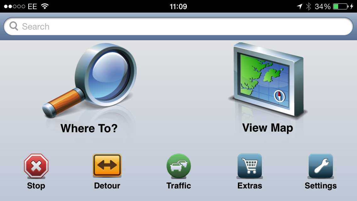
Starting from the home screen you have the "Where To?" and "View Map" buttons dominating the display with a row of secondary functions underneath. This will be remarkably familiar to anyone who has ever used a Garmin device before. Tapping the "Where To?" button takes you to a secondary screen to select the type of destination.
But I am getting ahead of myself. Lets get back to basics: the maps. The app I installed is for Western Europe. Now everyone knows that the main consumer of storage in a navigation app is the maps. We all know that memory is a precious resource on a device designed for multiple uses and with restricted memory. Garmin have realised this, and despite the fact that my iPhone App is for Western Europe it allows me to select which sections of the map to install. This means that rather than install the full 2.47Gb of maps I can just install UK & Ireland which is only 360Mb. If I travel into Europe I can add the section(s) of mapping I require for my trip.
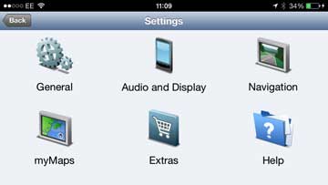
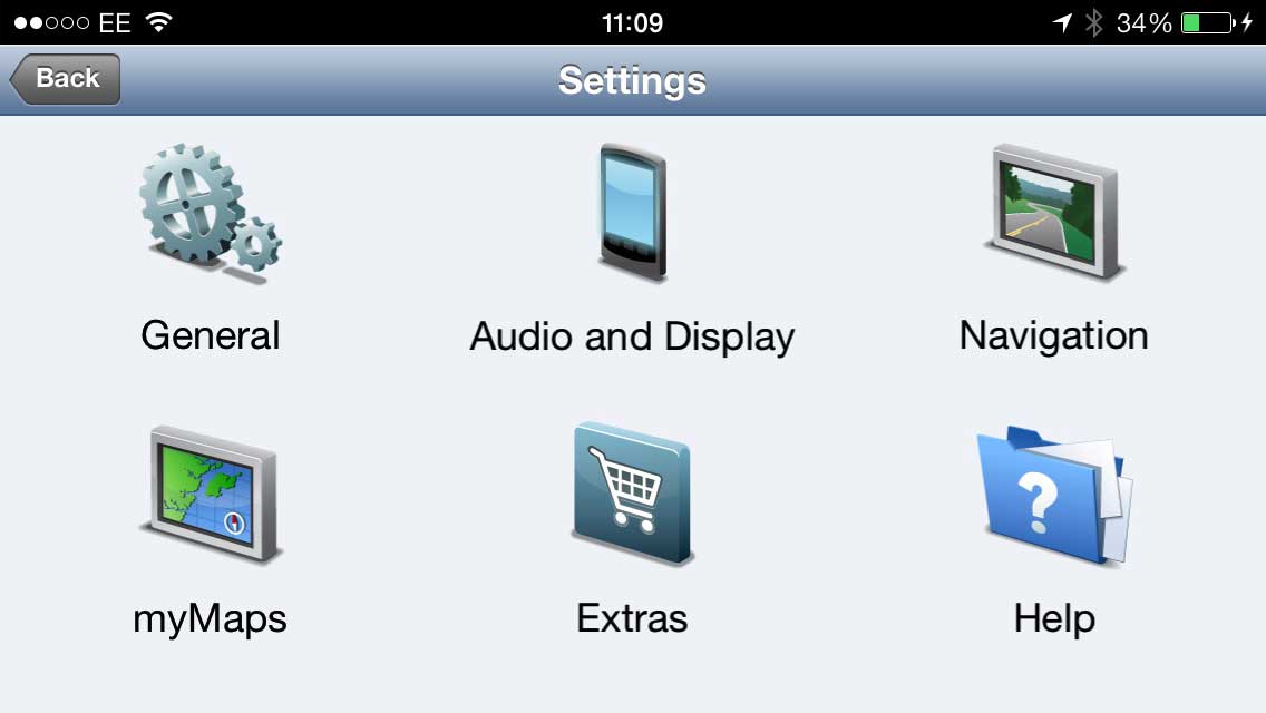
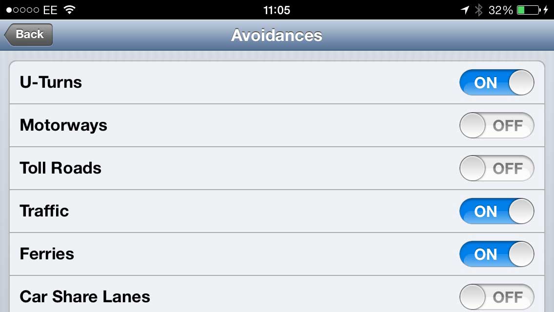
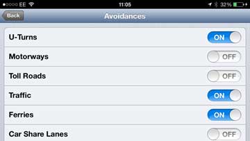
There are a wealth of settings that I can modify to configure the app to work just the way I want it to, but the most important of these are the "Route Preference" and the "Avoidances". With these you can shape the routing engine to calculate the type of route you prefer. I tend to have it set to 'Faster Time' and avoiding everything except Motorways, Toll Roads, and Car Share Lanes.
Having set the preferences the next thing to do is to plan the route. This is done from the "Where To?" button. Having tapped it you are presented with a scrolling screen of 14 different ways to select your destination. The most basic of these is Address. Selecting the address input allows you to "Spell Town/Post Code" or "Enter House Number". The former works as expected, but the later doesn't make sense to me. Maybe it is just the way I am using it but when entering the house number you are then prompted to enter a street and the street I am looking for never appears even after I have fully spelt it.
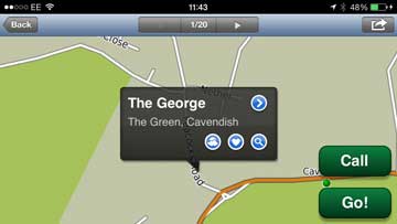
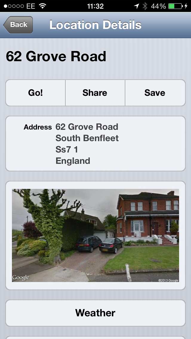
Having successfully completed the screens you will be presented with the map of the destination for you to confirm the correct location and to hit the "Go!" button to create a route.
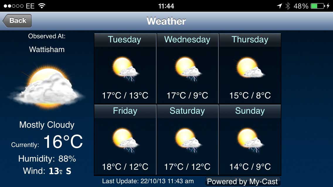
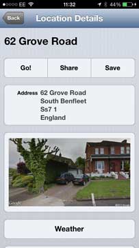
However before hitting go you can also check the local weather, save and remove the location to favourites, and search for POIs near the destination. A disclosure arrow gives you access to more information including a picture of the destination helpful to identify the house you are going to visit. In the example case the post code SS7 1JJ correctly decoded the address of my father's house, but the picture is of a house in the next road.
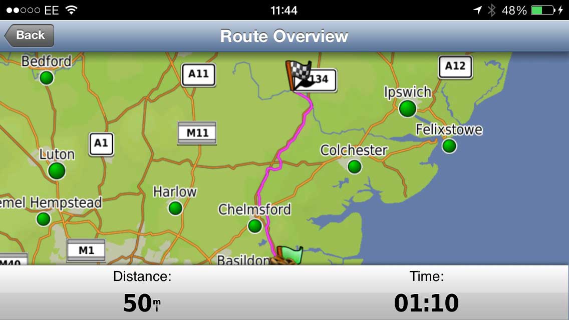
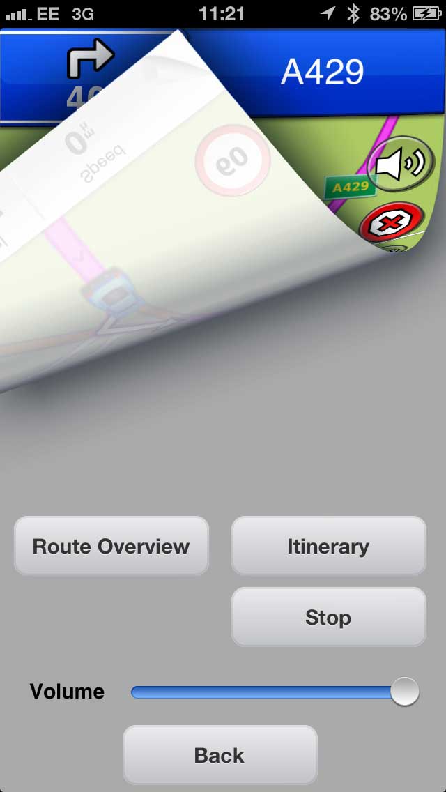
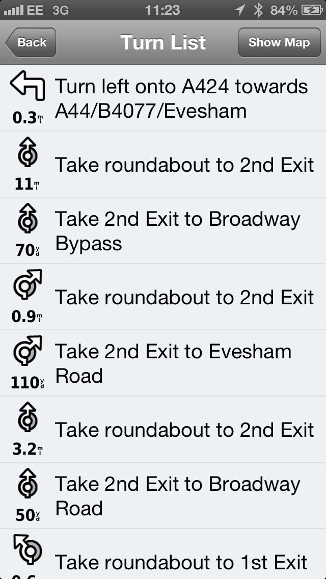
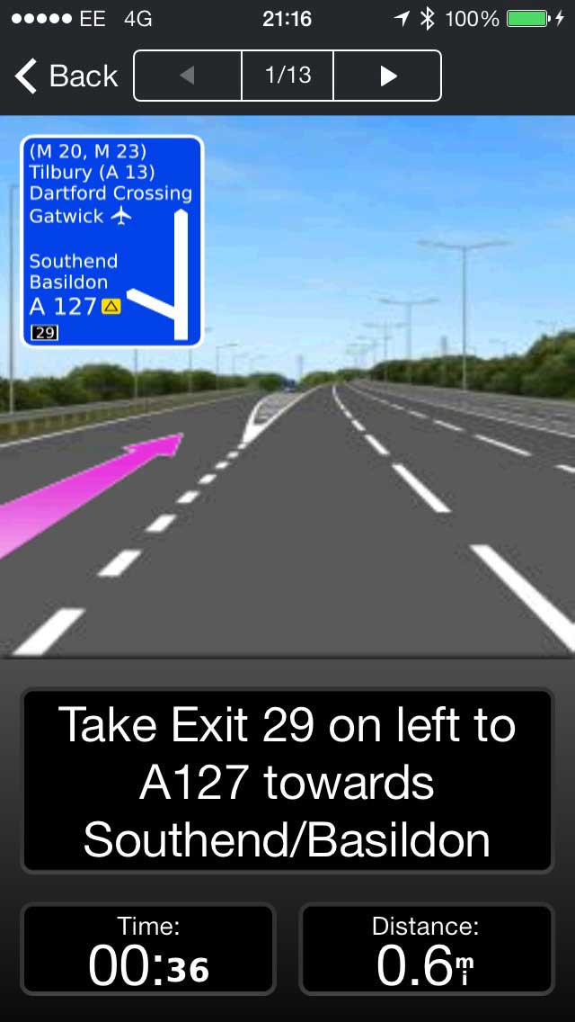
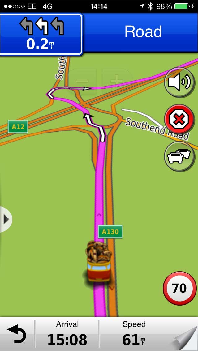
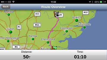
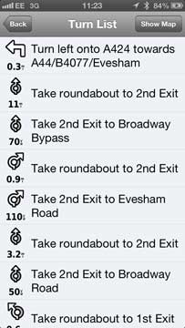
So with the route set I can quickly check the validity of the route. Rule #1: Never trust the navigation system to get things correct. Well maybe not the navigation system, but the interpretation of your input. We are always hearing stories of people going to wrong destinations when a quick overview of the route would prevent problems. The bottom right of the main screen will display a page curl when a route is active. Tap on this to see the route options and display the overview. You can also view the turn by turn itinerary of the route from this display. You can also adjust the volume of the instructions and the stop routing. The route overview is very useful for checking that you are indeed going to the destination that you intended, and not somewhere with a similar name.
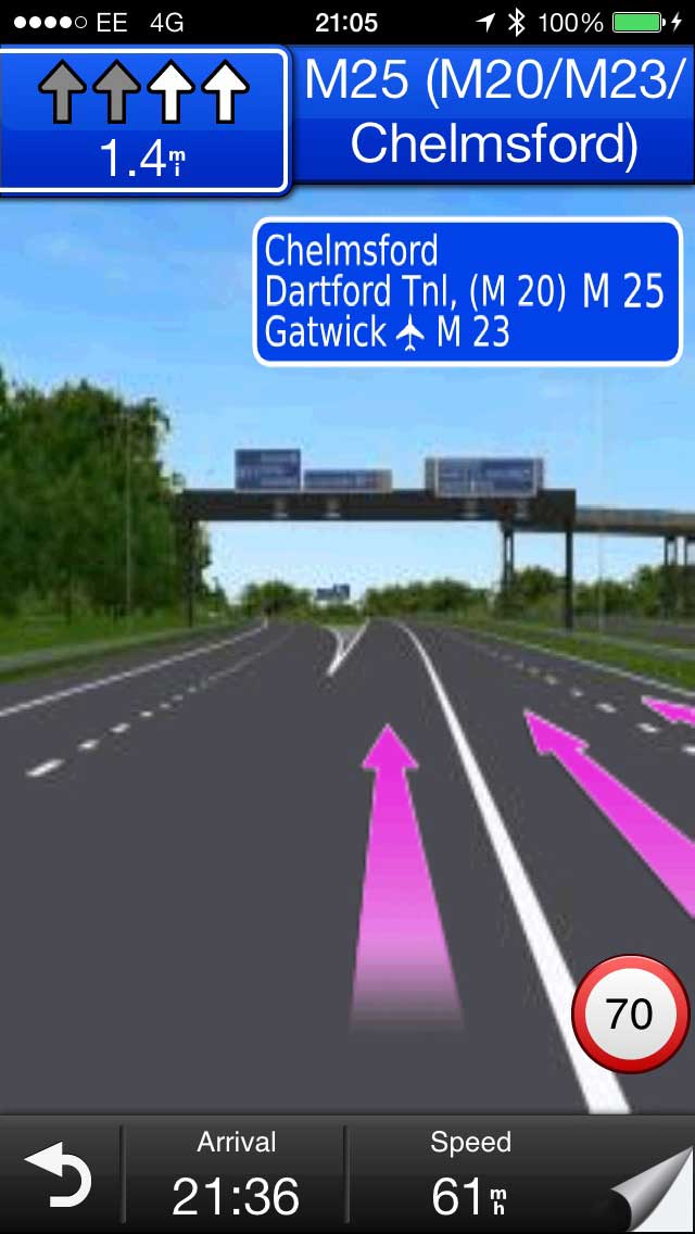
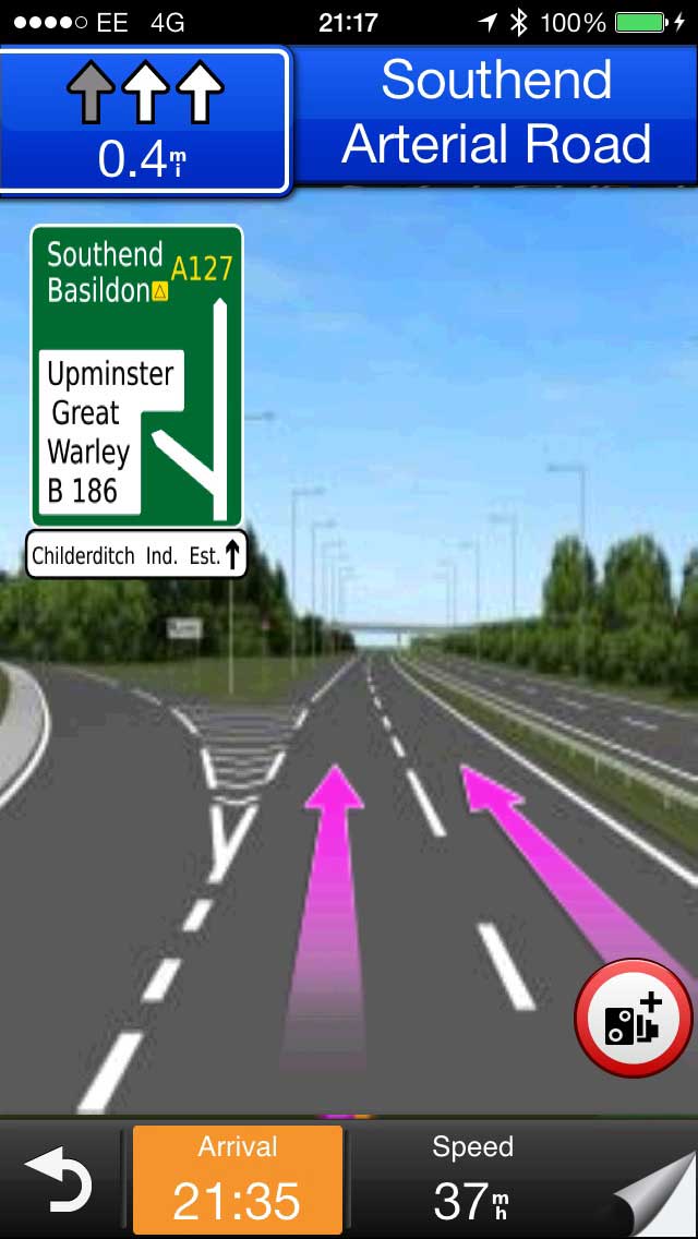
Having set and checked the route you are ready to set off. As you start to drive the map orients itself to the direction of travel and warns you as you approach a junction where you will make a turn. This is both an audible and visual instruction providing sufficient information to complete the action without having to look at the screen. Of course the screen gives you an easy to see visual indication as well.
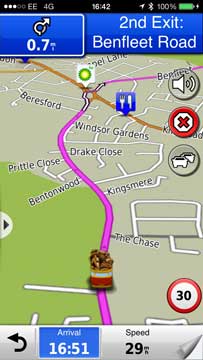
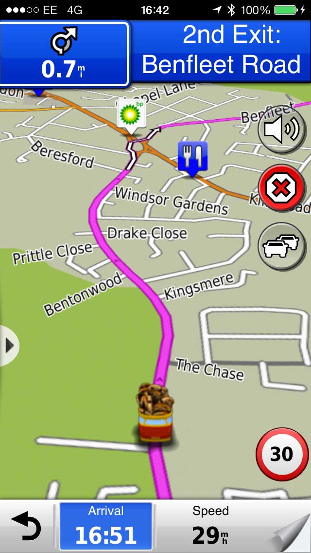
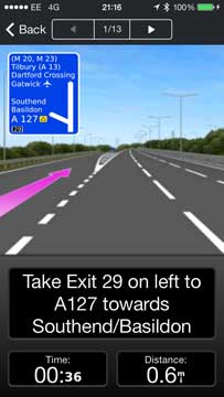
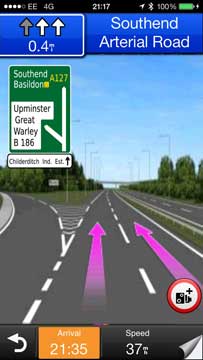
As you approach major junctions on multiple lane dual carriageways there is a lane guidance facility that indicates which lane you should be in as you approach the junction. Getting closer to the junction the "PhotoReal Junction View" kicks in and you are presented with a photographic image of the junction with your lane selection overlaid on it. This stays on the display for a few seconds before the display reverts to the map display.
The most important thing for a navigation system is to provide clear and concise audible instructions that remove the requirement to look at a screen and divert your attention from driving. In this the Garmin App works very well giving instructions well ahead of the turn and then repeating as you approach the junction. This coupled with the clear mapping and other visual aids keeps your attention on the task at hand and away from looking at or worse fiddling with the guidance system. With my system there was a slight issue. I found that there was no voice guidance when I was driving a route. Of course this was difficult to work out whilst driving, or more precisely stopped at the side of the road. The volume was turned up, and the audio was working on the iPhone. It turned out that the audio routing in the settings had Bluetooth selected, but there was no Bluetooth receiver in the car. This resulted in the audio being routed to a black hole. After selecting audio output: default everything started working as expected.
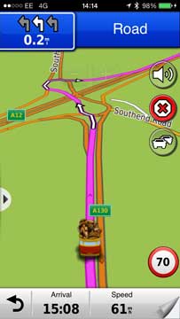
As you are driving along the map keeps up with you, showing either a North up, direction of travel, or 3D in the direction of travel display. This will have a number of items overlaid, predominantly POIs, which in some cases will appear with the company logos on them. At the bottom of the display are some metrics showing your progress on the route, which can be configured to show a number of items. I like to have the arrival time shown, along with the current speed.
The routes that I planned always got me to my destination, though sometimes it was difficult to see the rationale in the selection of route. This is most prevalent when there is no obvious direct way to get to the destination. I once set a route from Castle Hedingham to Glemsford and was taken down an interesting selection of single lane country roads. The route was not invalid, but not the one I would have selected. However if you did not know where you were going you would have arrived correctly at your destination. The same is true when approaching my home. Garmin always tries to route me through some back roads rather than take the more direct turning off the main road.
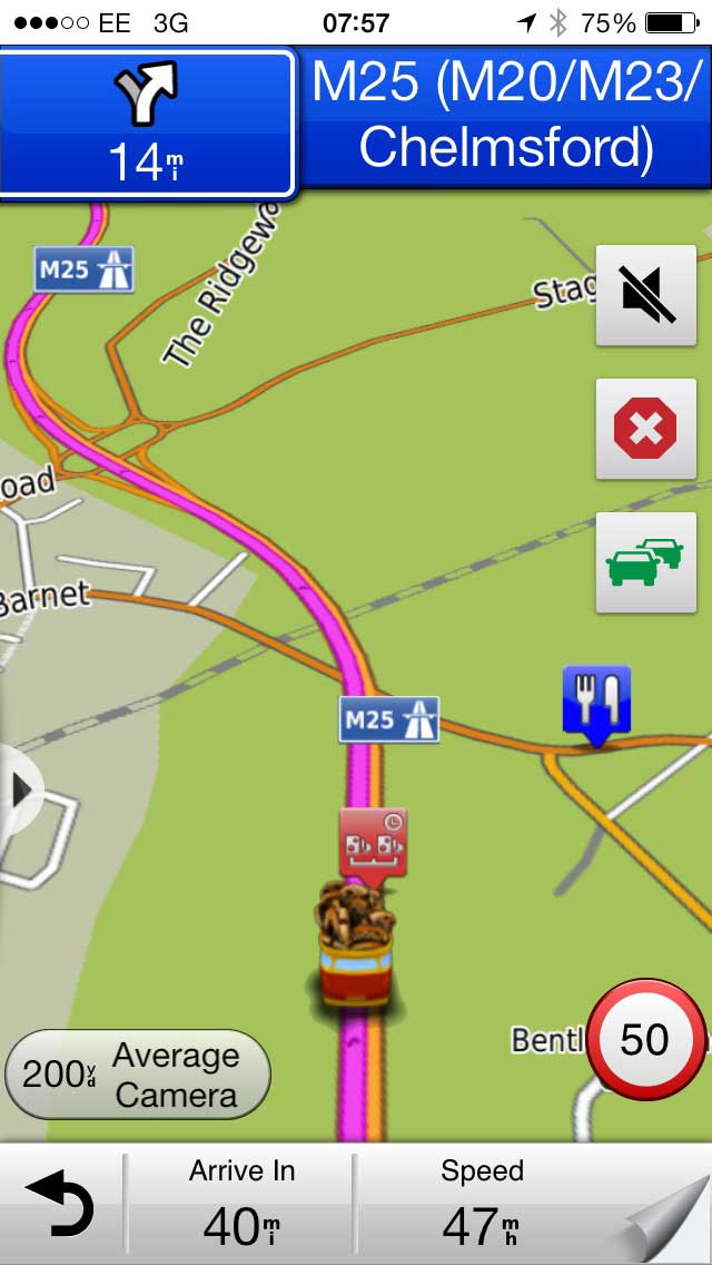
The app has speed camera warnings built into it. In general these proved to be relatively accurate, but somewhat difficult to understand what was happening. The warning is just a single beep, and the indication is a small grey display at the bottom left of the screen. The display of the camera icons were somewhat sporadic, and the average speed cameras (the most dangerous) were very hit and miss. The speed camera data is provided free with the app, and it is difficult to determine when, how, or even if it gets updated.
 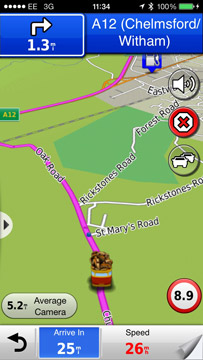
In one instance the app decided that the speed limit was 8.9MPH and an average speed camera was 5.2 miles from me. As I travelled the speed limit kept reducing until it was 1.2MPH!!! I was wondering if I has been transported back to the dark ages when the law required someone to walk in front of the car waving a red flag! I pulled over and restarted the app, at which point the speed limit reverted to the posted limit and my mystical average camera disappeared.
The Garmin StreetPilot app is compatible with the Garmin Heads Up Display that we reviewed here.
What is missing?
The functionality I have just detailed is pretty standard on SmartPhone navigation apps, but what is important is what is missing? The answer to this question is not much. The main functionality is either included or available as a premium add-in.
As I mentioned at the start of the review the Garmin implementation of StreetPilot would be very familiar to users but one major functional deficiency is the ability to add user defined POIs. This has indeed been a core feature of Garmin software throughout the lifetime of its GPS products, but is sadly lacking in their SmartPhone products. The implementation is not technically difficult, nor prohibited by Apple, so it is a conscious decision made by Garmin (and others) not to implement it. However despite this criticism I should point out that only one of the navigation providers, Sygic, have user defined POI capabilities where almost all of them have impelmented it on their range of PNDs.
Conclusions
Garmin have created a very good and reliable SmartPhone app with the StreetPilot for iPhone. There are a few niggles and bugs that need to be worked out of the system, but it is almost indistinguishable from the StreetPilot software that runs on their range of PNDs. Indeed this app has the benefit of being connected allowing the downloading and uploading of information to Garmin's servers and providing live traffic (premium add-on) features that are only available on the top of the range PNDs.
As the Garmin StreetPilot app is delivered via the Apple iTunes AppStore it is very easy for the company to create, distribute and update a large number of configurations of the Garmin App allowing you to pick and choose a navigation solution to suit yourself at a competitive price point.
|