Review by Lutz Bendlin
Mit A1 NAVI unterwegs in den USA
 We have done two reviews of Wayfinder already (here and here) but it's been a while and I thought I give the program another go. Wayfinder have added lots of features and some new supported platforms - this review focuses on the Pocket PC/Windows Mobile platform. We have done two reviews of Wayfinder already (here and here) but it's been a while and I thought I give the program another go. Wayfinder have added lots of features and some new supported platforms - this review focuses on the Pocket PC/Windows Mobile platform.
Adding a twist to this review - I managed to talk Mr. Kröpfl of the austrian mobile network operator A1 - mobilkom Austria into letting me review their special version of Wayfinder - "A1 NAVI by Wayfinder"- which comes with an interesting payment model. So you will see mixed english and german screenshots every now and then.
Since A1 NAVI is an offboard navigation system (meaning maps are not permanently stored on your device, and route calculation is outsourced to a central server) your Pocket PC must have some kind of internet connection, with GPRS clearly preferred. This ideally means Pocket PC Phone Edition - a device category that is steadily on the rise and recently got a pretty unexpected addition in the form of the Palm Treo 700w. But you could also use a standard Pocket PC with Bluetooth and a Bluetooth mobile phone as a GPRS modem.
You could also take the offboard concept to the extreme and prepare routes from home using your existing broadband connection but that will only work if you never ever leave the planned route - a highly unlikely scenario.
Where to get the program
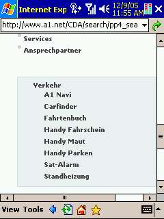
True to its offboard idea Wayfinder/A1 NAVI needs to be downloaded from the websites of Wayfinder and A1, respectively. The program seems to be updated pretty frequently, so make sure you check the version from time to time. For this review we used version 4.74 of A1 NAVI. Here is the path to the A1 NAVI on the austrian A1 website http://www.A1.net/ and on the mobile Vodafone live! portal http://live.A1.net .
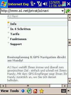 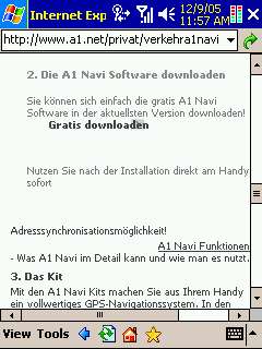
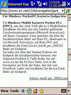 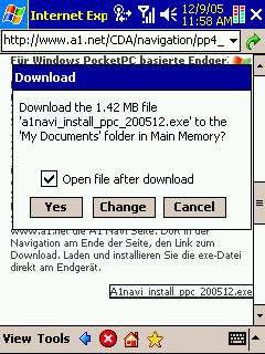
It does take quite a few clicks to get to the program download but the A1 site is pretty performant and this doesn't take long at all.
I was not as lucky with the Wayfinder setup program. The use of Javascript on the Wayfinder site and the inability of Pocket Internet Explorer to support Javascript adequately made for a somewhat frustrating merry-go-round experience when trying to download the Wayfinder setup program directly to the Pocket PC. I finally managed to find a way - to install Wayfinder directly from the device you need to point your Pocket Browser to http://eu.mywayfinder.com/install_wizard.en.php .
Installation
The Wayfinder (A1 NAVI) setup program is different from a standard CAB based Pocket PC installer. This is slightly irritating and does also not work well with the newer Windows Mobile 5 devices - those are normally much more strict about where a program should be installed. Contrary to that standard, the setup program asks you to choose the install folder.
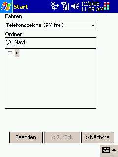 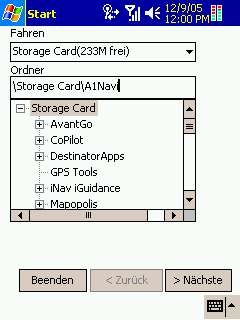
Any location can be chosen, the program runs equally well from main memory or from Storage Card.
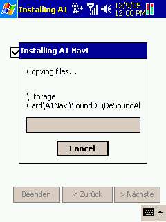
(On the way some of the translation went astray, and "Fahren" should actually be "Laufwerk", the other german equivalent to "Drive". Wayfinder may want to consider using a translation service who actually have some knowledge about the subject. Our readers for example...) As always, I chose Storage Card, and the installation went along nicely.
 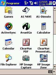
The A1-Dienste icon is specific to the A1 SIM card, and not part of the A1 NAVI installation.
Configuration
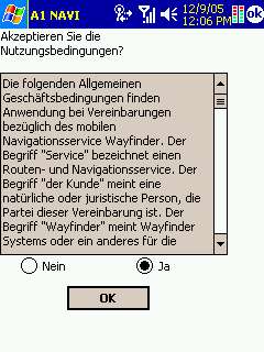
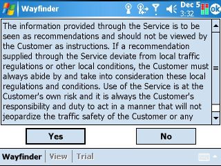
The left picture shows the initial disclaimer during installation, the right picture shows the screen that pops up every time when you start A1 NAVI or Wayfinder. You have to endure the legal disclaimer each and every time, there is no way to switch that off.
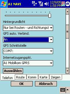
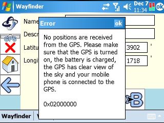
For starters let us configure the GPS connection. Any receiver that speaks NMEA can be used. For Bluetooth receiver you will need to know which outgoing COM port your PDA has assigned to the receiver. For my iPAQ 6315 that is COM7. And of course I want the GPS to connect automatically, so I set that to "On" too - your preferences may vary.
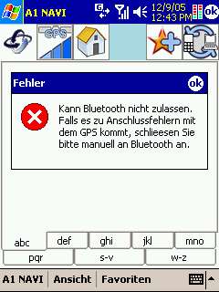
One word of warning: When you start A1 NAVI on a WM5 unit without the Bluetooth GPS switched on your GPS setting will be "lost" because the assigned COM port will not appear in the selection. You will have to exit the program, switch the receiver on, and restart the program to get the connection back. This was very annoying - TomTom for example help us forgetful souls by switching Bluetooth on for us if we failed to do that in time.
Sometimes you will also see a Bluetooth error message - one that seems to have been translated on a monday morning at 6 am... It seems to say something about seeing the receiver but being unable to talk to it. But I'm not really sure ;-) .
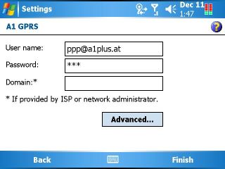
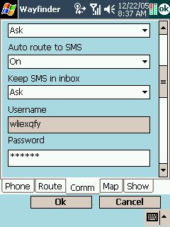
Since this is an offboard navigation solution you need to specify your internet connection and access point details next. For this review I was using an A1 SIM card so I selected the A1 GPRS connection I had created earlier after a brief Google search for the APN, user ID and password.
As I mentioned earlier you could also use a non-GPRS internet connection but then you will sometimes see a message about your phone not being compatible. You can safely ignore that message.
Next you will want to adjust units of measure etc. I had set mine to miles and feet and it changed the display accordingly. The voice instructions however would keep telling me distances in metres. So you need to make sure to also switch to a voice with imperial behavior.
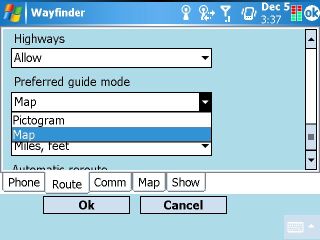
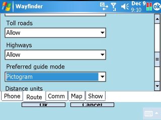
You should also specify your preferences for the navigation screen (Pictogram mode uses far less data and will be easier on your GPRS budget) and if you want to allow or block the usage of highways.
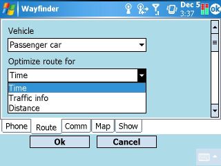
And lastly you can tell the program what kind of car you are driving, and if you want it to calculate the shortest or quickest route. Note the "Traffic info" setting - as I understand it this is not yet available for the US maps, but you should be able to subscribe to that service in Europe.
Backlight control
One feature that I liked in the most recent versions of Mapopolis has also been implemented in the A1 NAVI program. If there is no turn in sight (pardon the pun) then A1 NAVI/Wayfinder will switch off the Pocket PC backlight, and only switch it back on about 1.5 km prior to the next turn ("only when approaching route action").
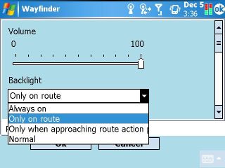
This is an excellent feature particularly for night rides but also generally to direct your attention towards the road. As a pleasant side effect it also helps to conserve some energy in case you run your PDA on batteries.
Finding destinations and POIs
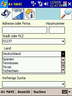
Finding a destination starts with selecting the "Search" menu item. Thankfully you can specify your search criteria in a multitude of ways. Fill in whatever details you know about the destination. If you do not know the country/state or city/zip code you can also select "From GPS" entry that will then attempt to determine these values from your current GPS position (given your receiver has a fix).
As you can see below the program automatically lists the US states even though it is initially supposed to know only the european countries. I believe that when you connect to the Wayfinder server the first time with a US GPS position the service will update the category listing to include the states of the US, as well as to change the list of POIs you can search for.
 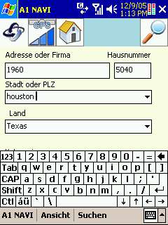
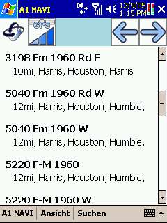
The Houston suburbia is well known for its wide spread, completely indiscernable city limits, and shameless re-use of addresses and house numbers. Searching for 5040 FM 1960 is a good example - it will return two results that are quite far from each other, and you need some extra information (East/West) to make the correct choice.
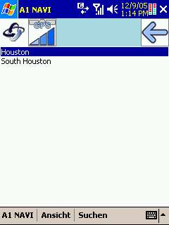
If the server is not sure about the city of the destination it will present you with a city selection screen - I found that rather unhelpful. I am not even sure if something like "South Houston" exists.
 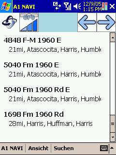
Search results are shown sorted by their distance from the current location, together with the county and city. While this is certainly a helpful way of presenting the results I would have wished that this would also include the bearing of the results - sometimes you know your destination is east rather than west of you, and this helps you select the right result in case of ambiguity. Mapopolis still has the best implementation of that way to present search results.
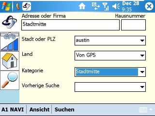
One of the rather interesting POI categories is "City Centre". Here I have tried to find the centre of Austin - note that I did not specify the country but left it to the service to find that from my GPS position.
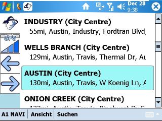
And sure enough, one of the search results did indeed take me directly to the centre of Austin. The route calculation itself worked only on the third attempt even though the distance was rather modest for an average Texas journey.
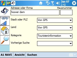
Other POIs are more difficult to find, and I had to enter a lot of additional information to finally receive a reply back. I was unable to find any tourist attraction - like the Hoover Dam - through this method.
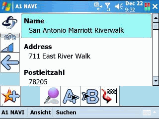
Once you have found a POI you can view its properties. The Wayfinder service returns a very impressive list of items that describe each POI, and this small example here also gives a bit of a taste what Location Based Service LBS) are capable of when utilized properly. Imagine you can select a hotel that is close to Downtown, with a room available at 100 $ maximum - and can make your reservation directly through the program...
Favorites and Itineraries
You can also store your Favorites in Wayfinder, and that even extends to the Wayfinder server. If you want you can synchronise all your favorites with the server, and when you change devices you can then synchronise the favorites back to the new device. If you are not comfortable with that then simply don't synchronise.
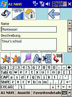
You can add your search results to your favorites - this is highly recommended since the application will not maintain the planned route through a program restart.
As you can see from the row of buttons a location can be saved, looked up on the map, specified as departure, specified as destination, or you can immediately start navigating to it.
Itineraries are only supported in their most simple form - A to B . You cannot specify waypoints, and you cannot store and retrieve itineraries. Hopefully that feature set will be implemented in a future version.
Communication with the Wayfinder server
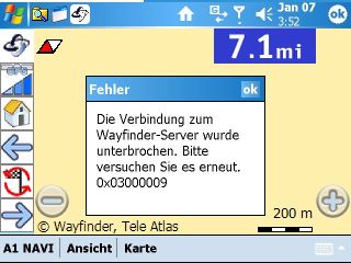
Time to talk about one of the weak spots of the application. In all fairness it is not the program that is to blame here - it's the server.
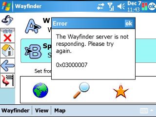
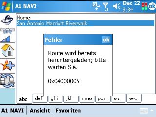
This message will unfortunately be very familiar - you have to be patient with the server when you do a search or calculate a route. More often than I would have liked I was greeted with a server timeout message. This may be acceptable if it happens once every twenty requests, but during my tests this was rather a one out of three ratio - clearly unacceptable in the long run.
Of course there will be scenarios where you are losing contact to the server because you are driving out of range of the GSM network.
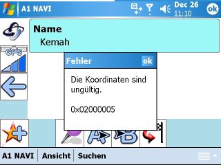
Don't try to set a start or destination point in a parking lot that is not close to a street - the Wayfinder server will tell you that your coordinates are invalid.
I do hope that Wayfinder will find ways (pun intended) to speed up the search and the route calculation, and to make timeouts and server error messages a thing of the past.
User Interface
Generally the A1 NAVI User Interface is very pleasant, with well selected color palettes that provided for good readability throughout the use cases. The only exception is the proximity arrow where the use of very similar shades of blue make it unnecessarily difficult to see the remaining distance to the maneuver.
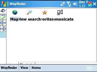
One thing I did not like was the (ab)use of the third menu item as a mode status indicator. Say you are in map mode and want to switch to guidance (pictogram mode). What you have to do is tap on "Map" and then on "Guidance". I found that rather non-intuitive and would have preferred a different, cleaner solution for switching between modes. The below "Home" screen seems to be an attempt at that but it is rather unimpressive.
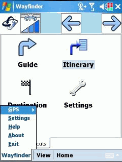
This menu misuse is most irritating when you are on the search screen and want to actually perform the search. Tapping on "Search" in the menu bar only brings up the other mode choices. If you really, really want to search you need to tap the magnifying glass icon. Go figure.
You may also have noticed the two arrow icons to the left or top - those will allow you to circle through all modes (by the way the left and right sides of the standard Pocket PC navigation cross will do the same). What can I say - I have never used the arrows because I always forget in what sequence the modes rotate, and anyhow all I wanted to do was to switch between map and guidance.
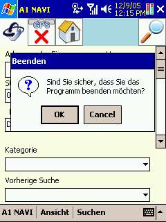
I already mentioned the startup annoyance with the legal screen popping up every time. On exiting you will have the same type of experience - one of those useless "Are you really sure you want to exit this wonderful program" message boxes. Sigh.
If you want to avoid that problem and switch your Pocket PC off (put it into standby mode) while Wayfinder is running then you will find that that doesn't solve anything. Upon wakeup the program will have lost the Bluetooth connection, or will freeze altogether. Hopefully Wayfinder can address that issue and make their program handle different power states more gracefully.
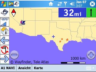
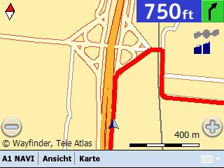
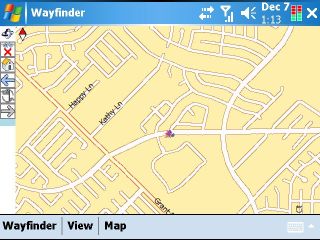
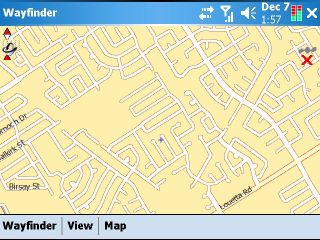
Map mode
Previous versions of Wayfinder did only support pictogram mode, mainly due to the limited available screen real estate on the Symbian mobile phones. Pocket PCs on the other hand have decent screens, and displaying a map has become feasible. I also found that in difficult urban situations a map view could better help me understand what action to take next.
Maps do not reside on the device but are downloaded from the Wayfinder server on demand. This happens pretty quickly, and it is even fun to see the map elements rendering within a few seconds. A rotating Wayfinder icon indicates that data transfer is in progress.
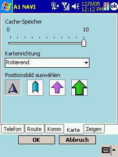
Maps are cached locally, and you can set the relative size of that map cache in the setup screen. However, there is no indication of how much "10" actually is - certainly not 10 MB, rather somewhere in the 1.5 MB area.
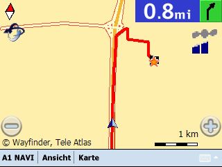
Maps are loaded dynamically, and there is a very slight delay when the Wayfinder icon is rotating to indicate the loading. You can see that the image below has more road details.
The route is also loaded dynamically, and like in a progressive bitmap you will first see a rough estimation of the route and then - over time, as more data is downloaded- it will adhere to the road more and more.
One could ask why the map cache is so small when today's storage cards would allow for much bigger sizes. Most probably this a conflict of interest between the end user's desire to save GPRS costs and the intent of Wayfinder and the mobile operators to drive the data traffic and the GPRS costs up. Obviously a GPRS flat rate comes in handy when you use programs like A1 NAVI...
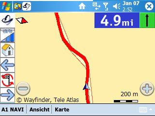
On longer journeys the map view does make less sense. The pictogram view is more suitable in that situation.
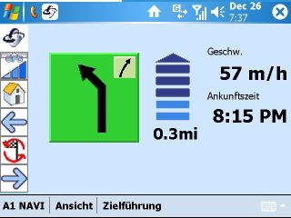
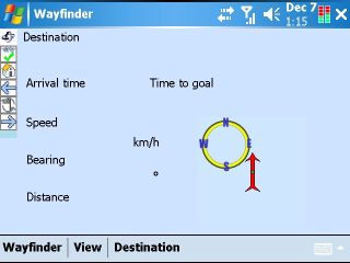
Guidance mode
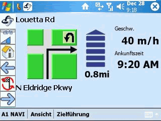
The pictogram mode has a few advantages. First of all it uses much less GPRS bandwidth. But it also provides more information - like the ETA (estimated time of arrival), the action following the current one, the street you are on and the street you need to turn into, as well as your current speed.
I ended up using the Pictogram mode most of the time, and only switching to map mode when in doubt. It would be nice if Wayfinder could introduce a hybrid mode - pictograms for longer uneventful stretches at constant speed, and map display when you approach a turn or slow down otherwise.
One word of advice - when you tap the pictogram the program starts recalculatibg the route. I am not sure if that is considered a feature or if it rather is a malfunction. Expected behavior would have been that the program would repeat the voice instruction for the current maneuver.
Voice instruction quality and frequency
The voice instructions are very good to understand, but they come a tad too often for my taste. You will get told what to do 2 km, 1 km, 500 m, 200 m, 100 m ahead of the turn as well as immediately prior to the turn. While some may like this chattiness I could live without the 1 km and 200 m announcements. Wonder what happens when I delete or rename those 1km and 200m files...
Switching between languages is possible as well - you can specify that in the settings. But you may also have to edit the ini file to get the new voice selection to show in the dropdown list.
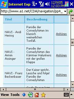
A1 are also offering a number of alternative voices on their site, some really hilarious among them (for example Franz Beckenbauer). You can mess around with the voices yourself, they are stored as separate OGG files in the SoundUS subfolder (or SoundUK or SoundDE etc if you installed those local versions.
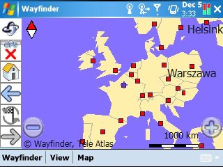
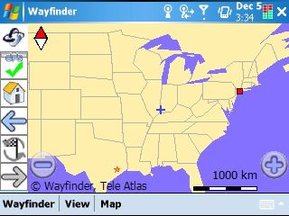
Map coverage and quality
Currently the Wayfinder server offers maps or Europe and the United States (Note that you need different Wayfinder activation keys for that). The beauty of the offboard concept is that this coverage can quickly be extended when maps are available for other countries that have a GPRS (or similar) network. So countries like Canada and Australia are prime candidates for service expansion.
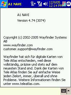
The maps for the A1 NAVI are provided by TeleAtlas. The "About" screen claims those are "...complete, precise, and always actual...". Yeah right. But seen in the big picture one should assume that at least the "actual" part would have some merit since it must be much easier to update the maps on the Wayfinder server instead of having to send them out to thousands of users.
In my tests the maps were of the same accuracy as the ones currently used by TomTom who also mostly use TeleAtlas maps.
Sending a message
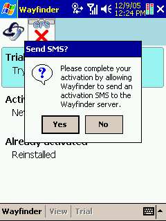
Since we are on a GPRS network, let's utilize that transport, shall we? Wayfinder allows you to send your current position or your current route via eMail or SMS to any recipient that can handle this format. Note that this is no automatic process - you will have to send these messages manually. Probably this was done to control the costs for GPRS traffic or SMS messages.
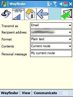 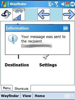
I can think of a number scenarios where this function does make sense, mainly when your car has caved in and you need to tell the towing company where to pick you up... Interestingly you can also send routes to another Wayfinder user, and they can use that route for navigation.
 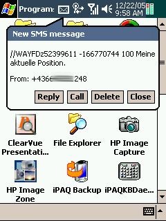
In the example above I used the SMS feature to send my current position.
Does it support VGA mode ?
Having a VGA device at hand I wanted to test how Wayfinder handles the higher screen resolution. Natively the program is not high resolution aware (meaning it runs in QVGA compatibility mode), so I had to tune it a little bit using the well known HI_DPI_AWARE hack.
The VGA results are rather underwhelming, and performance does also suffer from the need to render four times the information. In Full Screen mode the GPS cursor disappears from the screen completely which is not very helpful.
The setup screen does mostly work but the OK/Cancel buttons seem to have a hard coded height...
For what it's worth the QVGA mode is still the better choice, even on VGA devices. Maybe one of the next versions of Wayfinder can fix that.
Trial version and Registration
You can try the program for five days(but you will have to pay the GPRS charges). This is a very good feature since it will get you up and running immediately without the need to wait for any purchase you may have made to arrive at your doorstep. There are not very many programs that offer a trial period nowadays -which is an unnecessary complication for users that need to decide which package is right for them. Kudos to Wayfinder and A1 !
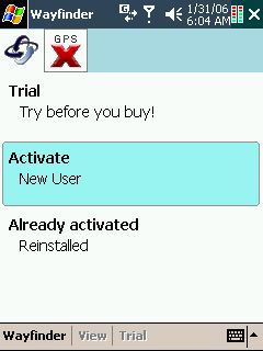
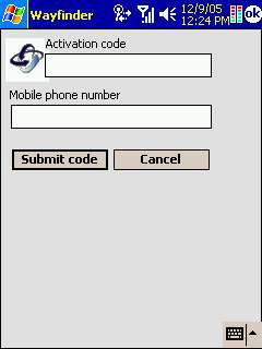
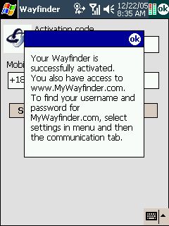
When the trial period expires you will be asked to register and enter your activation code. If you are using the Wayfinder client the user registration is based on the phone IMEI (as far as I can tell).
I am not sure if you can use the activation code with Dual SIM cards (two cards with the same phone number) - maybe one of the readers can answer that.
One thing that I found a bit irritating is the desire of the activation process to "call home" but I guess this is part of the fine print in the contract.
Actually this is a good time to bring up the privacy topic. When you use an offboard navigation system and outsource the map data and route calculation to a third party server you are basically allowing them to track your movements and routing habits.
If you are not comfortable with such a setup you will want to use a onboard system instead - the GPS system is purely passive, and obody can track you if you use a pure GPS receiver. But on the other hand every user of a mobile phone needs to be aware that they are tracked by the mobile network providers anyhow, so this is a bit of a moot point.
The A1 advantage
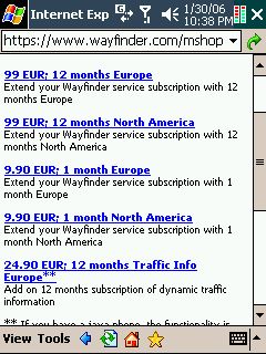
I mentioned earlier that I used an A1 SIM card. The interesting thing with that card is that you can skip the whole Wayfinder registration procedure - all of that is handled by A1, and you only pay A1. Prices are very moderate too, 1 € per day of usage, or 5€ for a whole month.

So you pay a maximum of 60€ per year for unlimited number of searches and route calculations. Of course your standard GPRS charges still apply, but even those are already included in the A1 card. This is a true all-in-one package.
So what is the target audience?
This was one area that left me scratching my head. Experiencing A1 NAVI in my daily navigation routine I was left with mixed results. If it works it works fine. But on quite a few occasions either the server was unreachable, or it came back with strange excuses for not finding addresses or POIs, or it timed out calculating a route. Most of the time it then worked on the second or third attempt but I don't think that the general public would accept such a behaviour on a permanent basis.
So who should be using A1 NAVI then? Delivery drivers? No, those would need itinerary functions and real time traffic information, both features that the program doesn't currently offer. Commuters? Hmm, those would need traffic info and road avoidance functions. Maybe tourists? Yes, I think this will be the most likely target audience. Many millions have somehow managed to find their destinations without GPS, and having a light weight navigation system can surely only improve things for them.
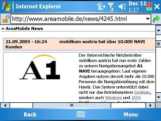
The A1 NAVI sales numbers indicate that there indeed is a market for that application. Last september they claimed to have 10.000 paying users - meanwhile (end of january 2006) this number has doubled to 20.000 .
Over the years we have heard many complaints from users of TomTom and other navigation programs that if they wanted to use the navigation for their oversas vacation they had to purchase new maps, sometimes even of the whole USA, even when their vacation was limited to nine days in Florida. Well - here is your answer. A1 NAVI or Wayfinder offer nearly the same functionality at a fraction of the cost, and you can get everything you need online, even after you have already arrived at your vacation spot. |