Review by Lutz Bendlin
 Introduction Introduction
Semsons.com have asked us to review the new version 4.0 of Odyssey Mobile. Since we didn't know the old version (was there ever one?) or the program itself for that matter, and we are always on the lookout for new competitors in the mobile navigation space (and for new ideas they might have) we gladly agreed. Thanks to Carlon from Semsons for providing the review unit.
What's in the box
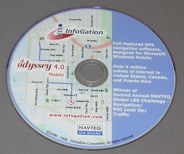
Well, basically nothing. There is no box. All you get is a DVD, and in reality you don't even need that one. How come? Odyssey is one of the very few programs that actually allow the user to test drive it (only Mapopolis and CoPilot have a similar feature) and to download all required components from the Infogation website.
The user guide is included as a PDF on the DVD as well as on the support website. The DVD mentions a lot of Navteq. The map data is from Navteq, and Odyssey claim to have won the LBS challenge in the Traffic area. I wonder if Infogation is another Navteq daughter company in disguise? The version screen also mentions SDAL - I am pretty sure no end user will know what that means (it is a wannabe map media format standard).
Interestingly enough Odyssey does not actually offer any traffic features.
In the case of Odyssey Mobile 4 the test period is rather short. You only have three days to make up your mind if the program is to your liking or not. But hey - three days are better than nothing, and they should be sufficient to figure out if you spend the money or not.
To start the test you can download the program from the Infogation website. The installation process is a bit of an annoyance, but it will eventually get you there.
Installation
To install the application you use the Odyssey Mobile loader that you downloaded from the above mentioned link.
First of all you need to have the device connected through ActiveSync for the installer to work. While that's still fair, the following step is not.
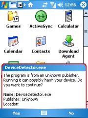
A "Device Detector" is sneakily installed onto your Pocket PC. Well, thanks to the ever alert WM5, it's not sneaky enough. But there's no way around that if you want to continue with the installation.
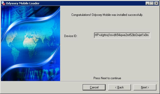
After the Device Detector has done its dubious work you can then continue with the setup. That is, if your device is deemed fit for purpose, and has received a rather longish ID.
Thankfully the Device Detector doesn't seem to stay resident on the Pocket PC. But it leaves a bad feeling - what else did they install that I don't know of?
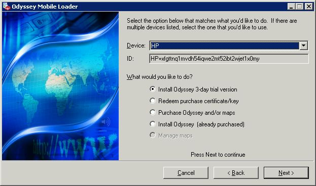
Initially you elect to install the 3-day trial. Later, after you purchased the licence key you can register it here too.
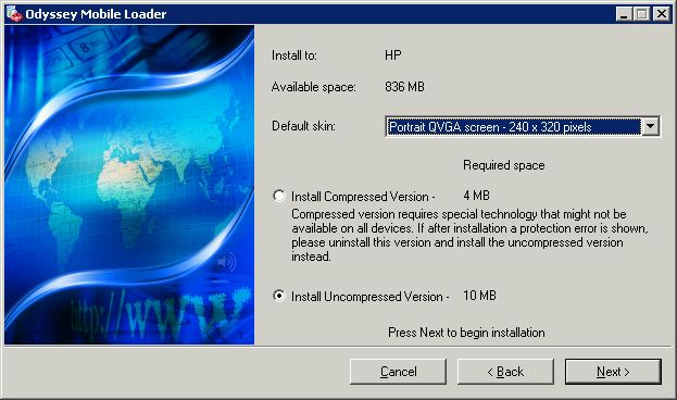
The installer claims to support QVGA portrait, landscape as well as square (No VGA!) but you have to select the orientation and screen size at installation time which is not very convenient if you regularly switch screen orientation. Further down in the customisation section we will come back to that.

The above mentioning of the compressed versus uncompressed version made me look at the installer in some more detail (through Qwerty.msi). Infogation have split the installer between the main executable and the other files like the sounds, images etc. This is important to know if you want to keep the CAB file for later mobile re-installs. You will also need to keep a copy of the Adeona file(s).
 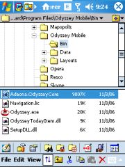
This also means the "storage space needed" number in the device screenshot above is mis-stating the true requirements since it only considers the CAB file size.
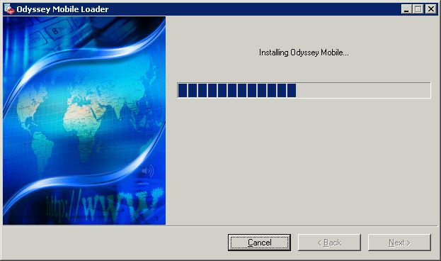
The rest of the installation is rather uneventful.
If you run the program now you'll get your wrist slapped. There!
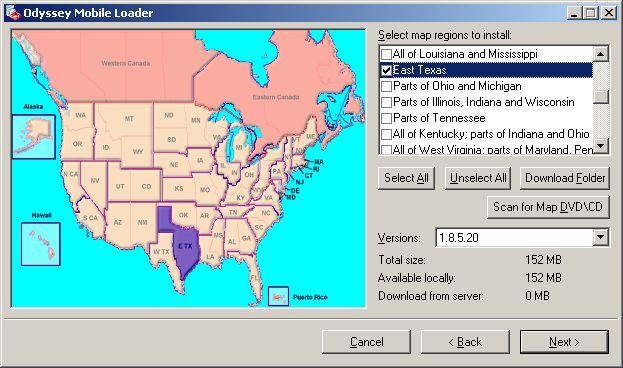
So, next up is the map download. Yes, you can download all the maps for Odyssey! That's a very nice feature, and probably the best option for everyone with a broadband connection. If you are still on dialup then you better wait for the DVD...
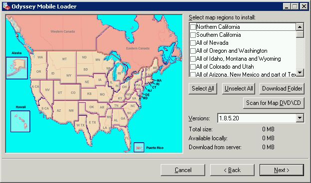
Odyssey has maps for the USA, Canada, and Puerto Rico. You can select individual states or combinations of states and state parts.
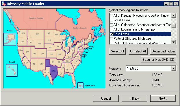
Well, East Texas for me please. You can load as many maps as you want and if they are contiguous you will be able to plan cross map routes. There is no "Major highways" map though so you will need lots of storage space fo coast-to-coast routes.
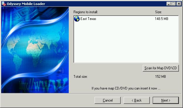
Note the size difference from what I have just been told a screen back - not a problem for the broadband connection but if your storage card is a bit tight you will have to watch this piece.

You can decide to download the map to a storage card that is attached to your PC (always recommended) or to the Pocket PC directly. The latter is rather risky since ActiveSync is not necessarily good at handling large file transfers.
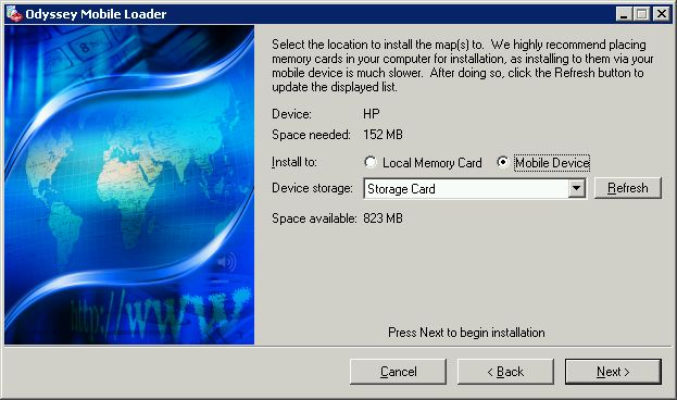
However, my notebook doesn't properly read mini SD cards, so I had to take the dusty route and keep my fingers crossed that the map would transfer ok. Which they did.

Here comes the next caveat. You can try Odyssey Mobile 4 for free, but you can't do it anonymously. Infogation want your details. You will have to register to continue. If you don't like that then this is where the buck stops.
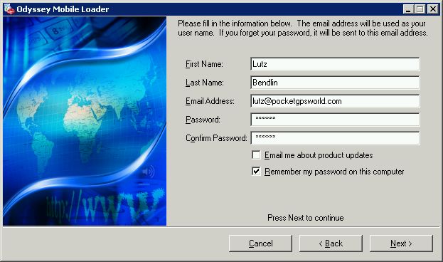
I did register, and was then able to continue with the download. Or so I thought.
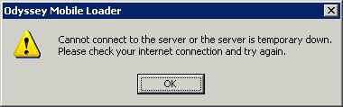
The installer assumes you have a direct internet connection. It will not work if you use a proxy to connect to the network. It will also not use your browser's proxy settings. This is something Infogation will want to fix in the next version.
I switched to a direct connection, and the map download continued.
Note that the map is now available locally, but I can always download it again if it is a different version.
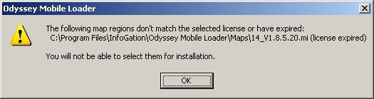
If you download maps again after a while this is what you will get:
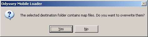
This is a message that I didn't understand, and still don't. Assuming the maps on the server are always up to date, isn't it natural that yes, I do want to overwrite my existing version? Whatever.
Once your three day trial has expired you will get a nice note about it, both on the PC and on the Pocket PC.
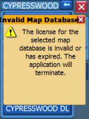
This is the time to purchase the product and enter the licence key or to bail out.
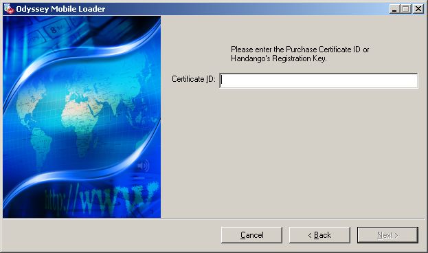
After that is done you need to re-connect to the PDA which will update the licence on the device, and then you can use the program without restrictions.
One note on hard/clean resets: If you install the application to the storage card then it will survive a hard/clean reset of your device. This means if your Pocket PC has lost power (pre WM5) or did the honors and reset itself (WM5) while you are far, far away from a PC you will be able to use the navigation program by starting it directly from the storage card. If you want you can recreate the shortcut in the start menu.
Using the program
As you may have noticed the executable is HUGE. This does have an impact if you are running off a system with slow storage - basically this includes every WM5 system. But it also means you need truckloads of free RAM to run the program. I had several cases where the program only started after I performed a soft reset.
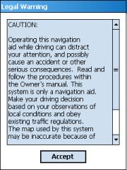  
On an iPAQ 6828 (which has a REALLY slow storage) the program took 45 seconds from the time of accepting the legalese to the time the map was shown.
Note the left screen - another Usability fauxpas that Odyssey shares with TomTom. There's no way to opt out if you do not agree to the legal stuff.
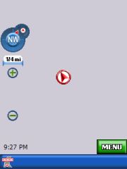
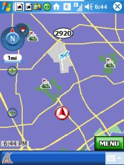
The map will eventually render, first with an arbitrary location, most of the times the city center of the state capital. Note the grey map background - a common mistake when corporate branding clashes with usability. Navigon have the same poorly contrasted grey background.
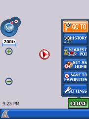
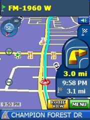
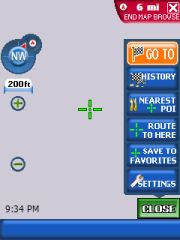
Looking at the Portrait layout, in the left corner you will have the GPS status, scale indicator, zoom in/out controls and the current time. At the bottom is either the current street or the next cross street (you can change that by tapping the bar). On the right side is the main menu button and this side is also used for all kinds of popups and daughter windows.
Setup options
It is time to setup the GPS receiver. I don't trust these auto detect routines, so I specified the receiver manually. Note that Odyssey does support COM0: - good for WM5 devices.
 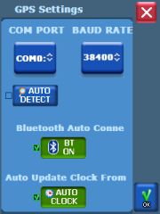 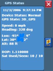
Two features for our lazy users are worth mentioning - you can let Odyssey switch Bluetooth on for you (but you'll have to switch it off manually after you exit Odyssey), and you can let it adjust the clock on your PDA from the (hyper accurate) GPS time.
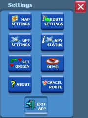
Let's look at the other setup options that Odyssey is offering.
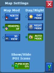 
In the map settings you can switch between North up and heading up, 2D and 3D view, Day/Night skin mode, and showing or hiding POIs. Automatic day/night mode works well in my location. Let's assume the same is true for different latitude values.
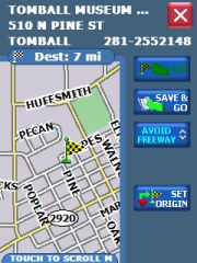
The route calculation options include the usual routing options and the unit of measurement. Note that the avoids for freeways and toll roads can also be set individually per journey.
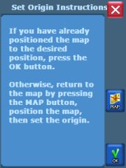 
"Set origin" left me baffled until I remembered a similar function in Mapopolis. There you can specify the search origin for subsequent searches of places and POIs. Something like "Show me the closest restaurants to that camping site in the middle of nowhere".
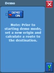
Demo mode is a nice feature to show the application to prospective buyers, and to make lots of screenshots from different situations without actually driving. You have to have a route defined before you can hit the Demo button.
Map rendering
In map mode you can zoom and pan the map. That is, if your device is fast enough for that. On my iPAQ 6828 zooming took about ten seconds per zoom level, and panning was only possible by holding down the action pad in the desired direction.
Additionally, zooming out loses too much detail too quickly, at least for my taste. Your mileage may vary.
  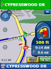
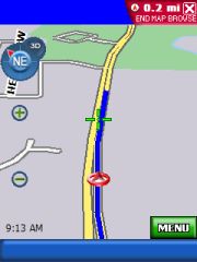
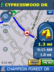
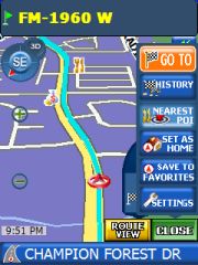
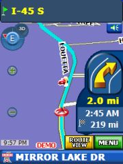
In guidance mode you get an approach indicator for the next turn At first the turn indicator (which is shown with the correct maneuvre geometry) is yellow, then it becomes green, and eventually red. It is a pretty unusual color selection but at the very least the red color does catch your eye at the right moment.
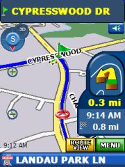
In Route view mode the next maneuvre is shown permanently in a daughter window. This eats into the real estate for displaying the current route, but I guess it will be up to personal preferences if this is acceptable or not.
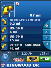 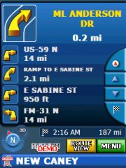 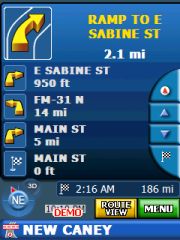
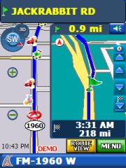
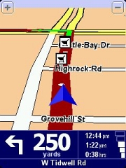
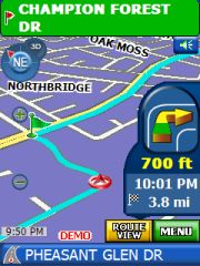
In Itinerary view mode the upcoming maneuvres are listed, along with the pictogram of the required turn and the distance between the maneuvres.
Map rendering and usability
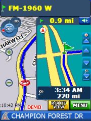
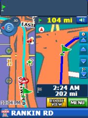
Here you can see Odyssey at its best - or worst, depending on your point of view. The way the streets are outlined in the map view does remind me of the Destinator rendering engine. It was well intended but it never had a chance against TomTom. The same is true for Odyssey. Street outlines are either missing completely, or they are too thick. As a result the streets look like they have been rendered by a five year old (I do apologise if you read that, kids).
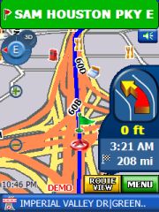  
In this comparison you also see just how much the Odyssey screen is overloaded with different colors and shapes. It is difficult to focus on the important information because you get distracted by all the eye candy around it.
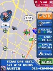
The POI icons are not much better. Rendered in extreme 3D, they are very difficult to understand. Anyone - what's that symbol to the right of the "600" label? I still have no idea.
You can of course tap on the symbol and will then see more details about it. This may also include the phone number of the POI. Unfortunately Odyssey does not support direct calling of the POI from a Pocket PC Phone.
You have to manually go back to the guidance mode by tapping the X in the top right corner - another UI design flaw because it is difficult to hit that area close to the bezel with your finger.
Have you been waiting for my standard rant? Here it is. All repeat after me:
Three-Dimensional User Interface design elements and 65K colors DO NOT WORK on such a small screen !
Like many others, Infogation ignore that fact, and the result is a unnecessary decline in usability.
For the standard skin the night colors do not actually offer any relief for the eye. The selected colors are only marginally darker than the day colors, and the contrast has even decreased. Streets tend to permeate into each other, forming a indistinguishable mass.
Finding a destination and routing to it
 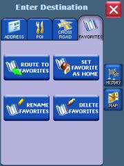
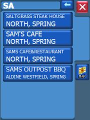
Odyssey does allow to search a destination starting with street name. This is a much needed feature in the land of suburbias where city limit locations are not part of the public knowledge.
Routing to an intersection is possible too. You can also route to a point on the map.
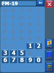  
Adaptive text entry is used to speed up the selection process for the next letter or digit. Only letters and digits are shown for which the places database has a match. If only one match for a letter or digit is found then it will be used automatically. I am not sure if this is actually quicker than the more conventional approach (always showing all letters and digits) but it does give the user more confidence in what options there are for tne next letter or digit to by typed.
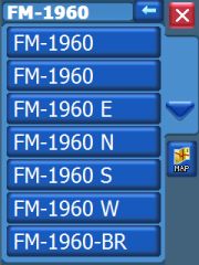
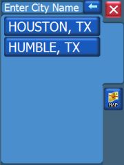
If a sufficiently small list of hits is compiled it will be displayed. As you see from the search result above this will not prevent duplicate entries from appearing. Once you select one of them the program will actually show you the difference - in this case the same street exists in two cities. I wish that information would already have been presented in the intital list.
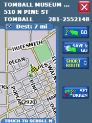  
Once the destination has been identified you still need to decide if you really want to route to it. Alternatively you can use that location as the origin, and then start over and select a different location as the destination. If you then calculate the route it will go from origin to destination, ignoring your current location. This is useful for offline planning of routes for the next day etc.
If you still have your doubts you can use the "Save and Go" feature. This will save the destination to your favourites and only then calculate the route.
The routing itself is acceptable, the turn commands are given at the appropriate time and they are easy to understand thanks to the use of WAV files. Street names and numbers are not spoken.
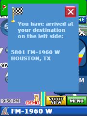
When you arrive at your destination the side of the street will be indicated both visually and through the spoken instruction.. This is very helpful when your destination is on a multi lane highway like the one shown above.
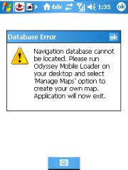
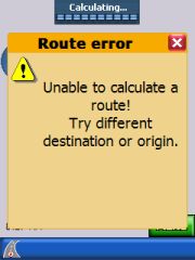
Odyssey does attempt to preserve a current route when you restart the program. But since it doesn't have a GPS fix immediately after starting the program it will give you this nasty error message.
In that case you will need to use the destination history - your route target will be on the top of the list.
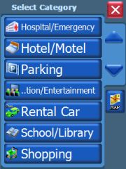
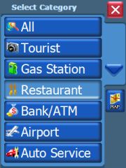
Points Of Interest
 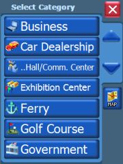
This is the standard Navteq list of POIs. It should cover the basic POI needs.
Custom POIs such as speed cameras cannot be included in Odyssey. POI warnings are also not implemented.
 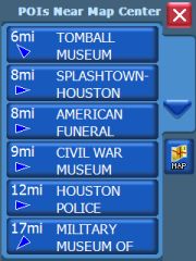 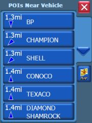
One of the better features of Odyssey is the indication not just of the distance to a POI or destination but also of the relative location of that POI. This way you can much easier judge if routing through that POI is just a small deviation from your original route or if this means you have to turn around and drive all the way back from where you just came.
When searching for a POI the result list will also show the city.
Volume control
  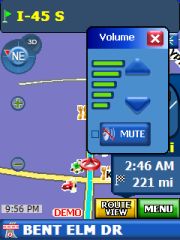
It is always important to be able to quickly mute the sound , either when you have arrived at the destination and are looking for a parking spot, or when one of the passengers is annoyed by the stuff that Claudia says. Odyssey lets you turn the sound on or off with just two taps.
Customisation
The Infogation website does list a number of skins that you can apply to the program. I won't comment on these. Ok, I will. Without exception these skins are equally bad from a usability point of view as the original skin. But that's my personal opinion. Feel free to play around with the alternative skins. You can install them the way Infogation wants you to do it (via a full blown installer) or you can simply replace the Adeona.skin file in the indicated folder.
This is also how you can switch between different screen orientations and geometries while away from a PC. Make sure you have all skin files on the Pocket PC, and then as needed copy them over the adeona.skin . I wonder if Infogation will make a skin editor available - that might be a way to get to a more useful user interface.
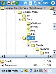
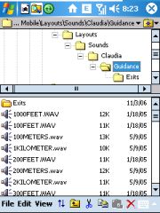
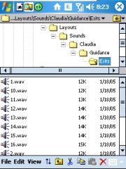
Voices for the navigation instructions are in WAV format. If you want you can record your own voice and put these files into the indicated folder. Intersection and roundabout exits have their own folder, roundabouts can have up to 16 exits. This should be sufficient even for the most verocious magic roundabout...
To exit or not to exit?
  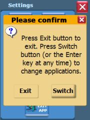
One interesting observation with Pocket PC Navigation solutions is that it always seems to take at least four taps to exit the program. Odyssey is no exception. You need to tap on the menu, tap on "Settings", then select "Exit" and then you need to endure that confirmation request on the right.
There is an alternative option to put Odyssey into the background by tapping the "Switch" button. This works reasonably well, but I found that Odyssey does not maintan the proper application icon from the initial startup (see the very first device screenshot in this review), so you don't really know which of the default icons to tap to get back to Odyssey. (The other misbehaving application is the phone program on my 6828). |


