|
|
 |
 |
 |
 |
News: Mystery island on Google Maps isn't actually real
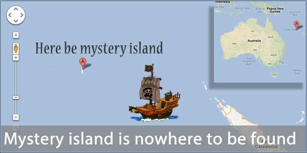
Here's an interesting story. Researchers spotted an oddity on Google Maps. An island was shown in the middle of the Coral See off the Eastern coast of Australia.
But what most attracted interest was that the marine charts for that area showed depths in excess of 1,400 metres, which would be highly unusual so close to a land mass. So they set sail for the island to investigate. And what they found, or more accurately what they didn't find, was any island whatsoever.
Despite being shown on maps from Google (look at -19.225583, 159.938759), Yahoo and Bing, there is no island at those coordinates. How it came to appear in these maps is a mystery, perhaps it was inserted by a map maker and used as a watermark to identify the originator?
Source:
Click here to read more...
Click here to discuss...
Posted on Thursday, November 22 @ 14:30:46 UTC by Darren Griffin |
 |
 |
 |
 |
| |
|
|
|
|
|
| Sorry, Comments are not available for this article. |
|
|
|
|
|
|
|


