Hi! We see you’re using an ad-blocker. We’re fine with that and won’t stop you visiting the site.
But as we’re losing ad-revenue from this then why not make a donation towards website running costs?. Or you could disable your ad-blocker for this site. We think you’ll find our adverts are not overbearing!
Posted: Sat Mar 13, 2004 11:13 pm Post subject: REVIEW COMMENTS: PocketMap
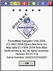
Lutz has completed his North American review of PocketMap by Space Machine. The review covers the new 2004 Edition (R3.01). PocketMap Navigator is a very colourful and "soundful" program. Clearly the developers had a lot of fun building this application.
In depth review, but there is a bias that I couldn't place. Reading the mapopolis review by the same person had the same feel.
I think the value judgements could be tossed out, but then without them, I wouldn't be able to loose respect for the style this review.
Its unfortunate that there are no trial versions of the large number of GPS packages so everybody can come to their own value judgements rather than having to wade through anothers to get to the facts.
Joined: Mar 27, 2004 Posts: 78 Location: Vandenberg AFB, Ca, USA
Posted: Mon May 17, 2004 10:41 pm Post subject:
I thought the rating you gave was a bit low. I've used D3, TType, and Garmin IQue 3600. PMN does routing very well comparatively speaking. The menus are easy to navigate. I like the custom routing flexibility also. Although you state the POIs are colorful, too colorful, and they can be annoying, but at least you can select only the ones you want shown from 40 catagories. This is very nice. I like to only show gas stations, police, tourist info, and campgrounds. With TType, it's all or nothing and I mean all 12 million of them!
The maps are easy to look at and colorful also.
I'd agree, it talks way too much and not a very good voice at that.
What I don't care for are the zoom levels and breadcrumb trail. The zoom only goes to 60yards. It should be in feet and minimum zoom should be 100 feet, not 180ft/60yards and max should be more than 8 miles . When you want to pan to follow the map or find "things" you have to drag the screen way too much. Zoom needs to be 100ft to 50 miles.
The breadcrumb trail needs to be a line, not dots. When hiking or driving a parking lot, the dots are useless and all you see is a screen of dots you can't follow. IE. If you walked a square with a line, you would see a box. With the dots, you would see four dots and you would not know where you started, what corner you went to next and where you ended. Snap to road should be selectable.
However, PMN has been great at its primary function, routing and ease of use. That with the nice maps makes this a great program. And, unlike Tom-Tom, you have street names in 3d mode.
O-ya, its also half the cost of most programs out there! I paid $79 USD! So, I use TType to find POI (Wal-Mart, taco bell, etc) and use PMN to get me there. The GPS status screen is also very nice. I think it's the only one that shows when you have a WAAS fix with an icon. Very nice, but have noticed the WAAS signal is not very strong. Also, when WAAS is being received, the accuracy is not improved beyond 12feet where I'm at.
I'd give the program a 9 or 9.5 if compared to D3 and TType v062004.
Good review though.
Posted: Sat Nov 06, 2004 6:05 pm Post subject: GPS status display
In case anyone purchases this program before going to the US, you will find that the GPS status display does not show your latitude and longutude whilst in the UK. I was informed by Pocket Map Support that PocketMap Navigator USA will only show co-ordinates when in the US.
I am pleased to confirm that this was the case and the program worked very well in my travels around New England (apart from some strange ideas it had for travelling from Logan International Airport to join the interstate headed for Cape Cod).
It would help if Space Machine pointed this out to any UK purchasers.
Joined: Nov 25, 2004 Posts: 344 Location: DFW, Texas, USA
Posted: Wed Feb 02, 2005 3:40 am Post subject:
The release notes for 3.11 give the following changes:
* Voice prompts features new recorded human voice.
* Added support for metric units (i.e. km and meters).
* Improved icon for displaying multiple POIs on the map.
* Improved highlighting of planned routes for better visibility.
* Option to turn off "Welcome ..." and "Goodbye ..."
Resolved Issues
* "Scan for GPS" feature now works for Bluetooth GPS receivers.
* Improved performance with Bluetooth GPS connections.
It looks as if route calculation is much faster.
The map display is much crisper and cleaner and the route display is also easier to see.
New Penelope voice does not say the street names, but is much clearer and louder.
Joined: 02/11/2002 22:41:59 Posts: 11878 Location: Massachusetts, USA
Posted: Wed Feb 02, 2005 5:21 am Post subject:
Thanks for the info.
Nice to see they actually implemented some of the suggestions from the review.
Just ran the install again, and it's still the same catastrophy. Despite me telling it to install to storage card it writes all over the place, into \Windows, even into the root folder. It also still places the main executable into the \windows\start menu path. They certainly get the golden raspberry for the worst install routine... _________________ Lutz
Joined: Nov 25, 2004 Posts: 344 Location: DFW, Texas, USA
Posted: Wed Feb 02, 2005 5:48 am Post subject:
lbendlin wrote:
Thanks for the info.
It also still places the main executable into the \windows\start menu path. They certainly get the golden raspberry for the worst install routine...
Ah, so that's where it went. I wondered about that. Couldn't find it when I tried to add a shortcut.
I really like that you don't have to know in /which/ of the 254 counties in Texas your destination is. Just stuff'em all onto your SD card, add Louisiana for good measure, and you're good to go (automatic map scanning and stitching, no need to open the needed maps --sorted by county-- individually and manually). Of course the more maps you have on your memory card, the longer the program takes to start, so you might want to limit the amount of data the program has to sift through on start-up.
The map managing program for the desktop PC is really nice and offers a lot of option for selecting the wanted maps: distance (up to 50 miles) around a certain city or county, by state, or, haroomph, by county name. _Lacking_ is a mode where you can draw a circle, rectangle, or a papaya if you want around a certain area, to include a somewhat coherent selection of maps from a three-state area, to wit, the Ark-La-Tex. If I /knew/ where Bon Weir is or Deaf Smith county, I wouldn't need a GPS navi system in first place, now would I?
Posted: Today Post subject: Pocket GPS Advertising
We see you’re using an ad-blocker. We’re fine with that and won’t stop you visiting the site.
Have you considered making a donation towards website running costs?. Or you could disable your ad-blocker for this site. We think you’ll find our adverts are not overbearing!
You cannot post new topics in this forum You cannot reply to topics in this forum You cannot edit your posts in this forum You cannot delete your posts in this forum You cannot vote in polls in this forum
Or you could disable your ad-blocker for this site. We think you’ll find our adverts are not overbearing!
Hi! We see you’re using an ad-blocker. We’re fine with that and won’t stop you visiting the site.
But as we’re losing ad-revenue from this then why not make a donation towards website running costs?. Or you could disable your ad-blocker for this site. We think you’ll find our adverts are not overbearing!


 Lutz has completed his North American review of PocketMap by Space Machine. The review covers the new 2004 Edition (R3.01). PocketMap Navigator is a very colourful and "soundful" program. Clearly the developers had a lot of fun building this application.


