Reviewed By |
Matthew (MaFt) Morley |
 |
| Review Date |
18 November 2010 |
| Manufacturer |
Garmin |
| RRP |
£299 EU / Continental |
|
Introduction
They say first impressions last. Since seeing the 37xx range announced by Garmin earlier in the year, I have to admit I was instantly taken in by its sleek design. Having finally got my hands on a review model, the design still sucks me in. So, enough of the pleasantries, let's get down to business!
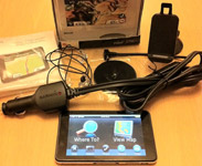 In The Box In The Box
Garmin nüvi 3790T
Micro USB lead
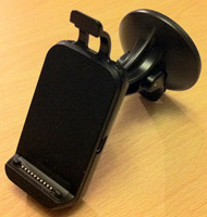
Window mount with integrated speaker
Car power adaptor with integrated FM receiver
FM extension lead with suckers
Dashboard mounting disc
Quick Start Guide
The Hardware
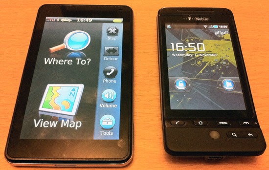
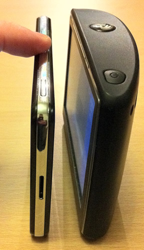
The first thing you will notice is the form-factor. The 3790T is thin; very thin. 8.9mm to be precise. It looks and feels like a modern day smartphone although it would be a little bit wide if it were. It is considerably lighter than a phone and does, at times, feel a little bit 'cheaper' and 'plasticy'; perhaps I've just got used to the relative weightiness of an HTC Hero and iPhone 4. The weight has an obvious advantage though, less downward force on the windscreen mount which has, so far, resulted in less 'Garmin Suicide Leaps' along the M62. The 37xx range is the first to feature an accelerometer; for those not au-fait with this technology it basically means that the device can detect its orientation and thus will auto-rotate the screen depending on if you are holding it portrait or landscape. The screen will rotate through all four possibilities. My personal preference, when driving, is portrait as it allows you to see more ahead; I did always wonder why companies released widescreen devices…
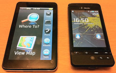  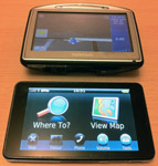
Size comparison of 3790T against HTC Hero and TomTom 520
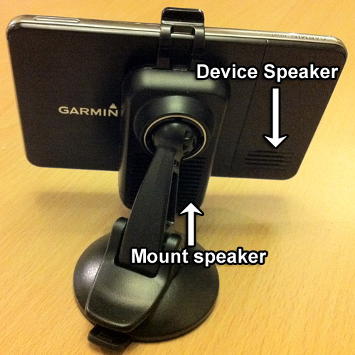
When I first powered up the 3790T I was shocked to hear how quiet the device was; it's very thin, so there's not much space for a powerful speaker. However, the mount is cleverly designed, it has an integrated speaker that is activated once the device is docked; this speaker is loud and clear.
The 3790T has an FM Traffic module which, sadly, is integrated into the power lead. The resulting thick/heavy cable is cumbersome and practically impossible to 'mould' around your dash to keep things looking tidy.
 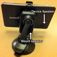 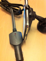
Mount, speakers and rather chunky FM Lead
The screen is clear, sharp, bright and surprisingly non-reflective. Garmin have, for this range, opted for a multi-touch capacitive touchscreen as opposed to a resistive one. In simple terms it means it can detect multiple touches at the same time and allows nifty features such as sliding the screen to move down a menu and 'pinch n pull' to zoom in and out; again, highlighting the smartphone feel. Perhaps their flirt with Asus for the nüvi-phone led to some of these new design ideas? Regardless I like it! It also boasts a whopping 800 x 480 pixel resolution - that's almost 4 times the number of pixels that the TomTom Go 1000 has but in the same screen size. It's also not far off the iPhone 4's Retina display.
In Use
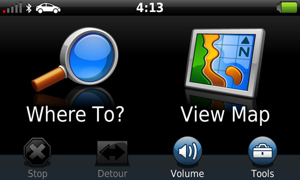
Garmin's nüvi 3790T is very simple to use. Using their tried and tested "2 option" main menu of 'Where To?' and 'View Map' (along with smaller options for 'Stop', 'Detour', 'Phone', 'Volume' and 'Tools') Garmin's nüvi 3790T is very simple to use from the outset. The main menu also shows the GPS signal strength, Bluetooth status, mode of travel (car, pedestrian or bicycle) and the current time. Pressing the car icon brings up a quick menu to change your mode of transport, pressing the time allows you to adjust the time too although you can't get further information on the satellite fix.
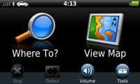 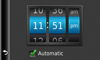
The main menu (night mode) and setting the time
Selecting a destination is simple. You have the following options: Address, Go Home, Points of Interest, Recently found, Favourites, Parking, Junction, Extras, Towns (which includes villages and business centres), Trip Planner, Browse Map and Coordinates.
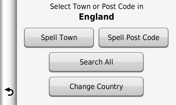
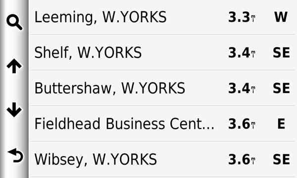
As with all Garmin's 'high end' models, a QWERTY keyboard is offered (you can also switch to ABCDE if you wish). When selecting an address you can choose between Spell Town (and then house number and street), Spell Postcode (followed by house number) and Search All (enter house number, spell road, select matching town/village). When you start entering values such as town or road the nüvi will bring up any matching, previously entered values. You can then click on these to speed up entry. It will also speed things up by showing a list of towns if there are only a few possibilities. For example, typing 'Wak' jumps to list showing Wakefield, Wakerley and Wakes Colne.
 
Address search (left) and Spell town (right)
POIs are the usual NAVTEQ affair, mostly accurate around my locality (results may vary by town!) but totally lacking Police Stations in Bradford. The maps are '2009' so are fairly up to date. Searching for a POI is a simple process where you can break it down by category and start typing to find what you need. Unfortunately with reviewing the nüvi 1690 and owning a variety of smart phones over the last half a decade I have been somewhat spoilt by constant connectivity to the internet. The nüvi 3790T is not a 'connected device' and so does not feature nuLink (like the 1690 does [see our review here]) which gives Google search, local weather etc. This isn't a major issue but every so often you just can't find what you are looking for in the POIs and Google is your only friend. Perhaps I should point out that we are not sponsored by Google and other search engines are available such as Bing, Yahoo!, Ask Jeeves etc etc etc… feel free to mention some others in the comments at the end!!
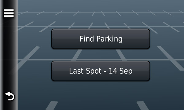
Selecting Parking from the Where To? menu leads to two options: Find Parking and Last Spot. Find parking simply acts as a shortcut to the parking POIs and Last Spot will take you to the last place you parked, or rather the last place you disconnected or turned off your device. This is a useful feature if you have a habit of forgetting where you parked (Mrs MaFt, are you reading?!) - shame it cant find your keys though.
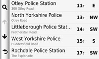 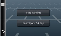
Still no police stations in Bradford (left) and Parking menu (right)
Extras is my first major issue with the nüvi 3790T. A number of years ago Garmin changed their software so that custom POIs were relocated from 'Where To / Points of Interest / Custom POIs' to 'Where To / Extras / Custom POIs'. I never quite understood the reason behind this but have always assumed it was to add an extra little bit of confusion for people using 3rd party POI files / speed camera files like ours. They seem to have gone one step further this time to make things difficult. When you install POIs using Garmin's own POILoader software it completes the task and tells you it has successfully installed 65,000 POIs. Wonderful! However, when you go to the device and go to 'Where To / Extras / Custom POIs' it tells you there are none installed. So, what do you do? Well, you need to install the POIs to a micro-SD card first, then insert it into the device. Or use a Mac as the Mac POI Loader adds the POIs just fine. This has been mentioned in the forums since the device went on sale and even the latest software update (2.50) has the same 'feature'. When a device is sold as having a certain feature is it so wrong to expect it to actually work on Windows as well as Mac? It is also quite buggy when you turn on proximity alerts for custom POIs - if you tick the box then press save it then removes the tick when it saves your settings. Leaving it unticked and pressing save again then restores the tick! Confused? Yes, me too!!
Navigation & FM Traffic
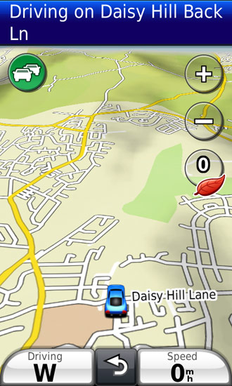
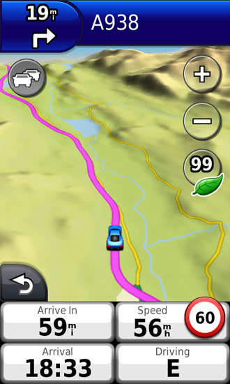
The navigation screen is nice and clear and the 3D view makes use of terrain data so you can make out hills and dips in the road. It also displays 3D renders of some landmark buildings such as the National Media Museum (IMAX) and Bradford City Hall. It's not overbearing and adds a useful level of data to the view. Pressing the bottom left button allows you to select what value is displayed. When navigating you can choose from Arrival Time, Distance, Time to Destination, Direction of Travel, Elevation and Time of Day; When you are just driving you get Direction of Travel, Elevation and Time of Day. There is an option to show four 'blocks' of information which could be useful but obviously eats up a bit of the map space.
   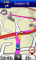
 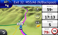
Terrain view and buildings. Also note the screenshots with extra information on display.
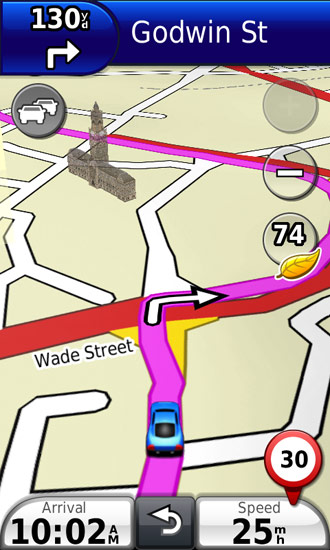
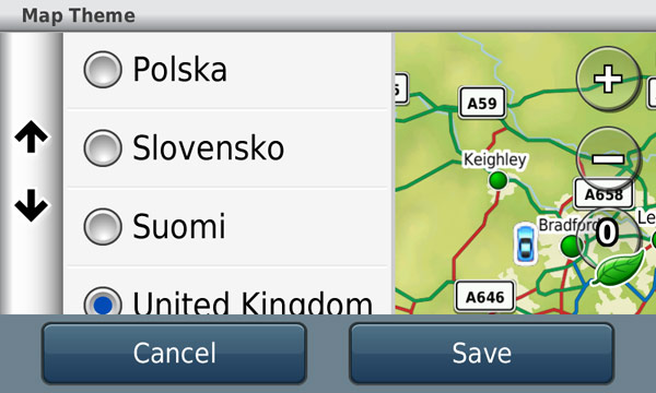
If, like me, you live in the UK and like your roads to show in a certain colour then you will be happy to note that the 3790T has 'Map Themes'. Changing this setting allows you to have 'normal' looking maps on your Garmin. It's such a small thing really but it makes such a difference!
 
Hooray for different map colours!
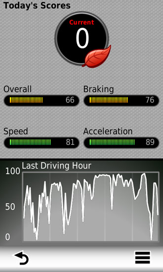
 The nüvi 3790T features EcoRoute and, because I covered this in some detail in the 1690 review, I won't repeat myself too much. Basically you enter your vehicle's MPG and the current fuel cost and it aims to calculate how much your journeys cost - you update fuel price and mileage etc when you refuel and it adjusts your MPG for you. It also shows how 'eco' your driving is based on your rate of acceleration and braking. Your 'score' can be shown on screen while driving. Garmin also offer EcoRoute HD which is a separate device that connects to your car's OBD II diagnostics port and connects, via Bluetooth, to your compatible device. The 3790T isn't compatible with this at the moment but Garmin have confirmed that it will be added in a future firmware upgrade. When it is added it will allow real time engine information such as air intake pressure, engine load, battery information and other geeky car stuff. The nüvi 3790T features EcoRoute and, because I covered this in some detail in the 1690 review, I won't repeat myself too much. Basically you enter your vehicle's MPG and the current fuel cost and it aims to calculate how much your journeys cost - you update fuel price and mileage etc when you refuel and it adjusts your MPG for you. It also shows how 'eco' your driving is based on your rate of acceleration and braking. Your 'score' can be shown on screen while driving. Garmin also offer EcoRoute HD which is a separate device that connects to your car's OBD II diagnostics port and connects, via Bluetooth, to your compatible device. The 3790T isn't compatible with this at the moment but Garmin have confirmed that it will be added in a future firmware upgrade. When it is added it will allow real time engine information such as air intake pressure, engine load, battery information and other geeky car stuff.
Routing seems sensible although I've had a few occasions where it opted for a narrow country lane. However, these are not that common. I suppose it must depend where you live and what map data is present - the only reason I can think of is that a narrow country lane has a national speed limit of 60mph (even though it is impossible and/or stupid to try and reach) and hence it appears to be a faster route. Remember kids, a satnav is an aid to driving and, while it would be lovely if they always gave the bestest, most safest and correctest route the fact is, they don't! This isn't a snide comment towards Garmin, all satnavs that I've used have had similar little quirks.
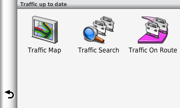
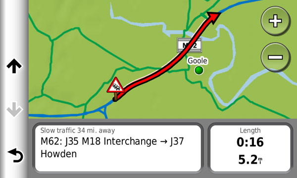
Traffic is one of those things that, on your own, is impossible to test. It seems to work; I was alerted to roadworks that i knew about on the M62. What I didn't know was just how long the delay actually was. The Garmin gave me a time but how could I check that it was accurate when I was already taking a detour that it told me was faster? Unless, for every trip, I took along my doppleganger Mr Russell Watson (see below) to confirm whether or not the delay a) existed and b) was as long as the device said it was! To be fair, again, this is something that affects every device with traffic functionality. On the main map screen you have the colour coded traffic icon: grey (no FM signal), green (route is clear), orange (some delays) and red (big delays). Pressing the button takes you directly to the traffic screen. FM Coverage seemed good in the areas I travelled and the information given seemed relatively comprehensive. The traffic screens show the traffic on your overview map as well as, when you select an individual event, the reason (where known) and approximate delay.

Dopplegangers: Opera Singer Russel Watson (left) and Karaoke Master MaFt (right)
As well as FM traffic, the 3790T makes use of historical road speed data and the time of day, similar to TomToms IQ Routes. A feature I've not been able to test is myTrends. According to the Garmin publicity "with myTrends, when you save your regular destinations in your “Favorites,” your nüvi 3700 will, over time, begin to figure out where you’re going even without your telling it! It provides time of arrival and relevant traffic information. So whether you’re driving to and from work or a regularly scheduled weekly event, your nüvi 3700 will help you get there on time". I only have one favourite set, Home, and in the time I've had the device it's not detected that I'm going home. Perhaps I've not used it enough but with no inkling of how long it should take, other than 'over time', it's hard to know if it works or not! If it does, then it could be a useful feature.
 
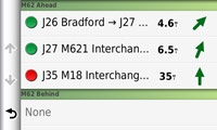 
FM Traffic information screens
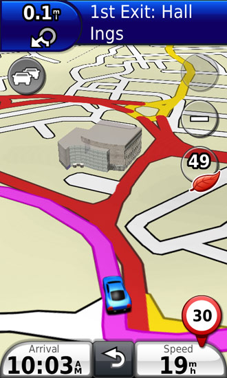
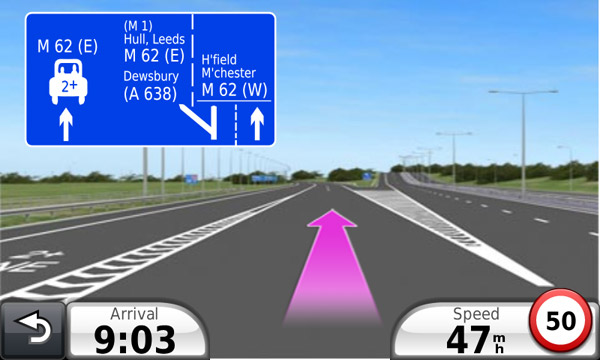
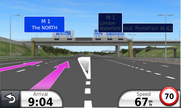
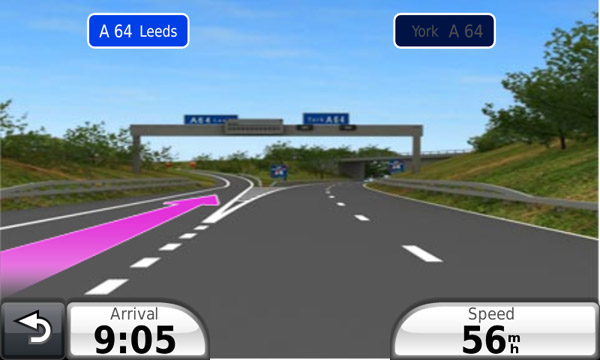
The 'photo-real junction views' are, actually, very good. While not actually photos of the junctions on motorways the layout of the road, nearby features (hills, trees, flyovers etc) and position of the signs and their contents are pretty accurate and useful to quickly see which lane you need to be in. In landscape view the junctions take up the full screen but in portrait the junction view is shown in the top half of the screen and the map at the bottom. According to Garmin's website I could also see buildings and double yellow lines. I've not seen buildings or yellow lines but the junction views I've seen on the A64, A1(M) and M62 have been suitably impressive and realistic - even going as far as showing the 2+ lane on the M606/M62 junction!
  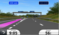
Photo-Realistic Junction Views
Advanced Features
Trip Planner:
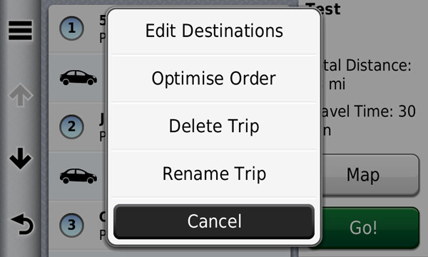
The 3790T has a useful Trip Planner. This allows multi-point routing and the option to optimise the points in-between your start and destination. It works well and came in useful recently when I went paint balling. I set my start point as home, then added the 3 addresses I was picking people up from and finally the location of the paintball place. It then calculates the route in the order you entered the points and it shows a break-down of the time between each point as well as total distance and time. You can change your mode of transport between each point and also choose to optimise by pressing the 'menu' button (3 lines). One thing that annoys me, and did with the 1690 too, is you need to calculate the route initially before you can optimise it - on a relatively short route this isn't an issue but on longer runs it can feel like you are waiting an age for it to complete.
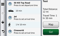 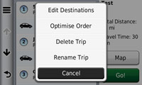 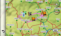
Trip planner: select destinations and transport method for each, optimise and view the optimised route
Voice command:
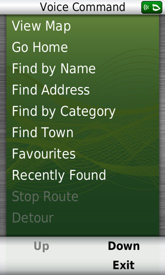
Now onto my favourite feature of the 3790T, Voice Command. Controlling your SatNav by voice is, in itself, nothing particularly new; many TomToms have this feature as did a couple of high end Garmins. The major flaw with previous methods of starting the voice command feature was that they still required some form of physical interaction either with a few button presses or the press of a hardware button mounted to the steering wheel. Also, TomTom's level of control was pretty limited and basically only allowed you to input your destination. Garmin's Voice Command is, in a word, amazing. Why? Well, for one you activate it using your voice - no button presses required. Simply say "voice command" while your are out and about and the voice command menu pops up with a list of functions you can use. Don't fancy using the phrase "voice command"? Well, you can change it to whatever you want, simply type it in the settings; I have mine set to "listen" which always makes the kids pay attention and wonder what they've done wrong!
The full list of commands you can use are: view map, go home, find by name, find address, find by category, find town, favourites, recently found, stop route, detour, phone, volume and brightness. A pretty extensive list and made so much more useable by being totally voice controlled; even saying 'up' and 'down' moves the voice command menu for you.
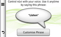  
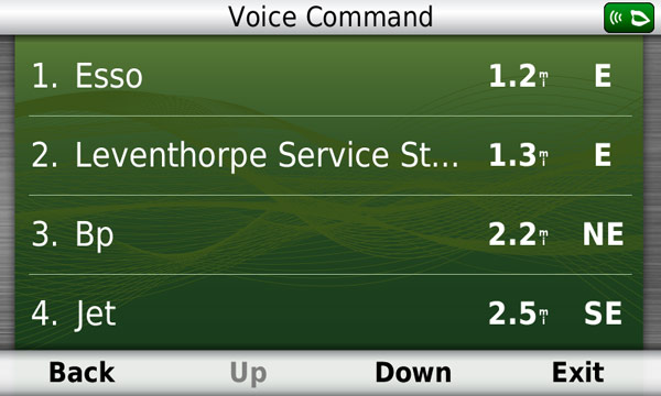
"LISTEN!", "Find by category", "Fuel"
On the road the voice command works well, you need to speak clearly and firmly (as opposed to shouting) and even with music playing and driving at 70mph on the A1/M it carried out every command correctly. The only issue I've had is when setting the volume or brightness it doesn't seem to react to 100. I've tried 'hundred', 'one hundred', 'a hundred' and even the long, drawn out, sarcastic 'one hun-derrr-edd' all to no avail. In these instances I just settled with 90 or tapped 100 on the screen!
Other Bits
The photo viewer is pretty standard in Garmin devices now; although personally I would prefer that they put a headphone socket and MP3 player back in. The viewer is pretty basic allowing you to view photos, zoom in/out using pinch/pull and, if geotagged, navigate to the photo's location. The nüvi 3790T has a micro-SD card slot. Most digital cameras have a full size SD card. Therefore, to use the photo viewer you would need to copy the photos onto a micro-SD card in order to make use of it. It's too convoluted to be of any real use. If you go to https://connect.garmin.com/photos you are able to download geotagged photos of any location you search for. This is powered by Google's Panoramio. You can also view all your pictures as a slide show and choose a picture for the lock screen background.
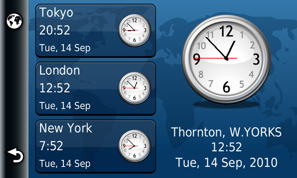
The device also has a world clock, alarm clock, calculator and unit converter. These aren't things I really use on a satnav but if you're abroad then they could be handy.

World clock
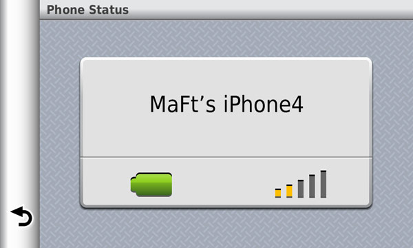
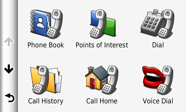
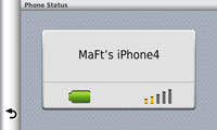
Bluetooth handsfree works fine and the clarity is perfectly acceptable. Unfortunately my phone does not handle SMS over Bluetooth so I can't comment on that. Using the Voice Command feature makes calling someone even easier: say your 'Voice Command' word (in my case 'Listen'), say 'Phone' and then say the name of the contact. If they have more than one contact phone number you then select which number to dial.
Bluetooth handsfree
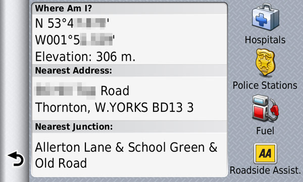
Garmin's 'Where Am I?' is also available on the nüvi 3790T - this shows your current coordinates, the nearest address and junction and quick links to hospitals, police stations (unless you're in Bradford!), fuel and roadside assistance. Roadside assistance, in the UK at least, is simply the contact number for the AA. Unfortunately you cannot change this. A good feature would be to be able to customise this with your own breakdown details with a customisable telephone number and a field for your policy number.

Where am I?
I should mention that the 3790T comes with the Garmin/Cyclops Speed Camera Database pre-installed. You can, however, deactivate it and use the superior PocketGPSWorld.com datbase instead!
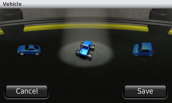
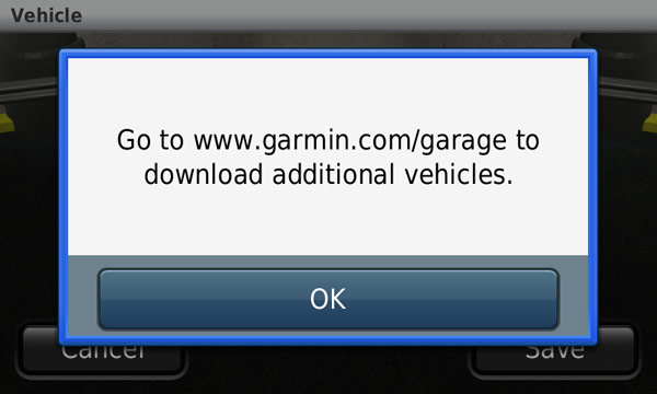
And, finally, the Garmin Garage. Out of the box you have about 10 or 12 vehicles you can choose from (as well as the arrow) to show your location on the map and you can also download extra ones, for free, from teh Garmin website. It's a nice little touch but not overly useful. However, come Christmas I can see a lot of people using Santa's Rocket-Powered Sleigh; but for me it's the Monster Truck all the way!
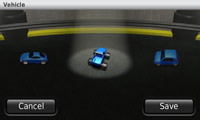 
Garmin Garage - choose your ride!
Also Available
For £20 less (RRP £279.99) you can get the nüvi 3760T. The two models differ in that the 3760T does not offer Voice Command, 3D Buildings or Terrain View. Personally I would recomend paying that extra £20 just for the Voice Command!
Conclusion
The 3790T is a very nice device with a lot of unique features. The voice command is truly amazing and the fact you can even activate it without any button presses is a massive plus point. Every person I've shown the device to has been impressed with the design and feel of the device as well as the features. It's hard to find any major faults with the device for an 'off the shelf' user, but more advanced users may face some issues with POIs and multi-point routing. All in all I believe Garmin, with the 3790T, have produced a very good satnav with useful bells and whistles and not too much pointless baggage. With a list price of around £300 (although you can pick them up for nearer £250) it is also competitively priced.
Specification
| Dimensions |
122 x 75 x 8.9mm |
| Display |
4.3"
16:9 Multi-touch, capacitive wide screen |
| Display resolution |
800 x 480 pixels (WVGA), dual-rotation, colour TFT with white backlight |
| Weight |
113.4g |
| Battery |
Rechargeable Lithium-Ion; Up to 4hrs quoted life |
| Memory |
8GB internal flash + microSD Card Slot |
| Connectivity |
Bluetooth (Handsfree Calling, Phonebook, SMS) |
|