Report by Lutz Bendlin
My recent vacation in Nova Scotia happened to result in a route that also touched Yarmouth, Maine. This happens to be the town where DeLorme is headquartered. Sooo - let's pay them a visit and see what they are up to nowadays. Luckily Charlie Conley, the Marketing Manager for Consumer devices at DeLorme, was available to answer my questions.
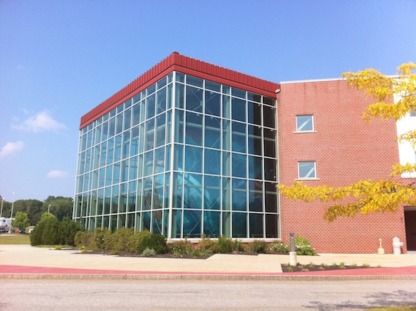
The first thing that catches your eye when you approach the DeLorme office in Yarmouth, right off I-295, is that giant ball in the glass cube. The ball is called Eartha and is the largest representation of our planet (apart from the real thing of course), with Guinness Book of Records certificate and stuff. Eartha has all kinds of gimmicks like elevation profiles etc. But I don't think it is pear shaped enough...
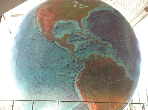
It also has the right incline, made possible by some clever mechanics.
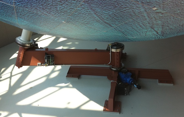
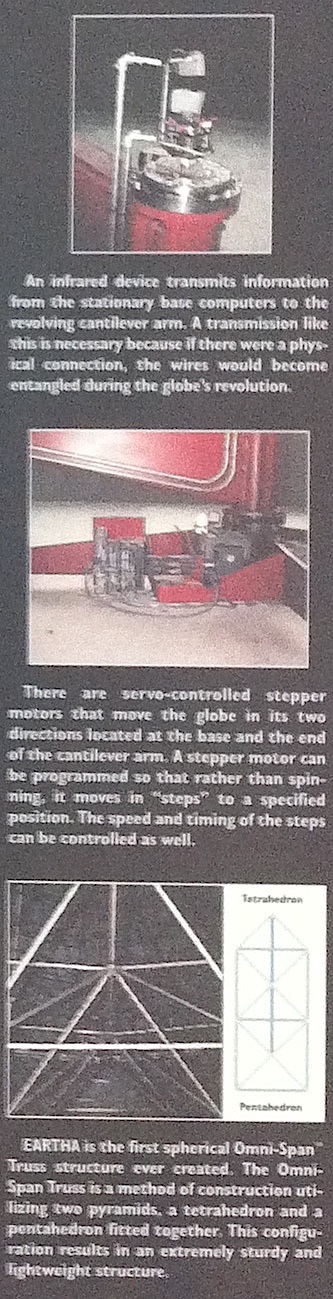
Here is part of a poster explaining the mechanics a bit more
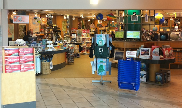
I know, exciting stuff. But - there is more, especially for the family members that do not appreciate the mechanical marvels as much as I do. DeLorme have a MapStore right inside the office building.
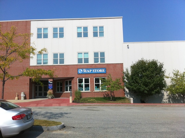
Anyone can come and get devices, maps, and geography themed educational toys. Beware - you need a budget limit or a time limit (or both) to get out of that store without being totally broke.
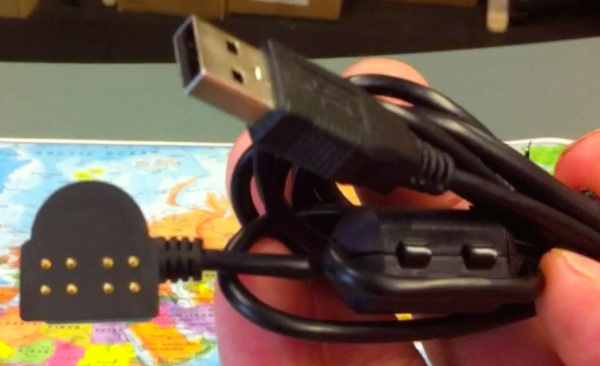
Here is the transcript of the chat I had with Charlie on September 1st. It's a bit meandering but I still hope you can glean some information from it. Apologies for the blurry pictures - these are stills (well...) from the video that didn't work because I am not good at talking and filming at the same time. We started off talking about this duo:
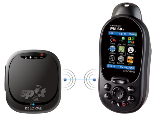
CC: This video which you can see on our website is showing the PN-60w with SPOT communicator. We don't have any in yet.
LB: When do you expect it to be in?
CC: We have shipped some to retailers, but the quantities are still small. We expect to ramp up in the fall (Editor's note: DeLorme have confirmed they now have them in store).
LB: What's the added function of the SPOT? Is it two way communication?
CC: Are you at all familiar with the SPOT technology?
LB: Well, Microsoft SPOT, but that is probably something totally different.
CC: SPOT is a California based company. Their parent company, GlobalStar, owns satellites, and SPOT sells devices that can send preset messages.
LB: So this works like a satellite phone? Or is it a surface communication ?
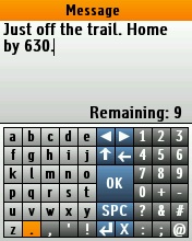
CC: The Earthmate PN-60w connects wirelessly with the SPOT device (via a proprietary radio protocol). The messages are sent from thePN-60w through the SPOT device to the satellites which relay them to ground stations. From there the messages are sent to cell phones, email addresses, Twitter, Facebook. The advantage of the PN-60w is an on-screen keyboard that allows you to create custom messages so you can be much more precise when describing your status.
LB: Is it one way only or can you receive messages as well?
CC: Yes, it is outbound only. We have been getting a lot of press on this already. We have been inundated with inquiries. I had no idea how many people go on expeditions. We get about five requests from expeditions per week. We just got a request from a guy preparing for a Mt. Everest ascend. We had one from a guy who just did a mountain bike trip up the Lost Coast in Alaska. We have gotten inquiries from Baja-1000 road race participants. So we're getting a lot of interest, and it is exciting for us.
LB: Well, it seems to fill a niche between the standard communication you have on a Cell phone network and the expensive satellite phone.
CC:Yes, and you don't need to go to the ends of the earth not to get cell phone coverage. I hike in the White Mountains, and my phone gets no signal there at all. And I am generally late coming off the trail. So it is nice being able to send something that my wife can pick up on her cell phone, letting her know that I am all right.
LB: Are there any thoughts to include a motion sensor in the SPOT device, for example to detect a fall? So if you can't take the action anymore the device can still send out updates by itself? Similar to what devices in the health care business do?
CC: That is not in the current development plans. But it is an interesting suggestion and I'll certainly bring that up with the developers.
LB: What's the average battery life on the device? Do you have additional power sources like solar panels etc?
CC:We provide Lithium batteries for best performance, and with those the device will last for about 24 hrs. Standard AA batteries will yield about 19 hrs. We are not offering solar chargers at this point. However, our eight pin connector cable has a standard USB A plug, and if your solar charger supports that then the device can possibly be charged from that solar panel - you will have to test that yourself though, we are not giving any guarantee. Generally, power is the most vexing issue with mobile devices.
LB: Indeed. I even have a selection of hand cranks and other contraptions that I am trying out (The pull-wheel Yogen is one example). Especially if you don't have sun those may just make the difference if you need to get the distress signal out.
CC: Once a device is out in the market the customers always come back with comments and suggestions how to improve the device, and we have the opportunity to implement some of them in upcoming devices. Are you familiar with our current product lineup?
LB: We've seen some of your offerings at CES but it has been a while. Maybe you could refresh my memory?
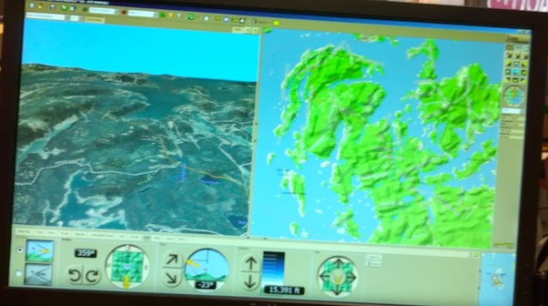
CC:Our desktop control application (Topo North America 9.0) supports color aerial imagery of the entire US. The resolution is one meter per pixel. The data comes from a variety of government sources like USGS etc. You can view the terrain at various viewing angles and from any compass orientation. Elevation contours, roads, trails and other layers can be superimposed.
LB: The elevation contours are really helpful.
CC: Yes. On the GPS receivers we are not offering 3D or shaded relief , but we show the elevation contour lines.
LB: What's the reason for not showing 3D on the device? Is it insufficient processor power, or not enough memory? Or is it not necessary?
CC: Speaking personally, when I am out hiking, I don't find it necessary. It might be nice to have but it is not something I would rely on.
LB: It would be interesting to combine the GPS with a compass and a gyroscope so that when you need to orient yourself the device could show you the elevation gain in the direction you are pointing. Similar to what the Google Sky Map application does on Android - there you can point the phone towards a constellation in the sky, and the application will tell you what constellation it is.
CC: As I said, we are always adding new features. The PN-40 is our second model, after the PN-20. The PN-40 has a three axis electronic compass. It also has a barometric altimeter, and both features carried through to the PN-60s. What the PN-60 has (and what the PN-40 doesn't have) are features like a much more intuitive user interface and improved power management.
LB: Couldn't you put that new user interface on the PN-40 as well?
CC: I am not sure what type of development that would entail. The PN-60s also have elevation profiles, GPX file support, more flexibility in saving waypoints and tracks both on the device and to an SD card. The GPX support by the way was done via a firmware upgrade, so you now also get that on the PN-40.
Comparison chart PN-40 vs PN-60 vs PN-60w (PDF)
CC: We have done a lot to extend the battery life, and we are providing Lithium batteries as mentioned earlier. When I used to do my seven hour hikes up in the White mountains, I would see a fresh set of batteries come down to 20% when returning. But just the other day I was there for five hours, and the Lithium battery set indicates it is still on full power.We also improved the power management by switching off non-essential functions like the screen at the appropriate time.
LB: You mentioned the SD card on all devices - is that SDHC?
CC: Yes, we support everything up to 32GB
LB: So to summarize, from a hardware perspective the PN series is your only offering?
CC: Are you familiar with our laptop GPS? We still sell that to customers who prefer the large-screen map perspective. But as you know the automotive GPS space is occupied by other companies like Garmin or TomTom.
LB: Well, even they see pressure now from the smartphone side.
CC: Price plays a big role here - when you can get a Garmin Nuvi for $89 there is not much space left for alternative offerings. Having said that, our LT-40 laptop GPS with Street Atlas USA is still selling well at $69. One other thing we have been focusing on is Geocaching. We offer Geocaching integration in our PN devices. But if you have an iPhone or similar you won't need a separate GPS as that is already included in the phone.
LB: It depends on the phone. Geocaching needs a pretty accurate GPS signal, and a lot of phones have rather weak GPS chipsets. I tried it on the iPhone 3G, and I was not impressed. The iPhone 4 is substantially better in terms of GPS accuracy.
CC: We feel that Geocaching with smartphones is a great sport in the city but if you are out in the woods, climbing over rocks, you may want to use a more robust and better performing GPS receiver.
LB: On the Nexus One I use an application called c:geo which will take my position and then tell me which caches are nearby.
CC: If you run that here you will find there is a cache right here, adjacent to the parking lot.
LB: On the mapping side - I noticed in the store that you also seem to offer rugged, waterproof print maps?
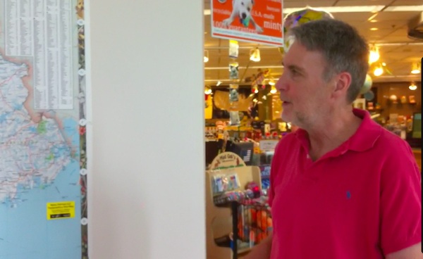
CC: This one here (political map of Maine,US) is actually printed in house. We can custom print this, mostly for businesses, communities or tourist agencies.
LB: Do you offer this type of map to regular customers too?
CC: We used to sell one that was 2x3 feet but it just was not a robust seller for us. Interestingly, when we stopped selling it, we still got about four or five inquiries a month for it.
LB: If you could print it on demand that might be a solution. We see that in the book market - there are already a number of book stores where you can choose to buy a book and while you go drink a coffee the store prints the book, adds the hard cover and all. You could do the same - let the customer decide which area they need, what type of map, what material, and then you could print and finish the map right here on your plotter while the person is looking at the other items in your store.
CC: That may very well be what will happen.
LB: Would the data have to come from you, or would a customer be able to come to you with their own data and you would print it for them?
CC: It would have to be our data. We have a large amount of data - paper maps are where this company started. And despite all the new technologies our atlases are still very strong sellers.
LB: We are reviewing all these personal navigation devices, but we also hear a lot of people say that they cannot use them or don't want to use them. They want to touch a physical map, they want to see more than just a little screen full of the map. It seems there will have to be a balance between the two media.
CC: Yes, there are a lot of niche manufacturers. If you visit hiking stores like LL Bean you can still find a wide selection of very good topographic maps on very good material. These manufacturers are making a living of that, so it didn't make much sense for us to focus on that as the market is well taken care of. So we were moving more into the mapping software and GIS area. However, we are still devoting a lot of development time to our Atlas and Gazeteer products - those are really the flagship products of our company for a long time, so we're not letting go of them.
LB: From a software perspective - you mentioned you are now on version 9 - what is the development roadmap in that area?
CC: Topo North America is still selling very well as a standalone product - you can buy it here in the store, in other Outdoors stores, or online for $99.95. We also use it as the map engine for the handheld GPS receivers - it comes with the devices, and is included in their price.
LB: Do you have an update package? Something like a yearly subscription?
CC: Yes, our registered users receive special pricing. By the way, you may notice that I say Topo North America rather than Topo US - we now also include topographical maps for all of Canada.
LB: And Mexico?
CC: For Mexico we are currently showing main roads only. It's really important for us to have a desktop program where people can do their waypoint exchanges, GPX import and export, and route exchanges.
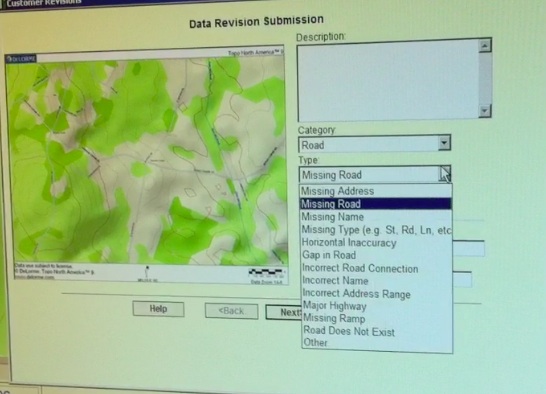
LB: How about user contributions? Can your customers submit requests for map updates?
CC: Yes, we have a form on our website where the users can submit map correction requests, and those then land via email in our data department.
LB: Do you do the map updates in house or have you outsourced it?
CC: We do all of the map data management in house.
LB: How different is XMap, your commercial offering, from the Topo North America product?
CC: XMap has a different data set, and is using more sources. It is a true GIS program for professional users.
LB: Looks like XMap is vector based, and TopoNorth America is based on bitmaps?
CC: Actually, our Topo North America and Street Atlas USA data is vector based. Of course the aerial images are bitmaps.
LB: So you can seemlessly zoom your Topo NA maps?
CC: Yes, you can use any magnification level, and the data will rerender without loss of quality - unlike a bitmap.
LB: What do you say to the newest Microsoft offering - the Bird's Eye view where you can "fly" around a location and see varying aerial pictures that have been taken at an angle? It feels like they were trying to one-up Google with that feature. For us as customers it is a good thing - we are benefiting from their fight of egos. But since both of them use images rather than vector data they have to come up with these fancy solutions. Google "StreetView" is just a sequence of pictures. Microsoft with their "Streetside view" are also computing the in-between frames, so to speak, and you get a more natural presentation of entire street fronts.
CC: I always found the Google StreetView to be annoying - navigating down the street in these chunks and invariably not exactly getting what you need. But yes, we are watching this space and are also thinking about coming up with solutions ourselves.
LB: Thank you Charlie for your time!
|


