A couple of weeks ago we were invited to the Southampton headquarters of the Ordnance Survey to discuss points of interest. Now as the Ordnance Survey are the premier mapping authority for the UK we thought it would be rude not to go... So one cold and damp British morning I braved the M25 rush hour traffic to go and pick Darren up on our way down to Southampton.
Now interestingly when you put in the postcode for the Ordnance Survey office (yes they do have their own postcode not shared with anyone else) you end up at the delivery dock. As I had been there before I knew about that so we headed off to the visitors car park.
The Ordnance Survey are known by most people for the paper maps that we use when we go hiking. For navigation (in the dark ages) we probably used the AA Book of the Road. In today's enlightened age we now use digital maps from Navteq or Tele Atlas. However what you may not know is that all the above are actually based on mapping data produced by the Ordnance Survey.
The guys at the OS don't just get the roads and contours on the maps they also survey buildings and manage addresses. The business group that we were invited to visit are responsible for maintaining the Points of Interest (POI) database for the UK. Which brings me nicely to the point of this article. The OS have millions of Points of Interest in the UK and want to find out if you guys are interested in them...
If you have a SatNav device then the likelihood is that you will be either using Navteq or Tele Atlas maps. Depending on the maps and your SatNav you will have more or less POIs pre-installed on your system. Typically for the UK these will be in the tens of thousands. This may sound like a lot, but when you stop and consider that there are some 2,000,000 companies in the UK then a few tens of thousands doesn't even cover 1% of them.
The Ordnance Survey has over 4,000,000 POIs geocoded with extended information such as address and phone number. These are categorised in three(or four) level hierarchy: Category (10); Sub Category (49); Detailed Category (over 600); (and Branding). These cover all aspects of stationary geographical features from petrol stations and shops to the more esoteric electricity pylons and railway crossings. The OS dataset covers just about everything with the exception of CCTV cameras and (fortunately for us) Speed Cameras. If you are interested in the category structure click here for a PDF document defining them.
We at PocketGPSWorld.com do have one category of POIs that the OS don't have: Doctor Who filming locations. Which goes to prove that this is a massive job that will never be complete because there will always be a special interest group that requires specific location data. Fortunately this is where community sites like ours come to the fore...
Getting back to the point. The OS collects and verifies the POI data using key suppliers such as Thompson, and definitive sources such as Shell, Department of Education etc. These are processed in conjunction with one of the OS partner companies PointX who specialise in location based data products. Up until now this data has only been available to corporates on a commercial basis. Which brings me to the real point of our discussions:
|
Article by Mike Barrett

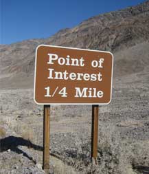
OK so this is a picture from Death Valley USA
but it illustrates the article rather well...
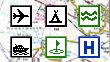
We are all used to seeing the POIs on the OS Maps.

This is how it was done in the old days.
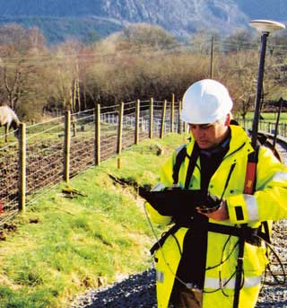
Today anywhere a person can go can be surveyed.
|


