Article by Lutz Bendlin
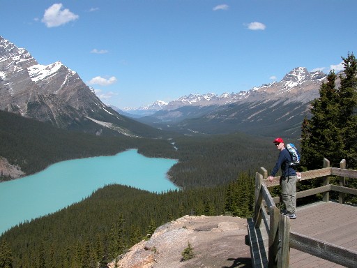
I recently enjoyed two weeks of wonderful hikes in the Canadian Rocky Mountains. This was also an excellent opportunity for me to test some GPS gear for "real life" hiking usability, particularly in the areas of battery life and ruggedness (and to test the patience of my wife...).
Choosing the hardware was pretty easy - I wanted to travel light and decided to take only my iPAQ 3970 with GSM/GPRS jacket and the CoPilot BlueTooth receiver with me. Thankfully they share the same charge plug.
Imagine my surprised face when I realized that I had plenty of road navigation software to choose from (well, not plenty, but at least a handful) but no topographical maps.
A couple of frantic Google searches, a bit of swearing and some Excel macros later I had a solution that looked promising (and turned out to work pretty well). Here's the essence of it:
top
What do you need
- a Pocket PC with lots of memory (a 256 MB storage card for example)
- a GPS receiver connected to the Pocket PC (preferably BlueTooth)
- a PC with internet connection and ample disk space
- topographic or orthographic maps from Toporama.ca in GIF format
- a weatherproof case for the Pocket PC
top
When you plan to use OziExplorer CE
- .MAP file generator (for example NTSConv)
- converter from GIF to OZF2 format (IMG2OZF)
- OziExplorer CE
top
When you want to calibrate the maps yourself
- LocBrowser Basic Edition (free for personal use, http://www.locbrowser.com )
- local knowledge for calibration (or information from Toporama or the Ozi process)
top
Common Process
1. On the PC, fetch the images from the Toporama server
The Toporama site can be found at http://toporama.cits.rncan.gc.ca .
GIF images are available in topographic or ortho (satellite photo) versions. You can download maps at scales 1:250,000 and 1:50,000.
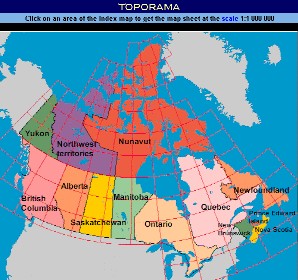
You can identify the area that you require by using the location search on the Toporama site. I was traveling to the National Parks in Alberta and British Columbia, so I needed areas 082 and 083.
It is highly recommended to use a generic URL fetch tool (like wget or WinHTTrack) to download all the images instead of doing that by hand (I used the afore mentioned Excel macros). Also, make sure your internet connection and your hard disk can cope with the amount of data.
The direct URL's for areas 08x are
Topo: http://toporama.cits.rncan.gc.ca/images/b50k/08/
Ortho: http://toporama.cits.rncan.gc.ca/orthoimages/o50k/08/
There is also a number of general maps of Canada available on the web, for example here
http://www.lib.utexas.edu/maps/americas/canada_rel97.jpg
(Conveniently includes the calibration hints).
top
Process for OziExplorer CE
2. create the map file for each image
You can use the excellent freeware script NTSConv ( http://members.shaw.ca/topham/ ) for this. It uses the file names from the images you downloaded from the Toporama server to identify the coordinates of the corners of each image and creates a .MAP file that is understood by OziExplorer CE. Note: Do not change the file names before this step is finished!
Another (shareware) tool is DRGMapCal ( http://members.shaw.ca/davepatton/drgmapcal/index.html ) which can also create calibration data for Fugawi and Memory Map Navigator.
3. create the ozf2 files
The IMG2OZF utility is part of the OziExplorer CE suite. You can use it to do batch conversions of all the image files to the OZF2 format. You need to specify the location of the .MAP files created in step 2, but you don't need to recreate them (something the program could do as well).
4. copy everything to the Pocket PC
You should now have your .MAP and .OZF2 files for the areas that you have downloaded in step 1, and now you can use a card reader to transfer the files to a storage card that your Pocket PC can read. The maps are really big (750 to 3000 KB for each 1:50000 quad), so you should try not to use ActiveSync.
5. Use the maps
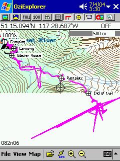
Point Ozi CE to the directory where you stored the .MAP and .OZF2 files, and off you go...Ozi will use your maps, switch between them if necessary, record the track, allow you to place waypoints - all this nice stuff.
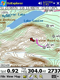 
Personally I was a bit disappointed by the way that OziExplorer CE only displays one map at a time - my hiking trails invariably started or ended at the map boundary, so I didn't have the complete picture. Today's Pocket PC has enough oomph to also load the adjacent three maps one would think. But hey - having maps in the first place is already a big bonus, so I stop complaining here.
top
 Process for LocBrowser Process for LocBrowser
2. Copy the images to the storage card
Use a card reader to transfer the files to a storage card. Again, the usage of ActiveSync is not recommend.
3. Use the maps
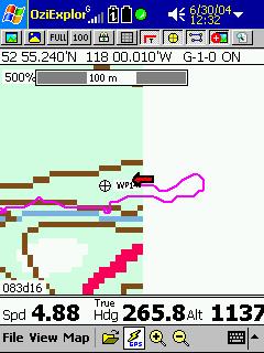
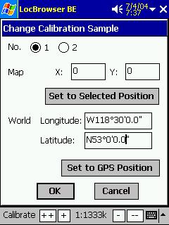
Start LocBrowser, load the map file and calibrate it manually, either based on known landscape elements (bridges, street intersections etc.) or using a little trick and recycling the information from the Toporama web site or from the Ozi process. For example the top left pixel of 083D16.GIF is 53,0,N, 118,30,W and the bottom right pixel is 52,45,N, 118,0,W in the Ozi .MAP file. LocBrowser would need these as W118°30'0.0" and N53°0'0.0" for calibration sample 1 (x=0, y=0) and W118°0'0.0" and N52°45'0.0" for calibration sample 2 (x=3199, y=1599).
top
Issues encountered
- Sometimes there is a slight shift between the Toporama maps and reality. Your position on the map may be systematically off, let's say 500 meters(yards) further north than anticipated. You can either manually change the information in the .MAP file (this is difficult because Ozi does not expose the x/y pixel coordinates for a position on the image that you may actually be able to identify) or - you just live with it. With LocBrowser you can easily recalibrate the map from your current location.
- Topo maps are pretty detailed when it comes to geographical attributes like bodies of water or altitude lines but they completely miss hiking trails and smaller roads. You will have to do some guesswork at trail crossings and make extensive use of waypoints...
- OziExplorer CE is not good at storing track and waypoints info to storage card. You may have to manually create a \oziexplorer\data directory on your Pocket PC and store the logs there
- you cannot use topo and ortho maps at the same time, unless you rename both the .MAP and the .OZF2 file for one or the other. Even then there's some confusion when Ozi is trying to identify the map with the best resolution for the current location - so what you should do is both rename the ortho files AND put them in a different data directory.
top
Loosely related remarks
top
Waterproofing
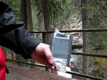
I did some experiments with the suggested solution for a waterproof and still usable case for my good old iPAQ 3970 with GSM/GPRS jacket. Let's say it like this - technically it works, but you need a plain model with no surface features (otherwise the screen is hard to read), and you need the XXL version to fit in both the Pocket PC and the jacket. I ended up putting the Pocket PC in the inside pocket of my waterproof jacket instead.
top
Battery life
You never know how long your hike will take (my longest was about ten hours). Conserving battery power is of utmost importance:
- Completely disable the backlight
- run your Pocket PC processor at a lower speed. For XScale processors use the Pocket Hack Master tool - http://www.omegaone.com/PocketPC/PHM.html
- set your GPS receiver to trickle mode if that is supported. 20% uptime is perfectly enough for walking, and your GPS receiver will last much longer.
 Most important: Do carry spare batteries or emergency energy packs. This can be a simple four-pack of AA batteries with the proper connector for you Pocket PC and/or GPS receiver - or it can be as sophisticated as a survival radio with a crank that you can turn to recharge that mega monster capacitor. I have to admit that my beloved iSun Solar Charger was of little help - not enough sun around, especially when I needed it most. Most important: Do carry spare batteries or emergency energy packs. This can be a simple four-pack of AA batteries with the proper connector for you Pocket PC and/or GPS receiver - or it can be as sophisticated as a survival radio with a crank that you can turn to recharge that mega monster capacitor. I have to admit that my beloved iSun Solar Charger was of little help - not enough sun around, especially when I needed it most.
top
Canyons
You have probably heard of GPS reception problems in urban canyons. Well, these problems exist in real canyons as well.
Due to limited sky view at the bottom of valleys you will have some degradation in GPS signal accuracy, and even some downright misleading information. Always make sure you base your trail decisions on a 3D fix, even if you need to climb up some hill to obtain one.
And, as a final note: Never exclusively rely on your GPS system alone. Always have a backup system ready, for example a basic (free) paper map of the area, a compass and/or a normal watch. We want you to enjoy your next hike, but also the one after it!
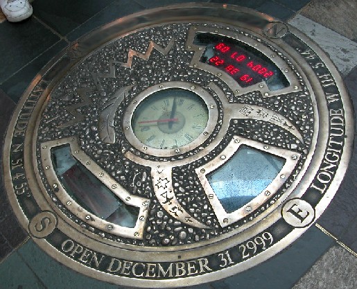
Quiz:
The first reader to tell me in which building this “time capsule” is will receive a watertight Otter Box 2000 (in green) that fits most PDAs (unfortunately my GSM/GPRS jacket is a tad too big for it, so I could not use it).
top
Conclusion
The Canadian Government has to be lauded for providing such a "low cost high value" map material to all the outdoor enthusiasts in Canada.
+ the maps are very recent, and show all important topographical features (with the exception of hiking trails).
+ the maps are freely available on the internet (the printed version costs CAD 14.95 - per single map!)
+ it is very easy to convert the maps into a format that is usable by Pocket PC navigation programs
- It is difficult to fetch maps using a mobile device (if you forgot a map segment or if you spontaneously decided to go someplace else) - so good advance planning and map conversion is very important! Better load more maps than you are likely to need.
|


