Hi! We see you’re using an ad-blocker. We’re fine with that and won’t stop you visiting the site.
But as we’re losing ad-revenue from this then why not make a donation towards website running costs?. Or you could disable your ad-blocker for this site. We think you’ll find our adverts are not overbearing!
A great news item on the BBC News web site earlier this week on how OpenStreetMap is being used to help aid agencies and relief workers in the earthquake damaged country.
Soon after the earthquake struck, users on the ground began mapping Port-Au-Prince and the surrounding towns and villages. As aid poured in the need for accurate current maps became ever more pressing and so more and more users collated data to build the map.
The BBC page shows how the map detail rapidly improved and as it now stands, Haiti is better surveyed than many other developed countries with detailed maps showing relief camps, aid centres, hospitals and medical locations etc.
OpenStreetMap is the ideal tool for such use. Data can be gathered by any basic GPS and the map can be edited and added to quickly and easily by users.
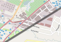
The BBC show an example of how much the map has improved but you can see yourself by viewing it on-line at the OpenStreetMap web site. It's remarkably detailed!
A huge thumbs up to OSM and all of those who have, and continue to, contribute data to it.
Hi! We see you’re using an ad-blocker. We’re fine with that and won’t stop you visiting the site.
But as we’re losing ad-revenue from this then why not make a donation towards website running costs?. Or you could disable your ad-blocker for this site. We think you’ll find our adverts are not overbearing!