|
|
 |
 |
 |
 |
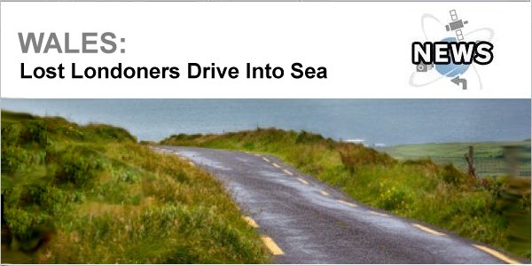
Lost Londoners Drive Into Sea
Article by: rob brady
Date: 24 Apr 2014
Yep, it's happened again! It seems not a week goes by without a satnav being blamed for an inattentive motorist ending up somewhere other than their destination.
Yes, of course these types of incidents also happen with good old-fashioned paper maps, but it does look as if it is on the increase due to us putting a bit too much trust in modern technology.
This time, a group of tourists from London, who were following their satnav's instructions, lost their bearings and drove straight into the sea at Angle, Pembrokeshire.
The four female holidaymakers were travelling in their hire car from Milford Haven to a coastal pub in Angle Village, but after driving 400 metres down a no through road, they found themselves stranded in the sea with water up to the vehicle's bonnet.
The local coastguard were called out to help the women to dry land and the flooded car had to pulled from the sea by a breakdown company.
Source
| | |  |
| Comments
|
 Posted by Guivre46 on Thu Apr 24, 2014 12:52 pm Posted by Guivre46 on Thu Apr 24, 2014 12:52 pm |
 |
This is why I wish satnavs could have an altimeter, when you get below sea level it could warn you to stop....
Mike R [aka Wyvern46]
Go 530T - unsupported
Go550 Live [not renewed]
Kia In-dash Tomtom |
|
| Posted by exportman on Thu Apr 24, 2014 12:59 pm |
|
| Guivre46 Wrote: | | This is why I wish satnavs could have an altimeter, when you get below sea level it could warn you to stop.... |
Then some plonker would stop in the middle of a tunnel passing under a river.
Make something idiot proof and all you get are bigger idiots
|
|
| Posted by Philip on Thu Apr 24, 2014 2:40 pm |
|
Yes, of course they were stupid (going down a "no through" road, and not stopping until the water was at bonnet height), but it also shows that the metadata associated with most satnav maps still requires a lot more work.
Why wasn't that road marked as "no through road" in the mapping data? That would have (hopefully) prevented the software from trying to route down it.
Anybody here with any local knowledge of the area? Would the route taken have been a potential way to get to that pub at (say) low tide?
Philip |
|
| Posted by GerryC on Thu Apr 24, 2014 3:01 pm |
|
There is an unsigned road on the way to the pub by the Church of St Mary Angle here. The satnav would have said "turn right" and they turned immediately instead of going to the end of the road first. If it was there, the mapping is right - they just didn't follow the directions given.
Streetview is showing it at low tide (boats stranded on land) but, nevertheless, you would only see water in front of you so why keep driving into it?  It's not like it was a ford with a road at the other end. It's not like it was a ford with a road at the other end.
Gerry
Gerry
TomTom730T
Cameralert for Android
Brodit ProClip mount |
|
| Posted by topbrass on Thu Apr 24, 2014 4:20 pm |
|
Four females....say no more !!!!!!!!! 
|
|
| Posted by worried on Thu Apr 24, 2014 7:35 pm |
|
I have a Garmin with up to date maps, but it does give turn directions way to early, you have to look at the screen to make sure that you are there.
Another fault is that it only shows places that are on the road it thinks you are on, 100 m to the side and not shown
So I also have my old Navman N20 that shows everthing, but its maps are not up to date
|
|
| Posted by lenfish on Thu Apr 24, 2014 8:27 pm |
|
"The four female holidaymakers......"
I rest my case, your Honour. (I'm leaving the country, you'll never take me alive!)
Len
|
|
| Posted by Wazza_G on Sun Apr 27, 2014 3:36 pm |
|
| lenfish Wrote: | "The four female holidaymakers......"
I rest my case, your Honour. (I'm leaving the country, you'll never take me alive!)
Len |
Just remember, London is like a Devon cream tea. It's rich, thick & full of clots. 
Be alert.. This country needs more lerts. |
|
| Posted by spook51 on Tue Apr 29, 2014 5:31 pm |
|
This seems to be the appropriate thread to mention the elderly German couple who drove their new BMW into a river because the sat nav didn't tell them to stop and wait for the ferry...
|
|
| Posted by MaFt on Wed Apr 30, 2014 10:19 am |
|
| Guivre46 Wrote: | | This is why I wish satnavs could have an altimeter, when you get below sea level it could warn you to stop.... |
No good in The Netherlands then... ;)
|
|
| Posted by Guivre46 on Thu May 01, 2014 10:01 am |
|
Well we could add an hygrometer? Would also be useful to tell you to turn the windscreen wipers on when it is raining....
Mike R [aka Wyvern46]
Go 530T - unsupported
Go550 Live [not renewed]
Kia In-dash Tomtom |
|
|
| Click here to view more comments... |
|
 |
|
|
 |
 |
 |
 |
|
|


