| View previous topic :: View next topic |
| Author |
Message |
BigJohnD
Frequent Visitor

Joined: Aug 26, 2007
Posts: 404
Location: Glannau Mersi, Lloegr
|
 Posted: Sat Apr 07, 2018 10:55 am Post subject: Posted: Sat Apr 07, 2018 10:55 am Post subject: |
 |
|
Thanks everyone for your responses.
@Jad12 - Yes, clearly the GB OS grid is not a simple transformation of a spherical surface and doesn't apply in France. The universal global system system used by Google (and indeed Garmin when enabled!) makes more sense. Many thanks for that.
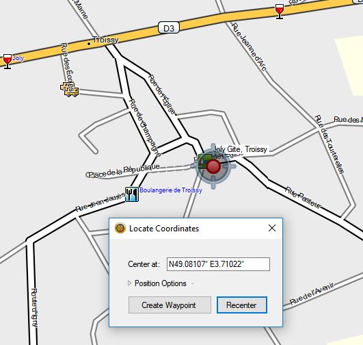
Garmin now all but overlaps Google Maps:
 |
|
| Back to top |
|
 |
M8TJT
The Other Tired Old Man


Joined: Apr 04, 2006
Posts: 10118
Location: Bexhill, South Sussex, UK
|
| Posted: Sat Apr 07, 2018 11:35 am Post subject: |
|
|
| BigJohnD wrote: | | Yes, clearly the GB OS grid is not a simple transformation of a spherical surface and doesn't apply in France. |
The GB in GB OS should give you a clue there.
Great Britain Ordnance Survey.  |
|
| Back to top |
|
|
sussamb
Pocket GPS Verifier
![]()
Joined: Mar 18, 2011
Posts: 4462
Location: West Sussex
|
| Posted: Sat Apr 07, 2018 7:39 pm Post subject: |
|
|

_________________
Where there's a will ... there's a way. |
|
| Back to top |
|
|
jad12
Occasional Visitor
![]()
Joined: Apr 13, 2017
Posts: 20
Location: Bromsgrove UK and Vung Tau Vietnam
|
| Posted: Sun Apr 08, 2018 5:59 am Post subject: |
|
|
Areas that are different are so because the WGS84 datum and spheroid (different things just have the same name) don't work very well. They have their own pre GPS best fit. This minimises distortion when projecting to a flat map. To be right the GPS position is transformed or datum shifted to the local map. Sometimes the difference may be small so as not to matter for certain uses which may include satnavs. Survey work always considers the difference. OSGB difference of 100m around the London area I would consider critical for satnav .
This is not the case everywhere. In Australia they use a GRS80 spheroid. This is also different from WGS84 but only in the spheroid flattening (squashing) at about the 5th decimal place. This is only important to the serious geodetic type guys. Here even survey coordinate software systems will state 'No transformation required'
There's always more to it so it's better to use a satnav map made for the area.
Cheers
_________________
A school of dolphins A flock of birds A pride of lions A lost of navigators |
|
| Back to top |
|
|
M8TJT
The Other Tired Old Man
Joined: Apr 04, 2006
Posts: 10118
Location: Bexhill, South Sussex, UK
|
| Posted: Sun Apr 08, 2018 9:57 am Post subject: |
|
|
| jad12 wrote: | | Survey work always considers the difference. OSGB difference of 100m around the London area I would consider critical for satnav . |
Can you show us an example of this please? |
|
| Back to top |
|
|
BigJohnD
Frequent Visitor
Joined: Aug 26, 2007
Posts: 404
Location: Glannau Mersi, Lloegr
|
| Posted: Sun Apr 08, 2018 10:32 am Post subject: |
|
|
| Naively, I assumed that Basecamp defaulted to a global (or European) datum rather than GB's OS. |
|
| Back to top |
|
|
jad12
Occasional Visitor
![]()
Joined: Apr 13, 2017
Posts: 20
Location: Bromsgrove UK and Vung Tau Vietnam
|
| Posted: Sun Apr 08, 2018 12:21 pm Post subject: |
|
|
Will do my best with the example.
I've picked the Greenwich Observatory which from Google Earth is
51deg 28min 36.51secs N, 0 00' 01.91"W. This is WGS84 lat/long the geodetic coordinate in Geodetic Calculator image.
(Greenwich Prime Meridian, the globally accepted 0 degrees, no longer goes through the observatory. This is to tie in with the global best fit WGS84)
Ah. Gentlemen I will continue tomorrow. Need to work out images and fix my dropbox.
Cheers
[/img][/url]
_________________
A school of dolphins A flock of birds A pride of lions A lost of navigators |
|
| Back to top |
|
|
sussamb
Pocket GPS Verifier
![]()
Joined: Mar 18, 2011
Posts: 4462
Location: West Sussex
|
| Posted: Sun Apr 08, 2018 1:59 pm Post subject: |
|
|
We're getting confused here. Your gps or satnav will show the correct position. You only need worry about datums if you're trying to compare it with something else. For most users datums aren't anything to worry about.
_________________
Where there's a will ... there's a way. |
|
| Back to top |
|
|
Kremmen
Pocket GPS Verifier

Joined: Mar 03, 2006
Posts: 7251
Location: Reading
|
| Posted: Sun Apr 08, 2018 2:05 pm Post subject: |
|
|
Yep
And yes the Greenwich meridian line is incorrect by a few hundred yards but when it was calculated they didn't have our level of sophistication.
_________________
DashCam:
Viofo A119 V3 |
|
| Back to top |
|
|
M8TJT
The Other Tired Old Man
Joined: Apr 04, 2006
Posts: 10118
Location: Bexhill, South Sussex, UK
|
| Posted: Sun Apr 08, 2018 7:01 pm Post subject: |
|
|
| sussamb wrote: | | We're getting confused here. Your gps or satnav will show the correct position. You only need worry about datums if you're trying to compare it with something else. For most users datums aren't anything to worry about. |
Providing you use the righht one.
I asked him to show us where the datum is 100yards out around London, using OSGB and WGS84. |
|
| Back to top |
|
|
jad12
Occasional Visitor
![]()
Joined: Apr 13, 2017
Posts: 20
Location: Bromsgrove UK and Vung Tau Vietnam
|
| Posted: Sun Apr 08, 2018 7:24 pm Post subject: |
|
|
Hi All
Quick(ish) for now and I will continue the eg when read up on how to post images.
I am but a simple surveyor. It's also latish at night in Vietnam.
[And yes the Greenwich meridian line is incorrect by a few hundred yards but when it was calculated they didn't have our level of sophistication]
True, we didn't. But we were not that bad and our Greenwich got accepted, in the end, by the world. I think in Napoleon's day the French used Paris. Spain maybe used Madrid. Nowadays GPS is better. Not actually GPS but the International Geodetic guys that decided that we go for the old Greenwich (good ol' Britain) but it fits GPS better if we move it a bit, something like 5 1/2 seconds of arc. About 100m. They talk angles because spheroid, or world related, not flat projected grid.
Like many things in the world international standards grow into being.
[We're getting confused here. Your gps or satnav will show the correct position. You only need worry about datums if you're trying to compare it with something else. For most users datums aren't anything to worry about.]
Again, I think true. I don't know how satnav map makers do it but they at some point need to go basics and use the old mathematical geodetic stuff that is world wide. Oil and gas, utilitities, etc. Wherever things are and we need to go back to them. OSGB isn't bad at all at doing that.
I would certainly hope that you never need to worry about datums. Satnavs are for general users not PHd mathematicians (trust me, don't ask, I'm not. Should be PhD).
If your satnav map you download has followed the principles it should all work. If you navigate in China with Google Maps it should work. Google may have mapped China by satellite imagery. Then they don't care about any China datums. It's all WGS84 or GPS related. If they have used any local maps they should have transformed them. Should have, but have they. I would expect so.
Maybe all this simply in the end is: You use a global map. It works. Compare with a local map. Why is there a difference?. But, if you use GPS with a local non satnav map you need to have something in the box to do them long sums.
To finish. This stuff does get involved. One reason I try to explain is because I take the attitude that satnav makers and map makers assume you are dumb guys. (Dumb guys wouldn't even know how to find this forum)(Mind you, I did). I say this because nowhere in any specs have I seen what GPS receiver card it has, it's accuracy (a Garmin hand held states 15m at 95%, good enough for me for a hand held specs. PS it does better), what the map is based on, projection, datum and the lot.
Great if someone can tell me I'm wrong there and they now do.
Again, it should not be a problem, but, there are these differences between maps.
er, wasn't so quick(ish)
Cheers
_________________
A school of dolphins A flock of birds A pride of lions A lost of navigators |
|
| Back to top |
|
|
jad12
Occasional Visitor
![]()
Joined: Apr 13, 2017
Posts: 20
Location: Bromsgrove UK and Vung Tau Vietnam
|
| Posted: Sun Apr 08, 2018 7:36 pm Post subject: |
|
|
Sorry Gentlemen
Dumb or wot. As well as posting images need to read through on quotes. Seems like mine didn't come right. Simple surveyor.
Cheers
_________________
A school of dolphins A flock of birds A pride of lions A lost of navigators |
|
| Back to top |
|
|
M8TJT
The Other Tired Old Man
Joined: Apr 04, 2006
Posts: 10118
Location: Bexhill, South Sussex, UK
|
| Posted: Sun Apr 08, 2018 11:20 pm Post subject: |
|
|
Ok. I suspect we all got the drift with your quotes. Pictures have to be uploaded to a host and the link posted.
The original problem was caused bu the OP using the OSGB datum in France rather than WGS84
If you compare the China Google map with the Google sat view, there is a difference of about 600m E/W and 150m N/S in Beijing.
Presumably because the map is based on China's datum and the sat view is based on WGS84.
But presumably if you had the China maps in your satnav then they would be right for navigation. |
|
| Back to top |
|
|
sussamb
Pocket GPS Verifier
![]()
Joined: Mar 18, 2011
Posts: 4462
Location: West Sussex
|
| Posted: Mon Apr 09, 2018 7:07 am Post subject: |
|
|
More that China deliberately creates an offset I think. No idea why as it's easy using other methods to work out what is what 
_________________
Where there's a will ... there's a way. |
|
| Back to top |
|
|
jad12
Occasional Visitor
![]()
Joined: Apr 13, 2017
Posts: 20
Location: Bromsgrove UK and Vung Tau Vietnam
|
| Posted: Mon Apr 09, 2018 7:39 am Post subject: |
|
|
Example continued.
Greenwich Observatory from Google Earth 51 28 36.51N,0 00 01.91W
One piece of software I use is Geodetic Calculator. The lat/long is entered as a WGS84 geodetic coordinate. As our wonderful world is gravity wise a squashed lumpy potato it's not appropriate to talk spheres but spheroids or ellipsoids. The language calls lat/long geodetic coordinates. The software will do the sum and convert to lat/long on the OSGB Airey spheroid.
[img]https://www.dropbox.com/s/n8igvxpg2cb3rjt/geodetic.PNG?dl=0[/img]
The difference is about 1.9 seconds south and 5.7 seconds east. Along longitude lines 1 minute is 1 nautical mile, 2000 yards, 1852 metres. 1 second of arc is about 30m so we have a longitude difference of nearly 60m. Along latitude lines 1 second gets smaller towards the poles. I think around London its about 18-19m so there is just over 100m difference east.
However taking each latitude as OSGB and converting to OSGB grid gives the following.
[img]https://www.dropbox.com/s/kymhq2smovsk9yc/geodetic%20grid%201.PNG?dl=0[/img]
[img]https://www.dropbox.com/s/qc6d6hbnm5qcely/geodetic%20grid%202.PNG?dl=0[/img]
This is a difference of 112m east and 54m south.
For comparison Lands End is 67mE,70mS and Lake Windermere 90mE,17mS
Hope images work
Cheers All
_________________
A school of dolphins A flock of birds A pride of lions A lost of navigators |
|
| Back to top |
|
|
|
![]() Posted: Today Post subject: Pocket GPS Advertising Posted: Today Post subject: Pocket GPS Advertising |
|
|
We see you’re using an ad-blocker. We’re fine with that and won’t stop you visiting the site.
Have you considered making a donation towards website running costs?. Or you could disable your ad-blocker for this site. We think you’ll find our adverts are not overbearing!
|
|
| Back to top |
|
|
|


