Home PageFacebookRSS News Feed
PocketGPS
Web
SatNav,GPS,Navigation
PocketGPSWorld.com Event Article

There's gold in dem dere hills!!!


The folks from GPSTraining are hosting a weekend in the UK's beautiful Lake district countryside focusing on the practical use of GPS for the up and coming sport of Geocaching. We at PocketGPSWorld.com are always keen to support these types of events, but we thought we would see exactly how easy it was for a newcomer to pick up the basics of navigating with a GPS...

In steps our very own mysk... Little does he realise that lie-ins over the weekend have been cancelled. He is going to be our novice GPSer for the weekend. Starting Friday with a drive up to Burrowdale in the PocketGPSWorld.com car, followed by some cycling, walking, running (not me of course), and not to mention theory and practical sessions he will be tired out by Monday morning in time for work.

Check out the GPSTraining Geocaching site for more details...


Created by Mike Barrett on Wednesday, May 10 @ 23:19:09 UTC


The GlobalSat GH-601 Fitness GPS geocaching prize


Globalsat are currently sponsoring geocaching events throughout the world by donating GPS devices to bbe given as prizes. For the "Lets Go Geocaching" event Globalsat kindly donated the BT-328 bluetooth GPS mentioned earlier and the new Fitness GPS the GH-601.

The GlobalSat GH-601 was won by Astley Sports College, Manchester. Rather than select a single winner the GH-601 is to be used by the school. They have also offered to write a report on the way that they use the Fitness GPS within the college curriculum.

Thanks to Globalsat for these prize donations.


Globalsat GH-601 Fitness GPS


Article by Mike Barrett on Sunday, May 14 @ 23:18:35 UTC


The Final Geotrail...


The final Geotrail was led by Simon and Peter ( a mountain rescue volunteer) and gave us a poignant lesson in why you should consult a map when geocaching. Fifteen of us set out from the YHA at around 3pm headed on a 90 minute circuit geotrail ending in a cache with a password for free Jennings Cumberland Ale.

Things started out well with us finding both of the first two caches easily. The third was about 900 metres away and we set of up the path in a direct line towards it. The path split in two and we followed the branch that went in the direction of the cache. This was the problem. We should have checked the map at this point but didn’t. We ended up a few hundred metres from the cache but unable to get to it as there were drystone walls and fences in the way. If we had stayed on the original path it would have circled round and have been somewhat shorter distance in the end…

This is a very important lesson to learn and remember. Normally it wouldn’t have been an issue for me as I would have the Ordnance Survey maps on my PDA and could have consulted them, or at worst I could have looked at the paper map in my backpack. This time it was raining quite hard, and I didn’t want to get my map wet. So we just too the bearing line from the GPS and followed it. You should never do this without consulting a map or knowing the terrain.

We were more aware of where we were going after that and avoided making the same mistake twice. A little while later we made our way back to the YHA and had a cup of tea before saying our goodbyes and vowing to do this all again in September.

Matt and I headed off to Edinburgh to see to some final preparations for the PocketGPSWorld.com SatNav Expo on the 20th at the Corn Exchange. Not without a little drama as the battery on the PocketGPSWorld.com car had drained over the weekend and we needed to get a jump start. A couple of hours later we are now sitting in a hotel room in Edinburgh having eaten, showered and shaved and have not only mobile phone signal, but Internet access as well. Civilisation!


Strung out in a line

The last 3 come in
The last 3 come in


Article by Mike Barrett on Sunday, May 14 @ 23:13:03 UTC


Sunday: Winners of the Globalsat BT-328 Bluetooth GPS receiver


As we found out on Saturday the High Spy Geotrail was pretty tough and the final cache was not found by some of the teams looking for it (us ;-) ) . Tony who had originally set the cache had got up at 4:30am and checked it. He also placed one of my business cards in the cache to be exchanged for the Globalsat BT-328 should anyone find it.

Sure enough it was found and the errors of our ways were graphically described to us in great detail...

Keith Burton and Dave Knight found the special GlobalSat prize cache and won the GlobalSat BT-328 bluetooth GPS. This was hidden in a cache at the end of the tough High Spy geotrail in a sheep fold near the climbing hut.


Mike hands over the Globalsat BT-328

Testing the Globalsat BT-328


Article by Mike Barrett on Sunday, May 14 @ 22:47:36 UTC


The Big Geotrail: PocketGPSWorld.com team tackle High Spy


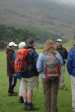
After listening to Peter we met up with Alex and Mike Alder for lunch. A short discussion ensued where the brave lads of PocketGPSWorld.com decided to take on the biggest, hardest, toughest geotrail. Off we set armed with a complete set of PDAs running Memory-Map, Anquet and Fugawi, a Garmin 60Cx, a Garmin Geko 201, a Garmin Edge 305 we were not intending to get lost…

Well we didn’t get lost, in fact between us our gear worked so well we didn’t even have any animated discussions on the routes we needed to take. The geotrail we were following was a multi-cache trail. This is where you find one cache and this then gives you the co-ordinates of the next cache. The caches also had clues to help us find the next cache.

We started off with a tricky one. The cache was hidden around a hairpin bend down a steep drop. It took us quite a few minutes to find it even with the supplied clue. Once started though we were on a roll. Except for Mike A that is. For some reason he was unable to enter the OS coordinates into his Memory-Map, despite it working in ours.

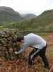
We trundled on to the second and third cache gaining in confidence, steadily gaining height. After finding the third we started up the mountain proper and the going got a bit tougher. The forth cache was secreted just off the path under a small cairn. I retrieved the cache and had a little slip on the way and banged the base of my right hand quite badly. It is bruised but functional now. Isn’t it funny how you always need to use a part of your body that you injure?

Cracking on the fifth cache was hidden within 400 feet (altitude) of the summit. It seemed a shame not to crack on and go to the top. It was a little disappointing when we reached it as the entire Derwent Water and the valley up to Kewsick was lying under a blanket of cloud. Never mind we made it…

We made our way back down to find the sixth cache near a climbing hut. This was where our early confidence was shattered. We searched and searched but could not find the cache. After about 30 minutes we had to concede and return to the hostel with our tails between our legs.

We thought that possibly the cache had been found and removed. The following day Tony (who had hidden the cache) climbed up to the hut and confirmed that it was still there. Even more embarrassment for the PocketGPSWorld.com team. However it was made good by Tony placing a card in the Geocache for a GlobalSat BT-328 bluetooth GPS receiver donated by Globalsat for the event. We thought as we had trouble finding the cache so would others…


I found cache 2
I found cache 2

Wrong way boys...
Wrong way boys...

Its here somewhere
Its here somewhere

Mike is on the right track

The clouds roll in
The clouds roll in

Alex tops out
Alex tops out

So does Mike
So does Mike

The last cache is here somewhere


Article by Mike Barrett on Sunday, May 14 @ 22:39:54 UTC


The Geocaching Seminar : What we came for...


The next Seminar was presented by Peter Howard: one of the 2 UK administrators of www.Geocaching.com. Geocaching.com is the world’s leading Geocaching authority, and has been in existence since September 2002 when Jeremy Irish picked up on the idea from David Ullmer’s original cache in May 2002. Since then the sport has grown phenomenally and there are caches hidden throughout the world in over 200 countries. In the UK we have something in the region of 12,000 caches, each of which is reviewed by one of the 2 UK administrators.

Peter also explained about the contents of the caches, mainly small toys, and trinkets. The concept is that you normally take something with you and exchange it in the cache. Each cache has a log book which you enter the data and time of your find.

A special type of cache item is a coded “Travel Bug” or “geocoin” which when logged back with www.geocaching.com provides a trace of the item around the world. Which caches it has been in and where it is currently. These travel bugs only work if the geocachers are active and visit lots of caches, especially on vacation or when travelling in foreign countries.


Peter introduces Geocaching


Article by Mike Barrett on Sunday, May 14 @ 22:15:40 UTC


Memory-Map Seminar


Our first Seminar was all about Memory-Map, presented by Dean from Memory-Map. This took us through all the functionality of Memory-Map and how it can be used with GPS devices.

Dean also gave us a live demo of creating routes, and the analysis of tracks. The 5 ‘Ps’ of Memory-Map (don’t ask me to remember them…). This session was so popular that we over ran, and Dean had to take questions outside the training room.


Dean presents the benefits of Memory-Map


Article by Mike Barrett on Sunday, May 14 @ 22:14:16 UTC


Starting to Navigate with GPS


The first seminar we attended was a practical session on navigating with a GPS. Everyone had a GPS some had borrowed one from the GPSTraining.co.uk team. Interestingly looking round our group of about 15 there was a single Magellan Explorer, the rest were Garmins of one sort or another. The most common seemed to be the top of the range Garmin 60Cx handheld GPS. I must confess to be the only person in the party with a PDA…

Simon took everyone in the group through the basics of marking your current position as a way point and then moving away and navigating back to it. The common navigation problems of GPS without an electronic compass were highlighted: you need to be moving at more than 2.5 KPH for the compass to be accurate. Once the basics were mastered we moved out into the field (literally).

The first Geocache we had to find was a wooden peg in the ground. This exercise highlighted another problem with GPS navigation: you cannot always go to your destination in a straight line. We had a river, wood and some drystone walls to negotiate. We actually took the easy way and went round on the road and entered the field via a style. It was a little tricky finding the first cache, but once we had the idea it was pretty easy. One of the GPS skills learnt was entering GPS locations “on the hoof”.

We then sat in on a couple of seminars during which time Alex and Mike Alder had arrived and had set off proving that PDAs don’t work when you really want them to…


Introducing GPS navigation

Introducing GPS navigation fieldwork

Introducing GPS navigation fieldwork


Article by Mike Barrett on Sunday, May 14 @ 22:13:20 UTC


Bright and Early Saturday


I brought my bikes with me for the weekend and I was in the middle of road testing the Garmin Edge 305 GPS. 6:15am. Yes 6:16 the birds were singing, the windows were bright, and yes it was raining, I got up and cycled into Keswick the nearest town 7 miles away. Just over 45 minutes I was back again ready for breakfast and raring to go.

Breakfast was not what I remember in a Youth Hostel. It was over 35 years ago that I was last in a YHA establishment and then we had to do chores and cooking and washing etc. Actual to call it a youth hostel could well be considered misleading advertising. Over 75% of the occupants of the breakfast room owned grey hair… There were a wide variety of people there with all different skill levels, from a party of School kids to couples and hill walking enthusiasts.


Early morning bike riders

Still cold on the road

Testing the Edge 305

Testing the Edge 305 and Garmin 60Cx


Article by Mike Barrett on Sunday, May 14 @ 22:12:07 UTC


I hate the British roads!!!


It’s 12:00 on the hottest day of the year and only 340 miles to go. TomTom tells me it is only 5 hours until we get there… Of course that isn’t the case. 100 miles and just over 3 hours later I am just clearing the third traffic jam and thinking there is no way I will be passing Manchester before 4:00 let alone reach the Lake district by 5:00.

After hitting another couple of jams we managed to arrive just before 8:30!! A whopping eight and a half hours for a five hours journey.

I also have to confess to committing the most basic beginners error in street navigation. I entered Longthwaite as the destination and picked the only one displayed without checking the exact location… Fortunately I realised the error before it became a problem.

Anyway just after 8 we rolled off the M6 and into the picturesque Lake District. The evening was balmy, the roads clear, the views spectacular. I was really looking forward to the weekend as we rolled into Borrowdale Youth Hostel. Of course we had missed the first few seminars which started Friday evening, but they were to be repeated throughout the weekend and we were able to catch up with them then.


Geocaching in Borrowdale

Geocaching in Borrowdale


Article by Mike Barrett on Sunday, May 14 @ 22:11:16 UTC


Make a Donation


CamerAlert Database

Click here for the PocketGPSWorld.com Speed Camera Database

Download Speed Camera Database
22.043 (17 Apr 24)


WORLDWIDE SPEED CAMERA SPOTTERS WANTED!

Click here to submit camera positions to the PocketGPSWorld.com Speed Camera Database


12mth Subscriber memberships awarded every week for verified new camera reports!

Submit Speed Camera Locations Now


CamerAlert Apps


iOS QR Code


Android QR Code


© Terms & Privacy


GPS Shopping