| View previous topic :: View next topic |
| Author |
Message |
PaulH66
Occasional Visitor

Joined: Aug 08, 2006
Posts: 15
Location: London
|
 Posted: Sun Feb 11, 2007 11:59 pm Post subject: Posted: Sun Feb 11, 2007 11:59 pm Post subject: |
 |
|
I can confirm that Peter D's instructions do work for GPS Map on the Mio as it now appears to be working on mine (although I have yet to calibrate maps for it).
Thanks Peter!
_________________
Mio C510E v3.2 (with European maps on 1GB SD card) |
|
| Back to top |
|
 |
GPSBear
Regular Visitor
Joined: Jul 15, 2006
Posts: 137
|
| Posted: Mon Feb 12, 2007 3:52 pm Post subject: |
|
|
Excuse me for being dim, but how does one actually download a map image from get-a-map?
_________________
Mio C710 on MioMap 3.3 |
|
| Back to top |
|
|
Sendero
Occasional Visitor
Joined: Feb 05, 2007
Posts: 5
Location: Surrey UK
|
| Posted: Mon Feb 12, 2007 6:36 pm Post subject: |
|
|
GPS Bear
It foxed me for a while too !!
Having followed the big pink dot link you reach the "Get a Map" page where you can search by postcode, etc or simply click on the map of the UK to zoom in on the area you want.
Having reached the required area, turn your attention to the top right hand side of the screen where you will find a dialogue box with three lines of options - the bottom one is "Print Save Copy".
Clicking on this will open a new window with the map area you selected in it. Don't worry if the quality looks a bit odd - it seems to work out OK. In this new window, right clicking with your mouse will offer a number of options including "Save Picture as". I've only saved them as Jpegs so far - seems to work fine.
Hope this helps
Regards
Greg |
|
| Back to top |
|
|
shanks
Occasional Visitor

Joined: Jul 27, 2004
Posts: 19
Location: Somerset, UK.
|
| Posted: Sun Mar 11, 2007 7:11 pm Post subject: New version of GPSMap-OS released |
|
|
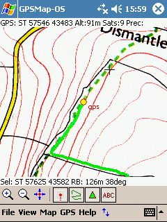
After a long pause in development a new release of GPSMap-OS is finally available! :P
New features in version 1.4:
- Coordinates can now be entered in WGS84 lat/long formats (ideal for those geocache locations!).
- Display of GPS altitude when available.
- Saving and loading of GPS trails.
- Trail recording can be switched on and off on the fly.
- Plus the obligatory bugfixes and tweaks.
Get the program from: http://www.craporola.com/GPSMap.html
dr. matt.
Last edited by shanks on Fri Dec 14, 2007 5:06 pm; edited 1 time in total |
|
| Back to top |
|
|
Searcher22
Occasional Visitor
Joined: Apr 22, 2006
Posts: 49
|
| Posted: Tue Mar 13, 2007 10:34 am Post subject: |
|
|
Glad I found this thread 
I will certainly be trying this out but I have one question for now?
I see from the Get a Map site that it has a default 'zoom'/scale setting for the "download". This covers a reasonable area but is it possible (and sorry if I missed this somewhere) to have a larger area covered by downloading more than one map and for your program to move across them as appropriate. Or should I be downloading a zoomed out map........? but that will have less detail.
I wonder if my ramblings make sense and hope you throw some light on this confusion on my part. And how it is possible for example to have most of Surrey or a selectable county on the PDA?
TIA |
|
| Back to top |
|
|
shanks
Occasional Visitor
Joined: Jul 27, 2004
Posts: 19
Location: Somerset, UK.
|
| Posted: Tue Mar 13, 2007 11:52 pm Post subject: |
|
|
TIA,
At the moment the program doesn't automatically switch between maps, but you can stitch a few of the getamap ones together using a photo editing program to cover a bigger area. There is a limit to the size of image you can load into the program though, depending on the memory space on your PDA, so you may need to experiment with rescaling the image down a little. The 1:50,000 scale has less detail as you say, but it does give wider coverage and is still pretty good for walking.
dr. matt. |
|
| Back to top |
|
|
JoeS
Occasional Visitor
Joined: Jun 02, 2007
Posts: 3
|
| Posted: Tue Jun 05, 2007 7:39 pm Post subject: |
|
|
Hi,
Great info so far, but
Has anyone tried to load GPSMap by Shanks on to the AytoBe (aka Malata PG63503). I have managed to get the software running but Im unable to change the setting on the GPS Serial feed, hence no comms with the GPS. When you go in to setting the screen goes gray with on text all input. The AytoBe is any AIO GPS running Win CE 4.2 Core. Does the software have a supporting file with Comm info stored or does it change the Reg.
Thanks
Joe |
|
| Back to top |
|
|
frank_lui
Occasional Visitor
Joined: Jun 30, 2007
Posts: 1
|
| Posted: Mon Jul 02, 2007 3:33 pm Post subject: |
|
|
| A great programme. But I found if the map file is larger than 200k, I cannot open it. |
|
| Back to top |
|
|
shanks
Occasional Visitor
Joined: Jul 27, 2004
Posts: 19
Location: Somerset, UK.
|
| Posted: Fri Sep 21, 2007 5:27 pm Post subject: New GPSMap Forum |
|
|
Just a quick note to let you know I've set up a forum for GPSMap users at http://craporola.freeforums.org. FAQs, chat, help and support, plus a place to share trails and map points with other folk. I know there are a lot of GPSMap users out there, so please make yourselves known by joining up today and helping make the site a useful community resource!
dr. matt. |
|
| Back to top |
|
|
shanks
Occasional Visitor
Joined: Jul 27, 2004
Posts: 19
Location: Somerset, UK.
|
| Posted: Fri Sep 28, 2007 5:05 pm Post subject: GPSMap-OS Version 1.5 Released |
|
|
Yes, finally a new version of GPSMap-OS hits the streets! 
Fantastic new features for this version:
- Map points can now be exported as Placemarks in a Google Earth/Maps KML file.
- Map trails can bow be saved as Paths in a Google Earth/Maps KML file.
- Added "Use GPS Position" button onto coordinate entry dialog. Makes map calibration and point update based on your current position easier to perform.
- Default folder for loading map images is now "GPSMap Maps" (avoids very long listing times).
- COM port number now freely editable to allow for using "virtual" COM ports, for example via GPSGate.
Download the new version from the GPSMap Homepage.
dr. matt. |
|
| Back to top |
|
|
photonick
Occasional Visitor
Joined: Oct 22, 2009
Posts: 1
|
| Posted: Thu Oct 22, 2009 10:57 am Post subject: |
|
|
Been using GPSdash but having had to re-install all software on my spv-C500 have lost the reg code and there's no answer from support. I am looking for a GPS program that will accept 'jpeg type' maps.
Question is will gpsgo or map-os work with my ancient setup SPV-C500 running Windows CE 4.21. I have copied the .exe files over but get a message 'cannot find GPSO or one of its components.....are all required libraries available. |
|
| Back to top |
|
|
|
![]() Posted: Today Post subject: Pocket GPS Advertising Posted: Today Post subject: Pocket GPS Advertising |
|
|
We see you’re using an ad-blocker. We’re fine with that and won’t stop you visiting the site.
Have you considered making a donation towards website running costs?. Or you could disable your ad-blocker for this site. We think you’ll find our adverts are not overbearing!
|
|
| Back to top |
|
|
|


