|
Review by
Lutz Bendlin
What has changed?
Since there is already a very detailed Mapopolis review for version 3.18 here, this review will mainly focus on the
differences and enhancements that version 4 has brought with it.
Version 4 of Mapopolis
Navigator has now been released. This review looks at version 4.14. The biggest change is already in the name of the new version -
ClearRoute.
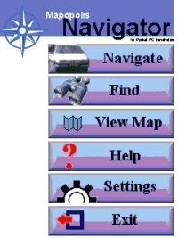
Another obvious change is the new splash screen that allows
finger friendly access to all important features. This screen can also be
reached via the "Quick Menu" option in the extended main menu.
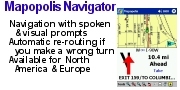
ClearRoute
ClearRoute (previously called ClearPath) is a service that provides
current and predicted traffic conditions in your area. This data is
received from partnering companies in the US, so a separate registration
is required and a service fee is to be expected (around 25 USD per
month).
Mapopolis ClearRoute requires that your Pocket PC be connected to the
internet, either via a wireless GSM, GPRS, CDMA, WiFi (802.11x) or
Bluetooth connection or by placing it in the device's cradle connected to
a computer with internet access. (This review was done with an iPAQ and a
GSM/GPRS jacket connected to the GPRS service.)
Traffic Data updates
You can select to update manually or have the program do it for you (It
will not dial the internet connection though if none is present).
Data can be fetched at preset intervals. It's pretty much up to you to
decide how often you want to get the updates, and how much you are willing
to pay for this.
The amount of data obviously varies with
traffic conditions. On the GPRS service it takes about 20 to 30 seconds
for each download.
You should
choose to "Revise Route after Update" (that's the whole idea of this new
feature, after all).
There's sound
that you can assign to this event, too - so you know without looking when
Mapopolis did actually recalculate the route based on the traffic
information.
Once the update is
complete the new data will be either silently considered in the street ranking,
or it will be shown in bright colors on the map if "Traffic Display Mode" is
selected. All other map colors are then replaced by shades of grey.
 |
 |
 |
| ClearPath Update |
Update Settings |
Results of Traffic
DataUpdate |
Your route is
recalculated based on the new travel data, and the application has a chance to
guide you around roadblocks or slowdowns. The result is only as good as the
service provided but so far I have been very pleased, and this feature has saved
me already an hour or two of sitting in my sports car (I wish - it's just a SUV) and waiting fast
in a traffic jam.
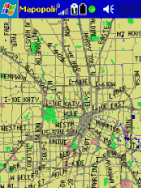
Another change from
version 3 is more subtle. Normally, American navigation programs draw streets as
single lines, making it difficult for the user to understand the street rank or
importance.
Mapopolis 4 offers a
compromise to European users - at levels of greater details streets are now
drawn like "real" streets while the single line design is maintained at lesser
detail levels - this makes sense because valuable screen estate is saved for
other information. At the same time the ClearRoute speed colouring looks nicer
on wider roads.
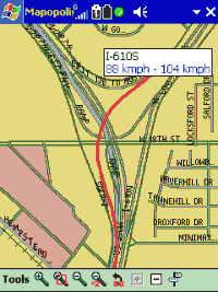
Map Display Features
The normal street data (provided by NavTech) contains
approximate values for each street's rank* , effectively the throughput speed
range. The ClearPath data will give you the exact current throughput of the
mayor roads in your area, collected by thousands of speed sensors all around.
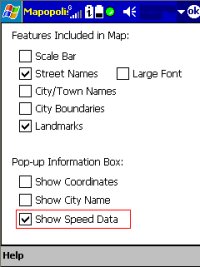
To see the street ranking for each of the streets, select "Show Speed Data"
in the "Map Features" section.
The "GPS Trail" option will now show you a little blue dot for each position
fix, very handy for situation when you're lost in an area without street
coverage or when you want to backtrack your original route. Very neat - you can
tap each of the blue dots and Navigator tells you where you have been when,
where you were going how fast, and even shows you the elevation at that time and
location!
* Unfortunately there is no place in Mapopolis where you could fine tune
these speeds - certainly an important feature of TomTom Navigator and other
programs.
Route Settings
Route planning got
much more granular with version 4. Now you can also influence the time the
program spends on route calculation, and you can avoid those costly toll roads
that are very common in the USA - many times those are anyhow as congested as
the normal roads...
You can even select to prefer or avoid freeways - a neat feature for those among
us on the hunt for the optimum route.
The estimated arrival time is now calculated with amazing accuracy, and it will
constantly be revisited during the ride, giving you the warm and cosy feeling
that you are late for your date - again...
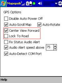
GPS options
There are a number of
new features here - even a track logging made it into the latest release.
"Center View Forward" adds some sanity to the display of your GPS location
relative to the map. It used to be centered in version 3, but most of us are
normally driving forward, so a centered cursor is basically wasting real estate
"behind" the car. With "Center View Forward" the cursor moves to the bottom of
the screen, so there's much more of the road ahead to see.
"Lock To Road" doesn't need much explanation. I never switch it on because
roads are very wide in the USA and the GPS position accuracy is most of the
times good enough to map to the right street.
In addition you may
want to know where you really are, especially when moving around in a
newly developed area for which NavTech may not yet have provided the data. This
is also where the GPS trail function comes in as a welcome new feature.
GPS Tracking
If you have enabled
GPS logging in the "GPS Settings" page then Mapopolis Navigator is keeping a
rolling log (of the size you specified above) containing the last few GPS
events. This log is stored in a file called maplog.bin in the program directory.
Once you finished logging you can have Navigator show the log file (looks like
it records location data for each second) and also play it back. (The GPS trail
pictured here can be switched on independent of the GPS logging - it just shows how bad I
was driving.)
Playback is at the
same speed as the actual journey that was logged - good enough for a bonus
feature but probably annoying when you have a very big log.
If you're done with reviewing your recorded route you should stop the Log
playback and restart the standard GPS.
|