Article by Dave Burrows
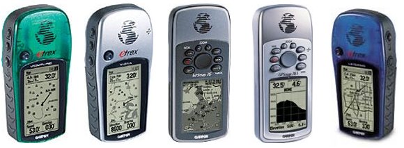
The Garmin range of handheld GPS Receivers are well known, many people ask if it's possible to load a particular map to a Garmin Handheld GPS. The answer to this is YES, but you cannot load just any old map that you have scanned, you have to purchase and upload various Garmin based product maps. Below is a sample of mapping and cartography products that Garmin make available for their Handheld GPS Receivers.
Please note that not all Garmin Handheld GPS Receivers support the uploading of maps. Please check with Garmin, or in our forums first prior to purchasing maps for your Handheld GPS Receiver.
MapSource City Navigator
 MapSource North America City Navigator v5 includes premium, full coverage maps for the United States and select coverage for Canada. This updated product (with access to all regions at no extra charge) is included with the purchase of a Garmin® StreetPilot® III Deluxe, StreetPilot 2610 and 2650. (Product not sold separately in the U.S or Canada.) MapSource North America City Navigator v5 includes premium, full coverage maps for the United States and select coverage for Canada. This updated product (with access to all regions at no extra charge) is included with the purchase of a Garmin® StreetPilot® III Deluxe, StreetPilot 2610 and 2650. (Product not sold separately in the U.S or Canada.)
Version 5 features include:
- Trip and waypoint management functions.**
- Full coverage for metro and rural areas throughout the contiguous U.S., supplemental coverage of Alaska and Hawaii and select coverage of Canada.
- Updated information for highways, interstates, and business and residential streets, with turn restrictions, speed categories, and other navigation features.
- The ability to create automatic point-to-point routes in MapSource and on the StreetPilot III, StreetPilot 2610 and 2650.
- Over 5 million points of interest such as:
- food and drink
- lodging
- attractions
- entertainment
- shopping
- emergency services
- post offices
- campgrounds
- movie theaters and more
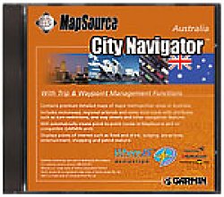 City Navigator Australia is available either individually or with the purchase of a StreetPilot® III in Australia, and is designed for the StreetPilot® 2610/2650 , StreetPilot III , GPS V , iQue 3600 , GPSMAP® 196 and NavTalk® GSM . City Navigator Australia is available either individually or with the purchase of a StreetPilot® III in Australia, and is designed for the StreetPilot® 2610/2650 , StreetPilot III , GPS V , iQue 3600 , GPSMAP® 196 and NavTalk® GSM .
Features include:
- Trip and waypoint management functions**
- Detailed maps of major metropolitan areas in Australia; with this purchase, you'll have access to the entire CD ROM coverage
- Includes detailed maps containing motorways, national and regional thoroughfares and local roads with attributes such as turn restrictions, one way streets and other navigation features
- Points of interest such as food and drink, lodging, golf courses, theatres and cinemas, petrol stations
- Software that automatically creates point-to-point routes in MapSource® and on compatible Garmin® units
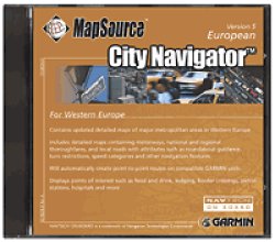 MapSource City Navigator Europe v5 is included with the purchase of a StreetPilot® 2610/2650 or Atlantic StreetPilot III Deluxe (with access to all regions at no extra charge). This product is designed specifically for the StreetPilot III. MapSource City Navigator Europe v5 is included with the purchase of a StreetPilot® 2610/2650 or Atlantic StreetPilot III Deluxe (with access to all regions at no extra charge). This product is designed specifically for the StreetPilot III.
Version 5 features include:
- Trip and waypoint management functions**
- Premium detailed maps of major metropolitan areas in 7 regions in Western Europe
- Detailed maps containing motorways, national and regional thoroughfares, and local roads with attributes such as roundabouts, turn restrictions, speed categories and other navigation features
- Access to the entire CD-ROM coverage
- Points of interest such as food and drink, lodging, border crossings, petrol stations, hospitals and more
- Software will automatically create point-to-point routes in MapSource and on StreetPilot III
MapSource City Select
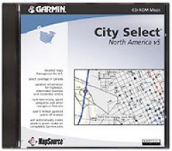 MapSource North America City Select v5 includes full coverage maps throughout the United States and select Canadian coverage. This updated product (with access to all regions at no extra charge) is included with the purchase of a Garmin® GPS V Deluxe or iQue 3600 . City Select also works with the GPSMAP® 196 . (Product not sold separately in the U.S or Canada.) MapSource North America City Select v5 includes full coverage maps throughout the United States and select Canadian coverage. This updated product (with access to all regions at no extra charge) is included with the purchase of a Garmin® GPS V Deluxe or iQue 3600 . City Select also works with the GPSMAP® 196 . (Product not sold separately in the U.S or Canada.)
Version 5 features include:
- Trip and waypoint management functions**
- Full coverage for metro and rural areas throughout the contiguous U.S., supplemental coverage of Alaska and Hawaii and select coverage of Canada.
- Detailed maps containing highways, interstates, and business and residential streets, with turn restrictions, speed categories, and other navigation features.
- The ability to create automatic, point-to-point routes in MapSource, the GPS V® Deluxe, iQue™ and GPSMap 196.
- Over 5 million points of interest such as:
- food and drink
- lodging
- attractions
- entertainment
- shopping
- emergency services
- post offices
- camp grounds
- movie theaters and more
 MapSource™ City Select Europe is included with the purchase of an Atlantic GPS V Deluxe , or NavTalk® GSM Phone , or iQue™ 3600 Atlantic (with access to all regions at no extra charge) and is also available for purchase as a stand-alone product for Americas GPS V and GPSMAP® 196 owners traveling to Europe. This CD must be unlocked via our unlock pages or by phone. MapSource™ City Select Europe is included with the purchase of an Atlantic GPS V Deluxe , or NavTalk® GSM Phone , or iQue™ 3600 Atlantic (with access to all regions at no extra charge) and is also available for purchase as a stand-alone product for Americas GPS V and GPSMAP® 196 owners traveling to Europe. This CD must be unlocked via our unlock pages or by phone.
Version 5 features include:
- Trip and waypoint management functions**.
- Updated, detailed maps of major metropolitan areas in Western Europe.
- Detailed maps containing motorways, national and regional thoroughfares, and local roads with attributes such as turn restrictions, speed categories, and other navigation features.
- Points of interest such as food and drink, lodging, border crossings, petrol stations, hospitals, and more.
- Software that automatically creates point-to-point routes in MapSource and on the GPS V Deluxe, iQue 3600 , GPSMAP 196 , and NavTalk GSM phone.
- Access to the entire CD-ROM coverage.
 MapSource™ City Select South Africa - Download map data for South Africa using your compatible Garmin® GPS with the MapSource City Select South Africa CD-ROM. This CD also contains features to automatically calculate routes on your GPS V , NavTalk® GSM, iQue 3600, GPSMAP 196 , StreetPilot® 2610/2650, or StreetPilot III. City Select South Africa is available for purchase as a stand-alone product, and also comes with the purchase of a GPS V or StreetPilot III in South Africa. MapSource™ City Select South Africa - Download map data for South Africa using your compatible Garmin® GPS with the MapSource City Select South Africa CD-ROM. This CD also contains features to automatically calculate routes on your GPS V , NavTalk® GSM, iQue 3600, GPSMAP 196 , StreetPilot® 2610/2650, or StreetPilot III. City Select South Africa is available for purchase as a stand-alone product, and also comes with the purchase of a GPS V or StreetPilot III in South Africa.
Features include:
- Trip and waypoint management functions**
- Contains detailed maps of select cities and towns in South Africa—with this purchase, you'll have access to the entire CD-ROM coverage
- Map detail includes motorways, national and regional thoroughfares, and local roads with attributes such as turn restrictions, speed categories, and other navigation features
- Displays points of interest such as:
- food and drink
- lodging
- petrol stations
- hospitals and more
- Automatically creates point-to-point routes in MapSource and on your GPS V®, NavTalk GSM phone, iQue™ 3600, GPSMAP® 196, and StreetPilot III
- “Unlock Wizard” to guide you through the unlock process
MapSource MetroGuide
 MapSource MetroGuide U.S.A. v5 now provides the same great mapping that is packaged with our premium products, such as the StreetPilot® III (sold with North American City Navigator) and the GPS V® (sold with North American City Select®). With this latest version, MetroGuide U.S.A. now utilizes Navigation Technologies® map data, which means we can offer the same high-quality mapping for all of our GPS products. MapSource MetroGuide U.S.A. v5 now provides the same great mapping that is packaged with our premium products, such as the StreetPilot® III (sold with North American City Navigator) and the GPS V® (sold with North American City Select®). With this latest version, MetroGuide U.S.A. now utilizes Navigation Technologies® map data, which means we can offer the same high-quality mapping for all of our GPS products.
MetroGuide U.S.A. contains full-coverage map data for the continental U.S. and Alaska and Hawaii, and will provide automatic route calculation on the PC only.
Version 5 features include:
- Trip and waypoint management functions.**
- Full coverage of interstates, highways, and state, local, and residential roads in both metro and rural areas throughout the United States (including Alaska and Hawaii).
- The ability to create automatic point-to-point routes using MapSource.
- Points of interest, including over 5 million business listings, such as:
- food and drink
- lodging
- attractions
- entertainment
- shopping
- emergency services
- post offices
- campgrounds
- movie theaters
**These functions work with nearly all Garmin® GPS units, excluding the GPS 100 family and panel mount aviation units.
 MetroGuide Australia contains premium detailed maps of major metropolitan areas in Australia, and is designed for use with any compatible Garmin® mapping unit. MetroGuide Australia contains premium detailed maps of major metropolitan areas in Australia, and is designed for use with any compatible Garmin® mapping unit.
Features include:
- Trip and waypoint management functions**
- Detailed maps of Australia
- Access to the entire CD-ROM coverage
- Locked product providing access to the entire CD ROM
- Detailed maps containing motorways, national and regional thoroughfares and local roads
- Roads in rural areas within Queensland, New South Wales, Victoria, South Australia, Northern Territory, Tasmania and Western Australia
- Points of interest in the detailed areas such as, food and drink, lodging, golf courses, theatres and cinemas, petrol stations, hospitals and more
- Real time track plotting allows you to interface your Garmin GPS with a PC laptop***
**These functions of this product work with nearly all Garmin GPS units, excluding the GPS 100 family and panel mount aviation units.
***The real-time track plotting function of MapSource will work only with GPS products that have valid unlock codes that work with MetroGuide Australia.
 MapSource® MetroGuide Canada v4 uses DMTI Spatial map data to create detailed maps for all provinces in Canada, including provincial highways, controlled access highways and local roads. MapSource® MetroGuide Canada v4 uses DMTI Spatial map data to create detailed maps for all provinces in Canada, including provincial highways, controlled access highways and local roads.
Features include:
- Trip and waypoint management functions**
- Now using DMTI Spatial map data
- Automatically creates point-to-point routes on PC and once downloaded to a compatible Garmin GPS
- Address lookup capability on the PC (and once downloaded to a compatible Garmin GPS)
- Provincial and local highways
- Local, county and residential roads for Canada
- General lake coverage throughout Canada
- Over 750,000 points of interest, including:
- food and drink
- lodging
- attractions
- entertainment
- shopping
- emergency services
- campgrounds and more
- Real time track plotting
**These functions of this product work with nearly all Garmin GPS units, excluding the GPS 100 family and panel mount aviation units. Some products require a Garmin data card to download maps.
 MapSource MetroGuide Europe v5.00 software includes map data for all of Western Europe on one CD. In addition to the updated map data, users can take advantage of automatic routing capabilities on the PC. MapSource MetroGuide Europe v5.00 software includes map data for all of Western Europe on one CD. In addition to the updated map data, users can take advantage of automatic routing capabilities on the PC.
Version 5.00 Features include:
- Trip & waypoint management functions that let you transfer waypoints, routes and tracks between your Garmin® GPS and your PC**
- Updated map data and expanded coverage for all of Western Europe
- Detailed maps of major metropolitan areas in Western Europe, with business and residential street names and address lookup capability on the PC before downloading to a compatible unit with address lookup feature
- Map detail contains attributes for automatic routing on the PC
- Detailed maps containing motorways, national and regional thoroughfares, and local roads, plus other navigation features
- Points of interest, such as food and drink, lodging, border crossings, petrol stations, hospitals, and more
- Real-time track plotting
**These functions of this product work with nearly all Garmin GPS units, excluding the GPS 100 family and panel mount aviation units.
MapSource Points of Interest
 MapSource® Points of Interest CD-ROM contains 4 different categories: MapSource® Points of Interest CD-ROM contains 4 different categories:
- Businesses
- Cities
- Landmarks
- Marine
These will appear separately on the drop-down menu, but can be loaded into the GPS unit simultaneously.
Features include:
- Trip and waypoint management functions**
- Locations of services throughout the U.S. and Canada, including food and drink, lodging, entertainment, shopping, banks and much more
- Displays cities worldwide
- Marine navaids worldwide, and includes lights, buoys, beacons, marinas, mile markers, wrecks, obstructions and hazards for the U.S.
- Addresses, phone numbers and descriptions for business listings
- U.S. interstate exit information, such as service stations, hotels, hospitals, restaurants and more
**These functions of this product work with nearly all Garmin® GPS units, excluding the GPS 100 family and panel mount aviation units.
MapSource Roads & Recreation
 MapSource Roads & Recreation US - Plan your next vacation or recreational outing with MapSource® United States Roads & Recreation CD-ROM. MapSource Roads & Recreation US - Plan your next vacation or recreational outing with MapSource® United States Roads & Recreation CD-ROM.
Features include:
- Trip and waypoint management functions**
- Local, county, residential roads, and interstates for all 50 states
- U.S. interstate exit information such as service stations, gas stations, restaurants, hotels, campsites, hospitals, banks, and more
- U.S. inland cartography with shoreline detail for lakes, reservoirs, rivers; icons indicating boat ramps, dams, marinas, public facilities, mile markers, and first-aid stations
- U.S. nautical navaids such as daybeacons, radiobeacons, RACONs, fog signals, lights, buoys, and other navaids
**These functions of this product work with nearly all Garmin® GPS units, excluding the GPS100 family and panel mount aviation units.
 MapSource Roads & Recreation Europe - All of Garmin European Roads & Recreations have now been combined and updated into this single Roads & Recreation Europe CD which covers all of Western Europe. In addition to the updated map data, we've added enhanced features. MapSource Roads & Recreation Europe - All of Garmin European Roads & Recreations have now been combined and updated into this single Roads & Recreation Europe CD which covers all of Western Europe. In addition to the updated map data, we've added enhanced features.
Features include:
- Trip and waypoint management functions**
- Detailed maps of major metropolitan areas in Western Europe with business and residential street names
- Detailed maps containing motorways, national and regional thoroughfares and local roads
- Points of interest such as food and drink, lodging, border crossings, petrol stations, hospitals and more, and shows the addresses for selected points of interest.
- Shoreline detail of lakes, rivers, streams and canals
**These trip and waypoint management functions of this product work with nearly all Garmin® GPS units, excluding the GPS100 family and panel mount aviation units.
MapSource WorldMap
 MapSource® WorldMap CD-ROM provides worldwide coverage with basemap-level detail including the following features: MapSource® WorldMap CD-ROM provides worldwide coverage with basemap-level detail including the following features:
- Trip and waypoint management functions**
- Political boundaries, cities, towns, major motorways and/or interstates, and principal highways; lakes, major streams, and rivers; and urban areas and railroads
- Coastline detail which includes many offshore islands, as well as worldwide nautical navaids such as daybeacons, radiobeacons, RACONs, fog signals, lights, buoys, and other navaids
- U.S. Interstate Exits Information, such as service stations, gas stations, restaurants, hotels, campsites, hospitals, banks, and more
**These functions of this product work with nearly all Garmin® GPS units, excluding the GPS100 family and panel mount aviation units. |


