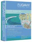
FUGAWI Release Marine ENC Version 4
Date: Friday, February 18 @ 00:11:19 UTC
Topic:
 Fugawi are currently exhibiting at the Miami International Boat Show. To co-incide with the show Fugawi have released the latest version of thier Marine mapping software which uses amongst other charts and map formats the NOAA ENC standard, hence the name. Fugawi are currently exhibiting at the Miami International Boat Show. To co-incide with the show Fugawi have released the latest version of thier Marine mapping software which uses amongst other charts and map formats the NOAA ENC standard, hence the name.
Amongst the new features in the software are 3D visualisation of charts and maps, the overlaying of Street data, and (if you have the appropriate receiver) it will display the position of commercial shipping or any other traffic transmitting Automatic Identification System (AIS) data.
Fugawi are exhibiting at the Miami International Boat Show in booth 1653. If you are going there mention that you saw the press release on www.PocketGPSWorld.com. Check out www.fugawi.com for more details.
Click here for the full Fugawi press release.
Comments?
|
|