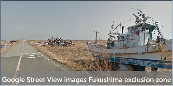
Google Street View maps Fukushima exclusion zone
Date: Thursday, March 28 @ 10:42:06 UTC
Topic:

Haunting imagery of Namie-manchi, a small city in the Fukushima exclusion zone, has been released by Google.
In 2011 a magnitude 9 earthquake off the coast of Japan triggered a tsunami and resulted in a meltdown at the Fukushima Daiichi Nuclear Power Plant. As a result of the nuclear accident everyone living within 12 mile radius of the plant was forced to evacuate.
Working with officials, Google Street View cars have been permitted to drive through the abandoned city and surrounding area so that its displaced residents and others can view their homes.
The imagery graphically demonstrates the scale of the disaster and the power of human nature. The fishing boat in the image above is more than a a kilometre inland. Although many of the older buildings in Nami-manchi collapsed during the earthquake, many more appear unaffected but the fallout from the nuclear accident means Namie-manchi will be off-limits for decades to come.
Source: maps.google.com
Click here to read more...
Click here to discuss...
|
|