
1930s SatNav - The First In-Car Navigation System
Date: Thursday, October 07 @ 11:24:42 UTC
Topic:
 Came across this great blog post on Dieselpunks.org introducing the world's first automatic in-car navigator. Came across this great blog post on Dieselpunks.org introducing the world's first automatic in-car navigator.
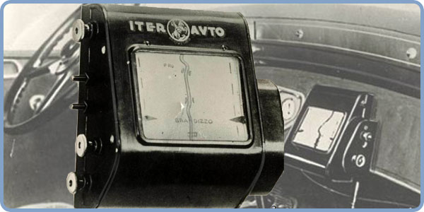
The Inter Avto, created in 1930, was a moving map navigation device that used maps on rolls of paper. The maps were wound from one roll to another across a display and the scroll rate was controlled by a cable connected to the speedometer.
It may seem rather crude today but I'm sure that back in 1930 this was a revolutionary as SatNav was to us when first released. It does have some drawbacks, if you leave the prescribed route then it isn't going to re-route you, there is no Map Share and POIs need to be drawn on by hand.
Click here to read more...
Click here to discuss...
|
|