
Transport for London Launch Digital Speed Map for Satnav's
Date: Friday, March 27 @ 18:04:41 UTC
Topic:
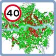 Transport for London (TfL) have launched a digital speed map. Transport for London (TfL) have launched a digital speed map.
Available for download on TfL's website, there are two distinct options. First, a basic POI based map available in Garmin & TomTom formats as well as KML that consists of a set of POIs covering the various enforced speed limits and secondly an application available only for TomTom devices that will continually warn if you exceed the speed limit for more than 15secs.
The speed map is an off-shoot of TfL's Intelligent Speed Adaptation (ISA) project exploring new technology in the fields of speed management. Any such technology requires an accurate digital speed 'map' and so the data has been captured for these purposes. The digital data will be made available to to anyone who wishes to create an application or indeed as here for personal use.
Click here to read more...
Click here to discuss...
|
|