Hi! We see you’re using an ad-blocker. We’re fine with that and won’t stop you visiting the site.
But as we’re losing ad-revenue from this then why not make a donation towards website running costs?. Or you could disable your ad-blocker for this site. We think you’ll find our adverts are not overbearing!
Joined: 20/08/2002 11:51:57 Posts: 3859 Location: Essex, UK
Posted: Wed Jan 18, 2006 9:36 pm Post subject: Garmin launch Topo Great Britain for Garmin GPS receivers
PocketGPSWorld.com are among the few privileged guests to be invited to the official product launch of the Garmin Topo Great Britain for the range of Garmin compatible GPS devices.
Garmin have had Street Mapping Data and Marine charts available in the UK for some time now in the form of MapSource. Topographical mapping has been available in the US now it will shortly be available in the UK.
Today Garmin launched a new product for the UK Market at Blenhiem Palace in Oxfordshire. Topo Great Britain is the first Garmin product to integrate Ordnance Survey topographical mapping into their Mapsource products. Coinciding with the launch of the new "X"-tended memory GPS receivers the Topo Mapping are perfect partners.
Garmin Topo Great Britain will be priced at £149 for full UK Mapping and will be available towards the end of Jan/beginning Feb. Regional mapping will be available on microSD card round about March. This will be available for holiday makers, price to be decided the actual regions are currently being decided.
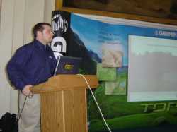
Matthew Palmer the Garmin Outdoor Product Manager presented the the new products at the exclusive venue of Blenhiem Palace.
The Garmin Topo Great Britain is delivered on a DVD and is constructed from OS topo MasterMap vector based mapping and Navteq street mapping data. This includes routable street maps allowing you to transfer your route from the PC to your hand hald GPS. You can use the same GPS to get you to the start of your walk and then the topo mapping will help
you navigate on your hike with confidence.
The topo maps cover England, Scotland and Wales. This does not include Northern Ireland, Isle of Man, The Channel islands, or the Republic of Ireland. The mapping data is drawn from a number of databases specifically the Ordnance Survey vector based MasterMap with some resolution down to 1:1250 Urban, 1:10k rural, and 1:25k Mountain regions. This is combined with
Navteq street mapping providing routable streetmaps with topo overlays.
The software supports Vertical profiling on PC and the compatible GPS devices. The elevation profiles are point to point on the GPS or PC (not along the route) As the data is surveyed the profile is very accurate.
The Topographical display has Contour shading (Mike thought this was a neat feature).
Tim Naylor Commercial Partner Account Manager of the Ordnance Survey said "I am really pleased that The Ordnance Survey and Garmin have come together to produce a market leading topograpical mapping product that opens up the worlds of both street navigation and recreational mapping."
Sir Chris Bonnington was on hand to give a talk at the Garmin Topo Great Britain Launch. He releated his experiences of using GPS on his latest trip to the Himalayas.
On the trekking/climbing trip to the Indian Himalayas Chris was using 1944 vintage 1 mile to the inch map with simple lat/lon calibration. This was digitised used to display daily tracklogs and waypoints recorded on a Garmin eTrex during the trip. The trip was a learning experience for Chris. The climbing team were able to see exactly where they were and where they had been on a daily basis. Chris said: "GPS is a really useful tool for expeditioning. Track back is a great for retracing your steps in a whiteout."
Chris also said: "If you are skiinig in a whiteout in the caingorms a GPS is an invaluable device to help you find your way safely."
Garmin Press Release wrote:
Garmin® Releases MapSource® TOPO Great Britain
OLATHE, Kan./18th January 2006 Garmin International Inc., a unit of Garmin Ltd. (Nasdaq: GRMN), today announced that it will begin offering the highly anticipated MapSource TOPO Great Britain software including detailed electronic topographical mapping of England, Scotland, and Wales.
In response to demands from the trade and outdoor enthusiasts, Garmin is proud to offer this very advanced level of digital mapping for Great Britain, said Sean Biddlecombe, Garmin Europes director of international marketing. Whether hill walking, camping, or touring the countryside, TOPO Great Britain will add a whole new dimension to GPS navigation.
TOPO Great Britain software is a combination of topographical data, provided by Ordnance Survey of Great Britain, and routable street level mapping provided by NAVTEQ. For the very first time, users can load topographical mapping for Great Britain as well as waypoints, routes and tracks to their compatible Garmin hand held.
The simple and easy to use software is provided on one DVD-ROM, containing over 90,000 points-of-interest, including restaurants, hotels, emergency services and more. The software is also capable of generating point-to-point routes on a computer or GPS handheld offering turn-by-turn guidance for use on the roads. The software does not support routing on trails.
TOPO Great Britain also offers vertical profiling of a route on a computer or a compatible Garmin GPS receiver. Other key features include contour shading as well as an extensive database of trig points. Users can load their trips onto MotionBased.com, to get an in-depth analysis of activities, view tracks on a variety of online maps, and share routes with others.
MapSource TOPO Great Britain is expected to be available in January 2006. Garmin recommends that TOPO Great Britain is loaded onto units with 20MB of memory or larger. For a list of compatible units, see www.garmin.com/cartography.
_________________ Mike Barrett
Last edited by MikeB on Fri Jan 20, 2006 2:47 pm; edited 5 times in total
For recreational purposes, contour mapping obviously adds much needed detail to the map screen.
However, since contour mapping is freely available via the SMC (Scottish Mountaineering Council) website, unless the Garmin Topomaps actually contain the public rights of way network (footpaths & bridleways), then I can't see it being worth the outlay of nearly £150.00
Baz _________________ Garmin DriveSmart 61 LMT-D
TomTom Go 50 - Going in the BIN
TomTom Go 730 (RIP)
Garmin Montana 650
Garmin Oregon 45oT
Garmin Edge 1000
Tracklogs Digital Mapping
Joined: 20/08/2002 11:51:57 Posts: 3859 Location: Essex, UK
Posted: Thu Jan 19, 2006 2:34 pm Post subject:
I am not quite sure what you mean Baz. I know Scotland has different laws regarding land access to the rest of the UK. Does the SMC contor map data download directly to the GPS?
What you get with the Garmin product is full Ordnance Survey maps of the entire UK on the GPS receiver. Something that is well worth £150. Other companies offering this do so at £200 without the street routing capability. _________________ Mike Barrett
Joined: 14/09/2002 20:56:18 Posts: 5231 Location: Surrey, United Kingdom
Posted: Thu Jan 19, 2006 2:58 pm Post subject:
Bazzer wrote:
However, since contour mapping is freely available via the SMC (Scottish Mountaineering Council) website, ...
The SMC is the Scottish Mountaineering Club; the Mountaineering Council of Scotland is the MCofS.
The Contour maps are available from the SMC website, here. Without looking too carefully, they appear to be contour overlay maps, not complete maps. _________________ Tim
Joined: 24/06/2003 00:22:12 Posts: 2946 Location: Escaped to the Antipodies! 36.83°S 174.75°E
Posted: Thu Jan 19, 2006 2:59 pm Post subject:
Bazzer wrote:
unless the Garmin Topomaps actually contain the public rights of way network (footpaths & bridleways), then I can't see it being worth the outlay of nearly £150.00
Have a look at the online browser and you can see the map detail. It appears to contain paths and I think the topo maps do autorouting on trails which is an interesting feature.
As for the SMC maps, can you load them into a Garmin unit? The advantage of the Garmin maps are that they are vector maps not bitmaps so they are a fraction of the size of raster maps. _________________ Gone fishing!
Joined: 20/08/2002 11:51:57 Posts: 3859 Location: Essex, UK
Posted: Thu Jan 19, 2006 4:10 pm Post subject:
Skippy wrote:
Have a look at the online browser and you can see the map detail. It appears to contain paths and I think the topo maps do autorouting on trails which is an interesting feature.
They do contain trails, and paths. They have exactly the same detail as the OS maps of the region. The trails are not routable though. You can only create autoroutes on the underlying NavTeq street data. _________________ Mike Barrett
The SMC contour maps are installed into the mapsource programme and uploaded to the GPS together with any Navtec maps that you select.
Currently, I'm using these maps when venturing into the hills and they give you a real sense of whats around you (when walking in mist) rather than just looking a a blank screen with a distant waypoint on it.
I've not had a close look at the new topo maps, but if they do contain the public rights of way network thenthey would be VERY useful.
Baz _________________ Garmin DriveSmart 61 LMT-D
TomTom Go 50 - Going in the BIN
TomTom Go 730 (RIP)
Garmin Montana 650
Garmin Oregon 45oT
Garmin Edge 1000
Tracklogs Digital Mapping
Further to my last message, I have just had a look at the Mapviewer on the Garmin website, and explored an area that I am familar with.
While the maps have some black lines shown as 'path', it does not look like it contains the public rights of way network (footpaths & bridleways), whic is disappointing.
Therefore, they do not contain the same information as the respective OS map (with the same details) but just appear to be mainly coloured/shaded contour mapping.
Baz _________________ Garmin DriveSmart 61 LMT-D
TomTom Go 50 - Going in the BIN
TomTom Go 730 (RIP)
Garmin Montana 650
Garmin Oregon 45oT
Garmin Edge 1000
Tracklogs Digital Mapping
Joined: 20/08/2002 11:51:57 Posts: 3859 Location: Essex, UK
Posted: Thu Jan 19, 2006 5:43 pm Post subject:
That makes me wonder if the mapviewer has the proper data available. I dont have the software yet as it was not available yesterday at the launch, but the areas I viewed on the MapSource application certainly had the paths and tracks on them. I was looking at areas in Wales and the Lake District. I am not familiar with Scotland so I would not have been able to make a judgment about any areas there. _________________ Mike Barrett
Hi MikeB, just to clarify, the area that I was examining is in the Clwydian Hills in North Wales which has a very good network of paths & bridleways. None of these appeared to be shown.
The contour maps from the SMC site cover the whole of the UK and not just Scotland.
As you rightly say, access and rights of way are completely different in Scotland to England & Wales. That is why it is disappointing if the rights of way are not shown on the new topomaps.
Let's hope that it is just the Mapviewer not giving sufficient detail, and that the maps do contain rights of way. Hopefully, someone 'in the know' can find out ?
Baz _________________ Garmin DriveSmart 61 LMT-D
TomTom Go 50 - Going in the BIN
TomTom Go 730 (RIP)
Garmin Montana 650
Garmin Oregon 45oT
Garmin Edge 1000
Tracklogs Digital Mapping
Joined: 20/08/2002 11:51:57 Posts: 3859 Location: Essex, UK
Posted: Fri Jan 20, 2006 2:57 pm Post subject:
I have just had a response from Garmin. Regarding the issues raised.
Garmin wrote:
Regarding bridleways, right of way and access land limits. As discussed during the presentation, unfortunately OSGB cannot offer this type of information to Garmin (or any other company) at this time in vector format, which is the most flexible and intelligent way to make GPS maps. We have brought this subject in the OSGB court and we hope they will progress. We do hope to be able to offer additional features and much finer categorization for the paths in the following release of TOPO Great Britain, but at this time we cannot offer the distinction between bridleways, minor and major paths, we cannot offer right of ways and we cannot offer access land limits. Nevertheless we think that TOPO Great Britain is very good value for money for the accuracy of the datasets used and for the additional functionalities offered, such as ability to find out the route profile before you can actually walk a route. Additionally this is also a routable product on roads, which will allow the user to have dual use of these mapping product.
Although we offer paths and tracks, unfortunately and again due to
the OSGB database, we are not able to assure 100% of the paths and tracks in Great Britain. Many areas are well covered with most paths and tracks, but in some areas the OSGB MasterMap vector database does not contain information for absolutely all the paths and tracks. Again we hope that OSGB will understand that without such information, GPS companies will not be able to accommodate the increasing market demand for good quality GPS maps. Maybe in the next release OSGB will have completed the paths and tracks for their MasterMap database, but at this time we can't say what their exact plans are.
It would appear that I was either mistaken or lucky that the paths I was looking at were on the maps. _________________ Mike Barrett
Joined: 20/08/2002 11:51:57 Posts: 3859 Location: Essex, UK
Posted: Fri Jan 20, 2006 4:03 pm Post subject:
I did have another look at the MapSource viewer for the Topo GB maps. I found that the paths were generally not shown untill you got to a reasonably high zoom value.
The following image shows Stickle Tarn in the lake district. If you actually pan north from that it shows Jake's Rake. Not exactly what I would define as a tourist track...
Source Garmin.
Click here for the Garmin MapSource viewer page. _________________ Mike Barrett
Joined: May 01, 2004 Posts: 706 Location: Monmouthshire
Posted: Wed Jan 25, 2006 9:54 pm Post subject:
Roger_Lewis wrote:
Anyone know which Garmin GPS units the OS up loadable maps will be compatible with. In particular will it work with the GPSMAP 60 CS ?
Well Garmin had the maps loaded on the gpsmap 60cs at the last pocketgpsworld meet in November. I don't know how much area though as the parts of the UK covered are around 1.5GB
Dave
Posted: Today Post subject: Pocket GPS Advertising
We see you’re using an ad-blocker. We’re fine with that and won’t stop you visiting the site.
Have you considered making a donation towards website running costs?. Or you could disable your ad-blocker for this site. We think you’ll find our adverts are not overbearing!
All times are GMT + 1 Hour Goto page 1, 2, 3, 4, 5Next
Page 1 of 5
You cannot post new topics in this forum You cannot reply to topics in this forum You cannot edit your posts in this forum You cannot delete your posts in this forum You cannot vote in polls in this forum
Or you could disable your ad-blocker for this site. We think you’ll find our adverts are not overbearing!
Hi! We see you’re using an ad-blocker. We’re fine with that and won’t stop you visiting the site.
But as we’re losing ad-revenue from this then why not make a donation towards website running costs?. Or you could disable your ad-blocker for this site. We think you’ll find our adverts are not overbearing!


 PocketGPSWorld.com are among the few privileged guests to be invited to the official product launch of the Garmin Topo Great Britain for the range of Garmin compatible GPS devices.
 Sir Chris Bonnington was on hand to give a talk at the Garmin Topo Great Britain Launch. He releated his experiences of using GPS on his latest trip to the Himalayas.