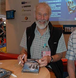
On the Memory Map stand was one of the people that has genuinely shaped my life: Sir Chris Bonington. Many years ago (actually 40) I met Chris at Grisedale Hall in the Lake District. He was on a lecture tour and gave a slide presentation on one of his expeditions. At the age of 7 this gave me the inspiration to explore the great outdoors.
Strangely when I told him this he didn’t seem to be able to recall me. Mind you I was somewhat shorter in those days and had curly ginger hair, sadly most of that has departed and the rest has gone grey.
Back in those days navigation was by map and compass. Obviously this has moved on a great deal since then.
Today Chris was on the Memory-Map stand signing copies of the Navigation Workshop DVD, which he has endorsed. PocketGPSWorld.com reviewed this DVD a while ago. Click here to read our review. The Navigation Workshop DVD explains how GPS works and how to navigate in easy to understand terms, with examples using Memory-Map and an interactive quiz.
The GPS and mapping products were all grouped together in their own area. CeBIT was the same. I am beginning to think they are doing it especially for me to save my poor legs. However, I doubt they are that considerate!
Wherever you went around the exhibition everybody seemed to be selling Memory-Map. Memory-Map themselves were not selling it, but all of the big Outdoor Stores seemed to have a Memory-Map demo and were selling copies.
Memory-Map didn’t have any new software, and wouldn't tell me when version 5 would be coming or what would be in it. They did have a couple if bits if news though.
Memory-Map has been selected as the approved planning tool for the Duke of Edinburgh's Award. This acknowledges the role of electronic navigation and GPS in today's modern society.
Memory-Map were also promoting their new Selections map product. When you buy the Selections CD you get a copy of the Memory-Map application and a 1:250,000 map of the UK. You then draw a route around the area you want and send it to Memory-Map. About a week later your detailed map data will be sent to you on CD.
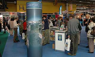
Anquet where there as well. I went up to the stand a few times to try and talk to them, but they were so busy it was impossible. This really is a good indication of how the digital mapping boom is continuing.
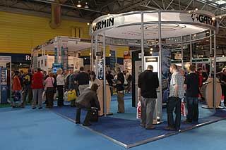
Last week we saw NavMan at CeBIT with the new pin570 and the NavMan Sport. Sure enough NavMan were here too showing off the sport. The traditional handheld GPS guys were there too, with Garmin and Magellan. A newcomer in the GPS market is Sunto. Sunto make a wrist fitting GPS, this has the functionality of a handheld GPS, but it fastens to your wrist, just like a big watch.
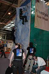
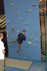
As usual there were a large number of activities that you could try out from bouldering and climbing to diving and BMX cycling.
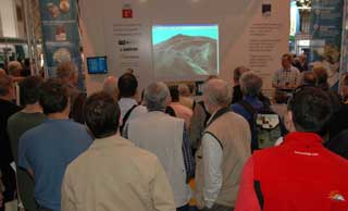
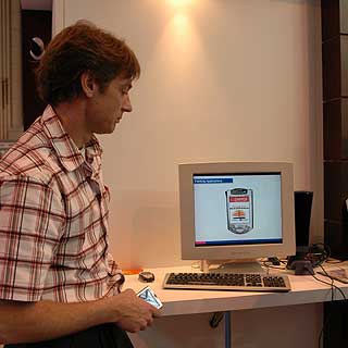
I was just about to leave when a chance conversation at the bar pointed me in the direction of the Ordnance Survey stand. I normally give this the once over then pass it by. I was told to look out for someone demonstrating "augmented reality". When I went over the chap needed to speak to was busy so while I was waiting I spoke to one of the surveyors. Interestingly he told me that base map for the UK is 1:1250 scale, and quite often the new features are "fitted in" as GPS surveying is so much more accurate than the traditional surveying methods.
I finally got round to talking to Chris Phillips, a senior research scientist for the OS. Now this was where the interesting information was gleaned. Chris and I talked about a number of R&D projects that he was working on.
The first of these was "Augmented Reality". This works by taking a picture and overlaying key elements like mountain names, or other POI data on the digital image.
Thereby augmenting reality and adding value to the picture. This is achieved by combining a GPS to provide a location, a digital compass to provide a direction, and a GSM/GPRS link back to the central database where the data can be analysed and the appropriate POI information sent back.
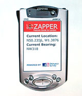
The second development project Chris showed me was the "Zapper". The Zapper uses similar technology, but this time rather than providing value added information to a picture, it allows you to point your PDA at a building and retrieve various data about it. You can see all manner of applications in both consumer and business markets for this technology.
Our final discussions revolved around the collection of height data for buildings. Currently the OS database records 2D data so a footprint of a building is known. By collecting and recording the heights of these buildings a new world of 3D representation in mapping can be produced. This may be a few years off yet, but the potential is there, and by the time the data has been collated the hardware and storage capacities for the mobile devices will have evolved sufficiently to utilise it.
All in all a well spent 45 minutes.
On the way home unfortunately I had the opportunity to test the Traffic interface of the new TomTom 5 software. Instead of just over 2 hours the journey took over 4 hours. Unfortunately the traffic reports were accurate, and doubly problematic was the fact that diverting round the jams took longer than the original delay. So I had plenty of time to ponder the events of the day, and in particular the possibilities offered by the R&D going on in the Ordnance Survey. |