
Tele Atlas announce high definition 3D mapping
Date: Wednesday, May 09 @ 13:29:41 UTC
Topic:
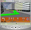 Last week Tele Atlas announced 3D mapping for European cities. This is the culmination of over two years work. When pocketGPSWorld.com visited the Tele Atlas offices in Gent back in August 2005 I was shown a demonstration of the 3D capabilities of the Brandenburg Gate in Berlin. Click here to read our full Tele Atlas visit report. Last week Tele Atlas announced 3D mapping for European cities. This is the culmination of over two years work. When pocketGPSWorld.com visited the Tele Atlas offices in Gent back in August 2005 I was shown a demonstration of the 3D capabilities of the Brandenburg Gate in Berlin. Click here to read our full Tele Atlas visit report.
At the time I was unconvinced about the usefulness of 3D imaging as a tool in navigation applications. It certainly adds a WOW factor to the navigation experience, but can it really enhance your journey and help focus your attention on the road? I was somewhat sceptical until I saw the new iGO software at CeBIT this year. Being able to tell with a quick glance what the upcoming terrain is like can give you the confidence that you are going the right way.
I expect that these maps will be more useful for users out of the car and travelling on foot (or on public transport) where the full splendour of the imagery can be fully appreciated. This, of course, can be coupled with interactive tour guides to provide a complete hi-tech tourist trail of a city.
Click here for a video and to read the rest of the article and the full Tele Atlas press release...
Click here to discuss...
|
|