|
i-gotU Bluetooth GPS Travel and Sports Logger Review |
15th September 2009 |
|
Review by Lutz Bendlin
 The i-gotU devices have been around for a while but we haven't yet had a chance to review them. Recently Mobile Action (the device manufacturer) asked us to consider the improved GT-200e version for review. So, let's have a look at this new member of the photo-data-logger family.
You will notice that some of the following pictures will say "GT-200" rather than "GT-200e". The GT-200 is basically the same device but with much less memory (8 MB rather than 64 MB for the 200e). The GT-200 consequently is also $20 cheaper, as seen on BuyGPSNow, and will probably be discontinued soon.
For the review we will focus on the ease of use (including the "right out of the box" behaviour), as well as the functions of the desktop program for configuring the receiver and for visualising the recorded results.
Real world usability testing was conducted by the chief chewers, throwers and general destroyers in the household, using innovative environments like buckets filled with a mixture of sand and salt water.
In the box
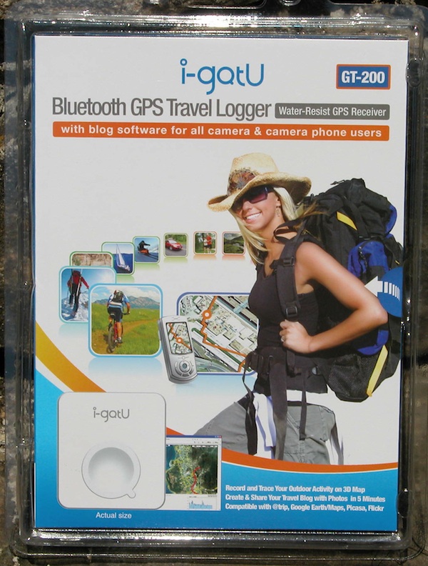
The GT-200e comes in a blister pack - this means you are more likely to see it in brick-and-mortar stores too (unlike most of the other GPS devices that are purchased nearly exclusively online).
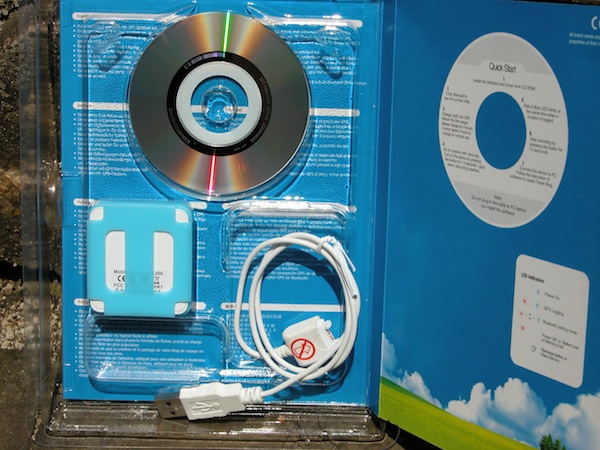
There's the receiver, a silicon cover, a velcro strap, a special USB cable (more about that later) and the driver CD.
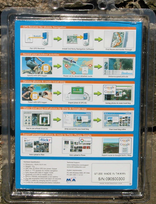
The back of the blister pack lists all the wonderful options that you have when using the receiver.
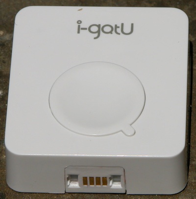
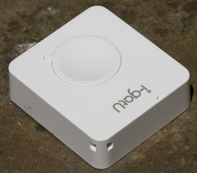
The device is very small, measuring just 46x41.4 mm and weighing all of 37 grams. The obvious interfaces are the single large button (in the form of a big O with a little quibble) and the non-standard USB connector (which even varies between the GT-200 and GT-200e). I can only imagine that Mobile Action used this connector to keep the device watertight - but I have seen other devices manage that feat with standard USB ports.
The USB port is coded so that you can shove the cable into the port only one way. In addition there's a red sticker on the cable alerting the user to pay attention to that detail.
Since the receiver is rather small it can easily be lost. To prevent that from happening Mobile Action have included a lanyard hook on the top ...
... as well as a nice silicon cover that you are supposed to fasten to the carrying belt of your camera - or to your leg, using the provided velcro.
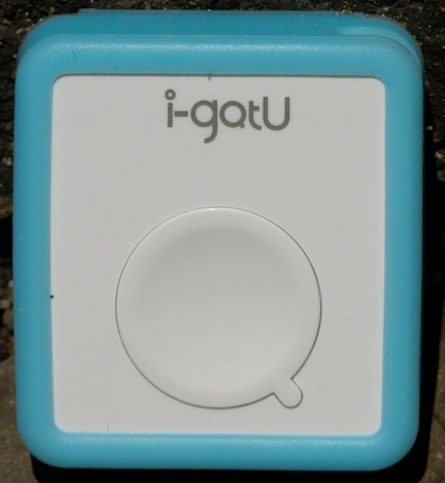
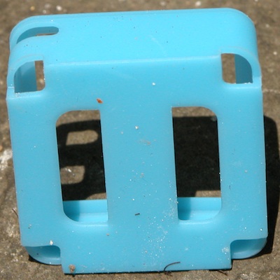
As you can see it is a bit of a dirt magnet, but then the device is designed for outdoorsy use, so I guess a certain amount of dirt is ok. The silicon cover seems to come in a variety of colors - the GT-200 had the above turquoise cover, the GT-200e came with a whitish-translucent one.
The back of the device is completely sealed - this basically means the battery is not replaceable. The built-in 750 mAh Li-Ion battery should be good for about 500 to 1000 charges which translates into more than two years of useful life.
I tested the waterproofing when I velcroed the device to the end of the paddle while we were canoeing around on a nearby lake. The device still works fine. It is worth mentioning that while the device will survive submersion, it is not buoyant - if you drop it in deep water it will be gone for good.
There are two LEDs hidden behind the front of the device. These LEDs tell you the device status.


charging/empty battery(*) power on/no lock


logging(**) Bluetooth pairing
*) blinks when nearly empty
**) if only the blue one blinks the device doesn't have a GPS lock
To switch the receiver on or off you press the button long (for BT pairing even longer). A quick press of the button will either tell you that the device is off (red light) or will record a waypoint at your current location (blue light).
The button is relatively intuitive to use. It has one major disadvantage though - it is too big and much too easy to trigger. Forget about tucking the receiver away in your pants pocket. It will switch off in no time because you inadvertedly pressed the button, and instead of your recorded route you'll come back with a clear memory. This happened to me on multiple occasions. I hope that in future designs the button can be made less protruding, or that some kind of locking mechanism could be implemented.
Installation and Setup
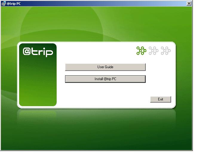
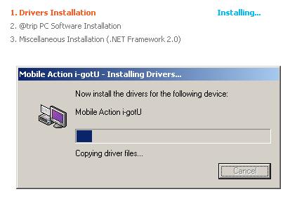
You will need the provided CD to install the serial-to-USB converter driver. This driver (and the @trip program) is only available for Windows PCs, Mac and Linux users won't be able to use the device unfortunately.
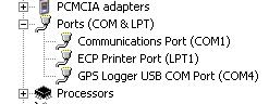
Once the device is recognized it can also be used as a standard USB mouse on the newly added COM port. And since the GT-200e supports Bluetooth you can use it as a BT mouse as well after you added the appropriate COM port.
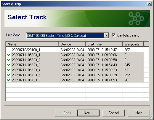
The @trip control program allows you to download and display the recorded tracks and to configure the logging settings.
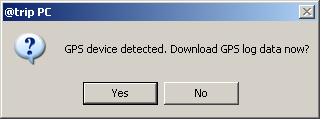
There is an option to start the download wizard whenever you attach the device to the PC via USB (theoretically it should also be possible to connect the @trip program via Bluetooth but I haven't tested that). Even if you have no new data it is safe to run this wizard - the program will automatically clear out duplicates.

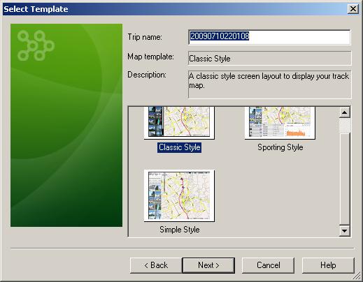
You can specify a trip name here, or do it later in the trip maintenance.
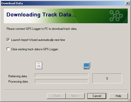
If you want to use the data logger only for independent short trips you can clear the memory after each download. This will speed up subsequent data transfers (as otherwise the program needs to re-download all the old data again, and the device only supports USB 1.1 speeds), but is not strictly required, especially given the large size of the memory. It's a bit like the difference between POP3 and IMAP4 mailboxes.
This being a photo logger there is one more (optional) step in the import process - you can point the program to the photos that you may have shot on the trip. In order to find out which photo was done where your camera's clock needs to be synched with the GPS clock BEFORE you record the tracks.

Configuration
As already mentioned configuration is done entirely in the @trip PC program. If you need to do this while on a trip make sure you have your special USB cable ready. (You can download the program from the website but you'll have to pollute the host PC(s) with the serial-to-USB driver.)
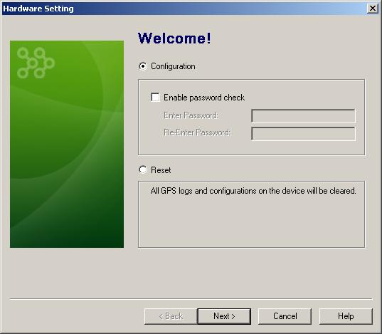
The configuration (and the data) can be password protected - this might be important for covert tracking. You'll get asked for the password when you want to retrieve the data.
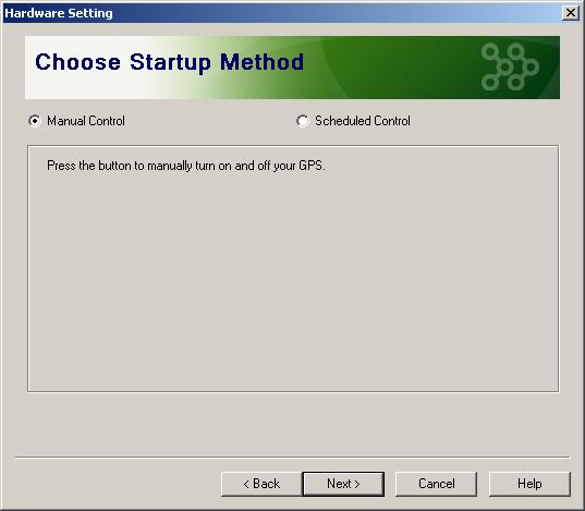
This is a very exotic setting. Probably to be able to save more battery, the device can be switched on according to a schedule. (Mobile Action told me they have plans to include a motion sensor in future devices)
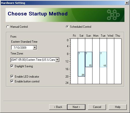
As an added bonus the device can be switched on by the schedule while appearing to still be off (no lights, and no reaction to the button). Pretty sneaky, eh?
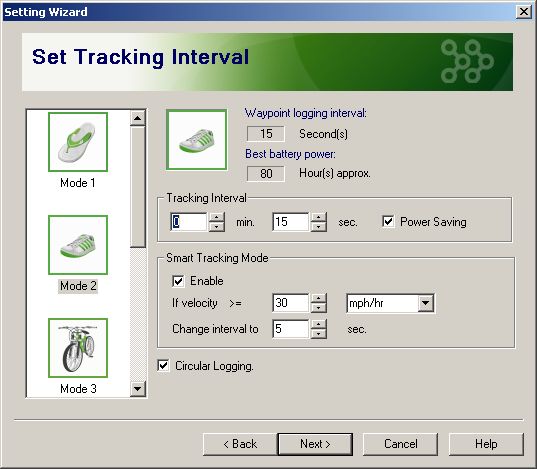
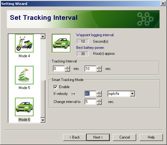
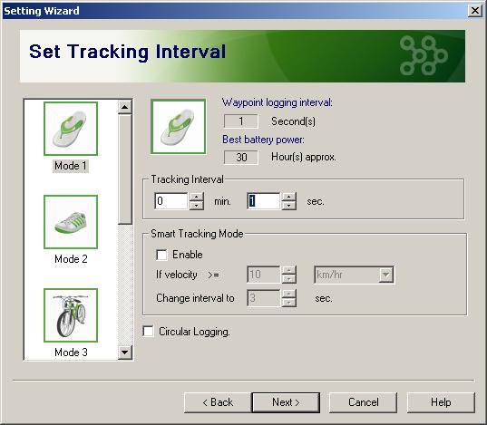
In the manual configuration section you have a number of modes which are basically just some templates for the most frequent movement patterns. You can quickly change all the relevant parameters to your own liking.
(Note: picture from older version of @trip)
The smart tracking mode allows you to compensate somewhat for the missing distance based tracking. But you could also choose a regime where normal tracking is every five seconds, and above 30 mph only every 60 seconds - even though that makes little sense.
The Power Saving setting will attempt to put the GPS circuitry to sleep after each successful position reading. This can even be done at the highest frequency (1 Hz) as generally the receiver only needs about 200 ms to do all the work, and then waits 800 ms for the next round. While you won't be saving 80% of your battery power (more in the 35% range) it certainly is worth considering if you prefer battery life over positioning snappiness.
I am not sure if the @trip program reads the current configuration data from the device. You better remember what you have set it to, or you just need to set it to what you need - again.
In use
Unfortunately there is also no way to switch between the logging modes while you are on the road. So you better know beforehand what type of tracking/logging you want to perform that day. (The GT-200e has bluetooth, so a smartphone based setup program could actually help here)
As already mentioned the memory on the GT-200e has been upped to 64 MB. This is good for 256K trackpoints. The highest recording frequency is 1 Hz (once per second). This means you can record for a good 72 hours on the most agressive recording mode before the memory is full. Your battery will give in long before that though. It will last about 20 hours in the 1 Hz mode (19 hours 45 minutes in my tests during which it recorded 68000 track points and then discarded all but 639 during the deduplication).
(The circular logging feature was a recent addition in the latest firmware. Be sure to check the Mobile Action website occasionally for firmware updates.)
Once the memory is full you can decide to use circular logging, overwriting the oldest recordings. This would be ideal for the "black box" scenario when you keep the recorder tucked away in your car. Alas, the GT-200e does not switch on when external power via the car's cigarette lighter adapter) is applied. So when the battery runs out this is where the recording will stop. If you use the device in the outdoors you can use any of the emergency chargers on the market to keep the battery running a bit longer.
The @trip software can tell you how much memory is left.

But on the actual device it is difficult to gauge memory (and battery for that matter) level. Clearly a compromise between design and function.
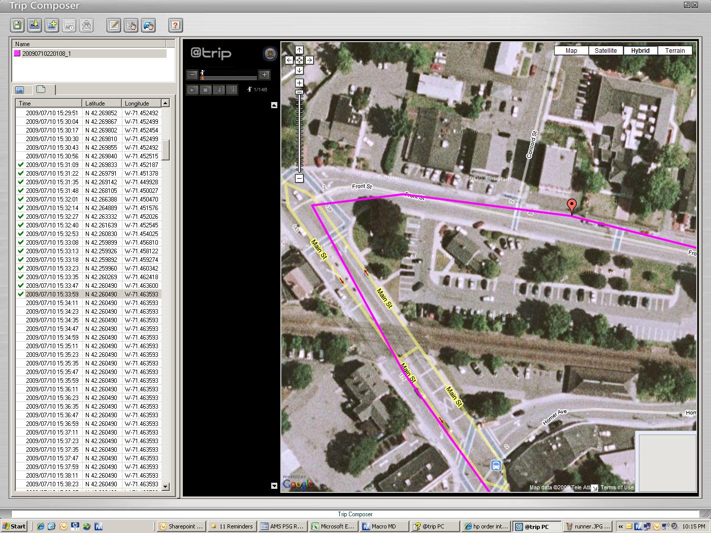
Track visualization
Each time you switch the device off (even if just inadvertedly) the currently recorded track is closed and a new one is opened when you switch the device back on.
Tracks are visualised with a Google Maps plugin. Tracks and waypoint display can be modified. The "sporting mode" also shows the altitude change along the course.
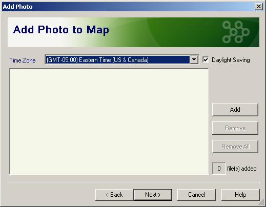
If you actually use the receiver in conjunction with a camera for phototagging then here is the step where you can add the photos to the track.
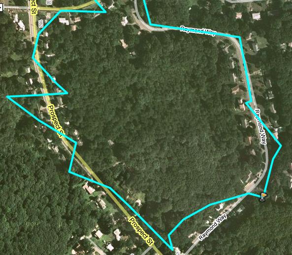
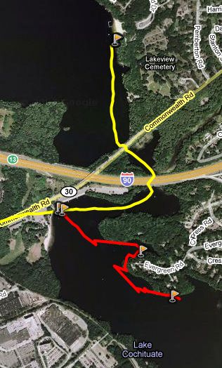
This track was recorded in walking mode, under heavy foliage. Note the waypoint marker at the right. Position accuracy is sufficient, but not really great. The receiver was tucked away in a back pocket somewhere so the reception was not optimal. I also tested it sitting in the middle console of the car, and it performed a bit better (the car has a sun roof though). The GPS chipset is a standard SiRF III version.
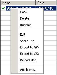
Besides the standard display in the Google Maps applet your tracks can also be exported to CSV or GPX files for use in other programs. "Share trip" will upload the trip data to the Mobile Action website for everyone to see.
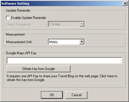
Looks like you can even store your own Google Maps API key and then point to your web based track log with a simple email link. I haven't tested this part of the program.
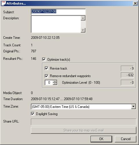
Many times you will be recording the same location over and over (when your device is not moved). The program allows to detect and remove these duplicates for cleaner display of the trip data on the map.
You can also edit your trip manually and remove individual track points and waypoints.
Round Up
Pros
- small and light
- waterproof
- large memory with circular buffer
- @trip program with many useful features
Cons
- no blackbox mode
- button too easy to press inadvertedly
- uses custom USB cable
- @trip does not work with OSX/Linux
References & Links:
References |
|
| Manufacturer's Web site |
http://www.i-gotu.com/ |
| Pocket GPS World Contributor |
Lutz Bendlin |
| Guide Price at time of publication |
$99 at Expansys |
| |
|
| Comments
|
 Posted by NickG on Mon Sep 14, 2009 9:16 am Posted by NickG on Mon Sep 14, 2009 9:16 am |
 |
At first glance, this looked good: More memory than my Qstarz - enough to record a week's skiing at 1 second (1 second is useful to record the turns, otherwise it just comes out as a wobbly line), but the negatives you mentioned have really put me off.
I still don't get why they don't just put a MicroSD card card in it, so you you don't have to worry about running of memory on longer trips.
Why don't they use a normal Mini-USB connector? Why come up with a new connector instead of using the standard one used by nearly all other devices?
That huge button is stupid. It should be a small recessed button. Even the tiny switch on the qstarz keeps changing itself - meaning I've often lost data and have loads of waypoints I never knowingly created. Lack of a physical power switch means it's no use as a permanent vehicle logger.
Sealed battery compartment is the showstopper though. Batteries never seem to last as long as they claim - especially if the unit has ever become very hot or cold (eg skiing). They only seem to last a year or two, even with low usage.
Also that track log under foliage looks pretty awful. I use my Qstarz (SirfStar III) in the New Forest quite often, and I never get tracks which look like that! They might be off by a few feet, but they don't zig zag about by 100ft as show in your picture.
On the plus side though, the software looks quite a lot better than that of other loggers I've used.
Looks like I'll have to wait a bit longer for the holy grail data logger (which would basically be a Qstarz Q1000, but with microSD and a barometric pressure sensor) and a recessed switch!
Twitter: @nickg_uk |
|
| Posted by lbendlin on Mon Sep 14, 2009 3:37 pm |
|
Using a GPS for skiing has a few additional challenges - you will want to use a receiver that handles the various altitude models well (including the geode correction), and the batteries generally don't handle the cold well (resulting in shorter useful run time)
The sealed battery is only an issue if you are off grid for longer times which is not very likely on a ski trip.
I am finishing up a review of the Columbus V-900 which has a SD card slot. But it is neither waterproof nor has it a removable battery either. You'll have to compromise...
Lutz
Report Map Errors here:
TomTom/TeleAtlas NAVTEQ |
|
| Posted by NickG on Mon Sep 14, 2009 3:47 pm |
|
| lbendlin Wrote: | | The sealed battery is only an issue if you are off grid for longer times |
So how do you get the battery out to change it? They only last about 2 years in my experience. Once it's gone you'd have to throw the whole thing away and buy a new one. Not really what I'd want to do if I'd spent Ł80 on a logger.
My iPhone battery is noticably worse than it was when I bought the phone a year ago, and there's no way to change it. 
Twitter: @nickg_uk |
|
| Posted by lbendlin on Mon Sep 14, 2009 4:05 pm |
|
At least on the iphone you can get it exchanged by a third party (for loads of moneys).
You will always have the option to use an external power supply (emergency charger etc) at the expense of losing the watertightness.
Lutz
Report Map Errors here:
TomTom/TeleAtlas NAVTEQ |
|
| Posted by HairyDJ on Fri Sep 18, 2009 10:56 am |
|
Been playing with a GT100 for a year or so now - bought for a friend to track her speed and route whilst out jogging.
I have found the button and checking of status very frustrating, and she has actually stopped using it now as it's simply not worth the hassle. She can use the running sensor in her trainers with her ipod in a couple of simple (and reliable) presses and then get out and run. To use the GT100, she would usually have to stand around outside for a minute or two to try and get a good GPS fix and then struggled to remember what all of the silly flashing light codes meant. As she said - I wanted it to help me with my run, not mess me about and distract me.
I've run with her a few times and "driven" the gadget, but found what I believed to be a massive flaw in the way it records it's data. It seemed to show up worst when running under trees (similar to the track in the review above). When I actually exported the data to excel and played with it I discovered that, rather than logging absolute Lat / Long data, it seemed to calculate a distance and track from last reading and then store that data. The effect being that cumulative errors seemed to put the track further and further out until it got a good fresh fix and seemed to put me back on track. Quite obvious as it had me running back and forth across a canal instead of along the towpath! I found that I couldn't edit the spreadsheet in any meaningful way due to the mapping plot seeming to use the movement data instead of the absolute Lat / Long for the map.
NOTE - I'm trying to explain this based on recalling from many months ago! I certainly know that whilst it had a vague idea of where we'd been, any attempt to calculate accurate distance travelled or speed over any section turned out utterly unusable answers.
Sadly, this is a gadget that I wanted to use and looked forward to playing with, but it's pretty much in the bin now ...
|
|
| Posted by NickG on Fri Sep 18, 2009 12:15 pm |
|
You could try using one of the QStarz recorders. They log every one second (the full current position) and would have enough memory for many hours of continuous recording. I've had no problems with the accuracy of the unit and usually I find my tracks are almost exactly overlaid onto any tracks or roads when I combine the tracks with satellite imagery. I can send you some sample data if you like?
Twitter: @nickg_uk |
|
| Posted by HairyDJ on Thu Oct 01, 2009 7:53 am |
|
latest maplins catalogue is punting these at a tenner off - hopefully the latest version 
|
|
| Posted by lbendlin on Thu Oct 01, 2009 12:11 pm |
|
| HairyDJ Wrote: | | latest maplins catalogue is punting these at a tenner off - hopefully the latest version |
they have to have "64M" on the face side.
Lutz
Report Map Errors here:
TomTom/TeleAtlas NAVTEQ |
|
| Posted by AnalyticAuto on Thu Apr 20, 2023 8:29 am |
|
 good good
|
|
|
|


