|
|
 |
 |
 |
 |
GPS IIF8 Thunders into orbit
Article by: Mike Barrett
Date: 30 Oct 2014
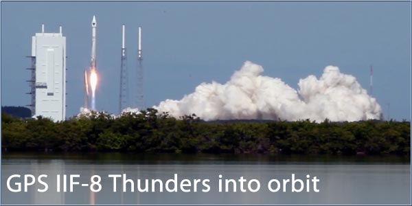
Yesterday saw the successful launch of the eight GPS-IIF satellite from Launch Complex 41 at Cape Canaveral Air Force station in Florida. Installed on top of the United Launch Alliance Atlas V 401 rocket the GPS IIF-8 satellite was lofted into orbit at 1:21pm local time. With a faultless flight plan the new GPS satellite will now be positioned in the GPS constellation. After a period of on-orbit testing the latest component of the USAF NAVSTAR navigation system will be transitioned to operational status replacing one of the ageing GPS Block IIA satellites.
An edited launch report from our colleague Ben Evans at AmericaSpace.com follows. The full article can be viewed here.
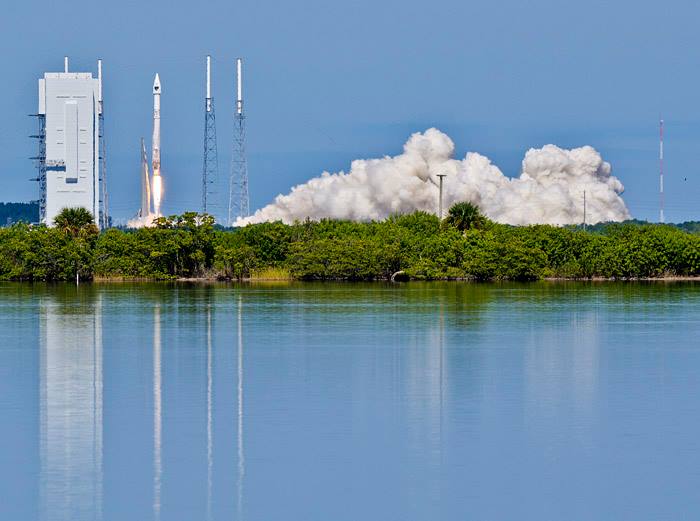
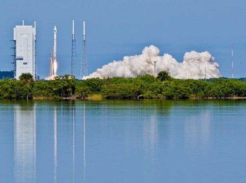
The Atlas V's Russian-built RD-180 engine ramps up to full power, ahead of a perfect liftoff at 1:21 p.m. EDT Wednesday, 29 October. The launch came just 19 hours after Tuesday's Antares failure. Photo Credit: Alan Walters/AmericaSpace
As the dust settled at Wallops Island, Va., following yesterday’s catastrophic loss of Orbital Sciences’ fifth Antares booster—carrying the ORB-3 Cygnus cargo ship, bound for the International Space Station (ISS)—the effort to continue delivering U.S. launch vehicles into space continued unabated today (Wednesday, 29 October), with the successful 50th flight of an Atlas V. Liftoff of the venerable Atlas, which is operated by United Launch Alliance (ULA), took place precisely on time at 1:21 p.m. EDT from Space Launch Complex (SLC)-41 at Cape Canaveral Air Force Station, Fla., approximately 870 miles (1,400 km) to the south of Wallops. The mission lasted 3.5 hours and perfectly inserted the eighth satellite of the Block IIF Global Positioning System (GPS) constellation into a medium Earth orbit, at an altitude of 11,047 nautical miles (20,460 km), where it will provide critical positioning, velocity and timing assets for worldwide users.
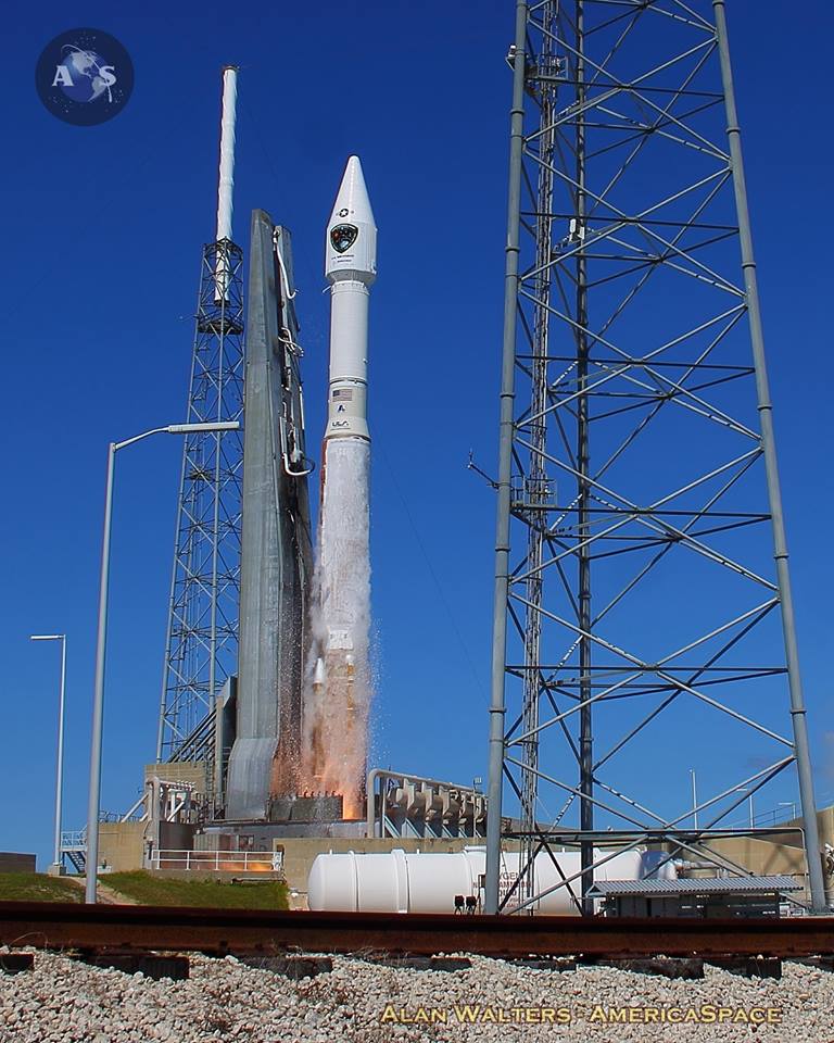
Wednesday's launch marked the 50th flight of an Atlas V and the 26th flight of the workhorse 401 configuration. Photo Credit: William Matt Gaetjens/AmericaSpace
Wednesday’s GPS IIF-8 mission was conducted by the workhorse Atlas V 401, which is numerically designated to describe a 4-meter (13-foot) payload fairing, no strap-on boosters and a single-engine Centaur upper stage. This configuration of the vehicle is by far its most-flown variant, having supported 26 missions since August 2002, and has the capacity to deliver 21,600 pounds (9,800 kg) into low-Earth orbit and up to 10,470 pounds (4,750 kg) into geostationary transfer orbit.
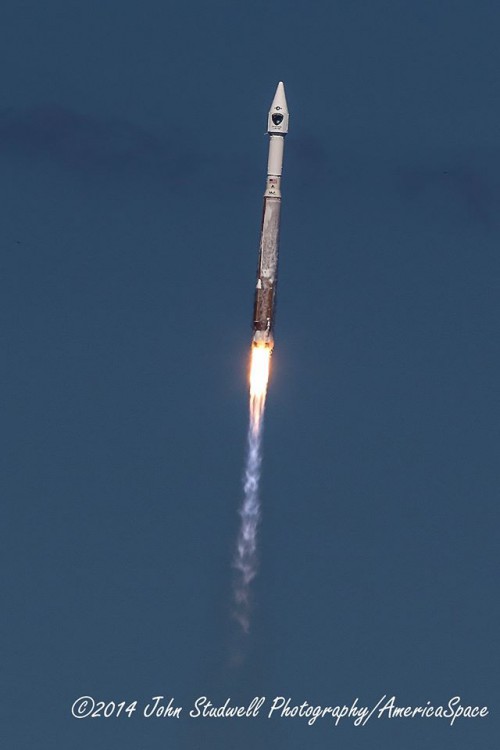
The pencil-like Atlas V climbs vertically from SLC-41, ahead of its combined pitch and roll program maneuver to inject GPS IIF-8 into orbit. Photo Credit: John Studwell/AmericaSpace
Following the standard Launch Readiness Review (LRR) on Sunday, 27 October, the 196-foot-tall (60-meter) Atlas V booster was rolled out, atop its Mobile Launch Platform (MLP), from the Vertical Integration Facility (VIF) to the SLC-41 pad surface on Monday, completing the journey in about 35 minutes. Upon arrival at the pad, it was carefully centered and propellant umbilicals and electrical and data links were connected. The track mobiles were removed and ULA engineers prepared for formal countdown operations, which kicked off early Wednesday morning. Patrick Air Force Base meteorologists had already identified a 70-percent likelihood of acceptable weather conditions at T-0, with key concerns revolving around northerly winds.
A final “Go-No Go” poll of all stations produced a unanimous “Go” to enter the terminal countdown phase at 1:15 p.m. and controllers released the clock from its hold point at T-4 minutes at 1:17 p.m. All propellant tanks were pressurized and the Flight Termination System (FTS)—tasked with destroying the vehicle in the event of a major accident during ascent—was placed onto internal power and armed. At T-60 seconds came the final, almost symbolic call: “Go Atlas, Go Centaur, Go GPS”, declaring that the booster, upper stage and payload teams were ready to support the launch.
The Atlas V 401’s RD-180 engine, with a propulsive yield of 860,000 pounds (390,000 kg), ignited about 2.7 seconds ahead of liftoff, burning a mixture of liquid oxygen and RP-1. Liftoff occurred at 1:21 p.m., precisely on the opening of the 18-minute “launch window”. Climb-out from SLC-41 commenced at T+1.1 seconds and the pencil-like vehicle rose vertically for about 16 seconds, after which the avionics of the Centaur upper stage commanded a pitch, roll and yaw program maneuver. This established the Atlas onto the proper flight azimuth of 45.8 degrees, following a north-easterly trajectory to inject the 3,600-pound (1,630-kg) GPS IIF-8 satellite into orbit.
At the shutdown of the RD-180—whose Russian heritage has made ULA the subject of much criticism in 2014, particularly in light of sanctions issued after the Kremlin’s annexation of Crimea in March—about four minutes into the flight, the Atlas V had already reached an altitude of 34 miles (55 km) and was 55 miles (88 km) downrange of the Cape, traveling in excess of 5,000 mph (8,000 km/h). The 41-foot-long (12.4-meter) Centaur and attached GPS IIF-8 were detached, prior to two “burns” to achieve the target orbit of 11,047 nautical miles (20,460 km), inclined 55 degrees to the equator. Ignition of the Centaur’s 22,300-pound-thrust (10,100-kg) RL-10A engine for the first time occurred about ten seconds after the separation of the Atlas V’s first stage. This engine employs a cryogenic mix of liquid oxygen and hydrogen and is designed to be restartable.
The first firing was followed by the jettisoning of the two-piece (or “bisector”) payload fairing to expose GPS IIF-8 to the space environment for the first time. The initial burn lasted about 13 minutes, after which the Centaur/payload combo coasted for almost three hours, ahead of a second burn, lasting just 90 seconds. After this event, the Centaur spun-up GPS IIF-8 to five revolutions per minute and released it into space at T+3 hours, 24 minutes and 17.5 seconds. Throughout the ascent phase, telemetry data was gathered by the Eastern Range, together with various worldwide installations under the U.S. Air Force Space Command Network, including New Boston Air Force Station, N.H., the Royal Air Force’s Oakhanger installation in Hampshire, England, Diego Garcia in the Indian Ocean, and Guam in the western Pacific Ocean. Additionally, NASA’s Tracking and Data Relay Satellite System (TDRSS) will participate in the gathering of telemetry.

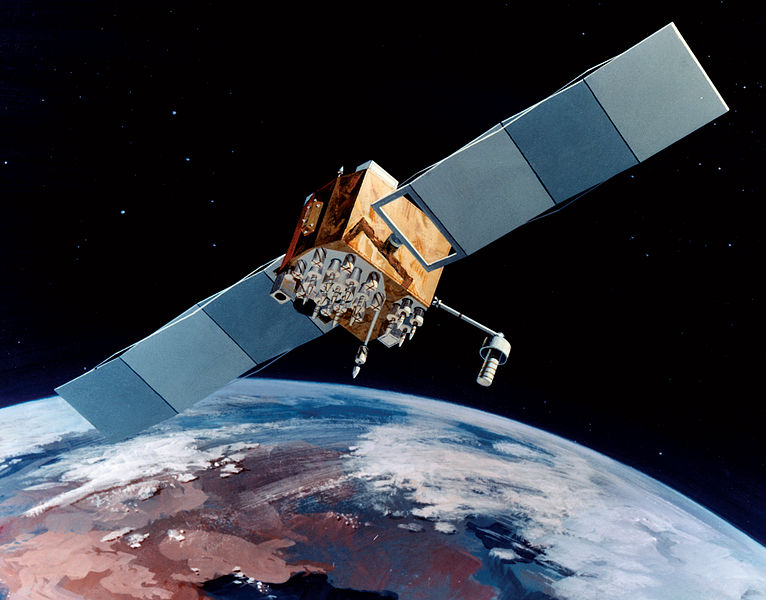
Artist's impression of a Block IIF GPS satellite in orbit. Image Credit: U.S. Air Force
“ULA is honored to work with this world-class U.S. Government and contractor mission team and we are very proud to have delivered the GPS IIF-8 satellite to orbit today on the 50th Atlas V mission,” said Jim Sponnick, ULA’s vice president for Atlas and Delta Programs. “Achieving 50 Atlas missions with 100-percent mission success is a tribute to this team’s sustained focus on one mission at a time and dedication to reliably meeting our customer’s launch needs.”
GPS IIF-8, which arrived at Cape Canaveral Air Force Station for final processing on 16 July, is the fourth of its kind to be launched in 2014 and will represent the 12th overall GPS to be lofted atop a ULA booster and only the third to ride atop an Atlas V. It is anticipated that the GPS Block IIF network will employ a mixture of Atlas V and Delta IV launches, with the latter having been employed to insert GPS IIF-1, GPS IIF-2, GPS IIF-3, GPS IIF-5 and GPS IIF-6 into orbit. The forthcoming GPS IIF-9 and GPS IIF-10 satellites—currently scheduled to fly in 2015—will both be carried aboard Delta IVs. These “Interim” Block IIF satellites will keep the Navstar system of positioning, velocity and timing assets fully operational until the next-generation GPS Block IIIA comes online in 2016.
Wednesday’s launch marked the fourth GPS mission of 2014. From its semi-synchronous, medium-altitude Earth orbit, GPS IIF-8 will circle Earth once every 12 hours. It represents the eighth satellite in a 12-strong network of GPS Block IIF spacecraft, the first of which was launched in May 2010. A second satellite followed in July 2011, then a third in October 2012, a fourth in May 2013, a fifth in February 2014, a sixth in May 2014 and a seventh in August 2014. The GPS IIF boasts improved positioning, velocity, and timing accuracy, a reprogrammable processor, an interference-free civilian signal for commercial aviation search and rescue, and a new Military code (or “M-code”) to offer better resistance to electronic jamming. “As each IIF satellite becomes operational, we continue the seamless transformation of the GPS constellation into an even more accurate, reliable, and durable navigation resource for the U.S. military and the global civilian user community,” said Craig Cooning, vice president and general manager of Boeing Space & Intelligence Systems. “Our efficient pulse-line manufacturing process, adapted from Boeing’s commercial airplane production lines, also ensures that we deliver each spacecraft on time and on cost.”
In the meantime, the Air Force expects the next-generation GPS IIIA network to enter service no earlier than April 2016, about two years later than originally intended. It awarded a $1.4 billion contract to Lockheed Martin in May 2008 to develop this new network, which may eventually comprise as many as 32 satellites, although the Air Force has only formally contracted for four of these. With 500 times the transmitter power of current systems, the IIIA satellites will benefit from improved navigational warfare capabilities, enabling them to shut off GPS services to limited geographical locations, whilst maintaining service to U.S. and allied forces. The GPS satellite system is operated and controlled by the 50th Space Wing, located at Schriever Air Force Base, Colo.
| Comments
|
| Be the first to comment. Click on Post Reply below. |
|
|
 |
|
|
 |
 |
 |
 |
|
|